
TA CHUNG
Cargo
Current Trip
| Trip Time | 14 h, 29 mins |
|---|---|
| Trip Distance | 230.53 nm |
| AVG Speed | 15.8 Knots |
| MAX Speed | 17.6 Knots |
| Dybgang | 5.2 m |
| AVG Wind | 13 knots |
| MAX Wind | 20 knots |
| MIN Temp | 18.4°C / 65.12°F |
| MAX Temp | 26.2°C / 79.16°F |
| Position Modtaget | 1 m siden |
Current Position
| Longitude | --- |
|---|---|
| Latitude | --- |
| Status | Under way using engine |
| Fart | |
| Kurs | 338° |
| Område | South China Sea |
| Station | T-AIS |
| Position Modtaget | 1 m siden |
Info
Information
The current position of TA CHUNG is in South China Sea with coordinates 22.59892° / 120.28837° as reported on 2025-12-12 09:09 by AIS to our vessel tracker app. The vessel's current speed is 0 Knots and is currently inside the port of KAOHSIUNG.
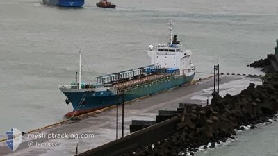
The vessel TA CHUNG (MMSI: 416004824) is a Cargo It's sailing under the flag of [TW] Taiwan.
In this page you can find informations about the vessels current position, last detected port calls, and current voyage information. If the vessels is not in coverage by AIS you will find the latest position.
The current position of TA CHUNG is detected by our AIS receivers and we are not responsible for the reliability of the data. The last position was recorded while the vessel was in Coverage by the Ais receivers of our vessel tracking app.
The current draught of TA CHUNG as reported by AIS is 5.2 meters
Weather
| Temperature | 23°C / 73.4°F |
|---|---|
| Wind Speed | 12 knots |
| Direction | 317° NW |
| Pressure | 1015.5 hPa |
| Humidity | 76.1 % |
| Cloud Coverage | 1 % |
Featured Company
Last Port Calls
| Port | Arrival | Departure | Time In Port |
|---|---|---|---|
| 2025-12-11 11:06 | |||
| 2025-12-10 18:24 | 2025-12-10 20:37 | 2 h | |
| 2025-12-07 18:41 | 2025-12-09 16:23 | 1 d | |
| 2025-12-03 16:24 | 2025-12-06 19:45 | 3 d | |
| 2025-11-30 15:30 | 2025-12-02 19:11 | 2 d | |
| 2025-11-26 14:20 | 2025-11-29 21:55 | 3 d | |
| 2025-11-23 12:47 | 2025-11-25 20:54 | 2 d | |
| 2025-11-19 10:40 | 2025-11-23 00:54 | 3 d | |
| 2025-11-16 09:14 | 2025-11-19 00:51 | 2 d | |
| 2025-11-15 10:57 | 2025-11-16 04:25 | 17 h |
Last Trips
| Origin | Departure | Destination | Arrival | Distance | |
|---|---|---|---|---|---|
| 2025-12-10 20:37 | 2025-12-11 11:06 | 230.53 nm | |||
| 2025-12-09 16:23 | 2025-12-10 18:24 | 316.43 nm | |||
| 2025-12-06 19:45 | 2025-12-07 18:41 | 314.39 nm | |||
| 2025-12-02 19:11 | 2025-12-03 16:24 | 293.62 nm | |||
| 2025-11-29 21:55 | 2025-11-30 15:30 | 254.86 nm | |||
| 2025-11-25 20:54 | 2025-11-26 14:20 | 233.73 nm | |||
| 2025-11-23 00:54 | 2025-11-23 12:47 | 173.48 nm | |||
| 2025-11-19 00:51 | 2025-11-19 10:40 | 120.11 nm | |||
| 2025-11-16 04:25 | 2025-11-16 09:14 | 67.91 nm | |||
| 2025-11-14 17:04 | 2025-11-15 10:57 | 226.08 nm |
Events
| Tid | Hændelsen | Detaljer | Position / Dest | Info |
|---|---|---|---|---|
| 2025-12-11 03:36 | STOP Sejllads |
22.59868 / 120.28828
[TW] KAOHSIUNG
|
Fart: 0.3 kn Kurs: 342° |
|
| 2025-12-11 03:06 | Skibe i havn |
|
22.61950 / 120.25560
[TW] KAOHSIUNG
|
Fart: 12.8 kn Kurs: 103.7° |
| 2025-12-11 02:54 | Destination er ændret | KAOHSIUNG TW KEELUNG TW |
22.63013 / 120.20105
KAOHSIUNG TW
|
Fart: 15.7 kn Kurs: 133.5° |
| 2025-12-11 02:54 | ETA er ændret | 2025/12/11 11:00 2026/11/30 15:30 |
22.63013 / 120.20105
KAOHSIUNG TW
|
Fart: 15.7 kn Kurs: 133.5° |
| 2025-12-11 02:33 | Ændre havområde | Taiwanese part of the South China Sea Taiwanese part of the Eastern China Sea |
22.70690 / 120.14642
South China Sea
|
Fart: 15.3 kn Kurs: 148.3° |
| 2025-12-11 02:33 | Status er ændret | Under way using engine Default |
22.70757 / 120.14597
KEELUNG TW
|
Fart: 15.1 kn Kurs: 147° |
| 2025-12-11 02:21 | Indenfor Dækning |
22.70690 / 120.14642
South China Sea
|
Fart: 15.3 kn Kurs: 148.3° |
|
| 2025-12-10 12:37 | Afsejlet fra sidste havn |
|
25.16486 / 121.75150
KEELUNG TW
|
Fart: 9.1 kn Kurs: 348° |
| 2025-12-10 12:29 | START Sejllads |
25.14457 / 121.75623
[TW] KEELUNG
|
Fart: 3.1 kn Kurs: 355° |
|
| 2025-12-10 10:39 | STOP Sejllads |
25.14517 / 121.75825
[TW] KEELUNG
|
Fart: 0.2 kn Kurs: 74° |