
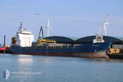
SWE-FREIGHTER
General Cargo
Current Trip
| Time Travelled | 1 day |
|---|---|
| Remaining Time | 3 days |
| Distance Travelled | 286.04 nm |
| Remaining Distance | 866.70 nm |
| AVG Speed | 12 Knots |
| MAX Speed | 12.6 Knots |
| AVG Wind | 14.2 knots |
| MAX Wind | 24.7 knots |
| MIN Temp | 3.8°C / 38.84°F |
| MAX Temp | 8.3°C / 46.94°F |
| Dybgang | 4.3 m |
| Position Modtaget | 1 m siden |
Current Position
| Longitude | --- |
|---|---|
| Latitude | --- |
| Status | Under way using engine |
| Fart | 12 Knots |
| Kurs | 207.7° |
| Område | Baltic Sea |
| Station | T-AIS |
| Position Modtaget | 1 m siden |
Info
Information
The current position of SWE-FREIGHTER is in Baltic Sea with coordinates 57.38747° / 17.01493° as reported on 2025-12-10 21:25 by AIS to our vessel tracker app. The vessel's current speed is 12 Knots and is heading at the port of HULL. The estimated time of arrival as calculated by MyShipTracking vessel tracking app is 2025-12-13 22:12 LT
The vessel SWE-FREIGHTER (IMO: 9194098, MMSI: 210547000) is a General Cargo that was built in 2000 ( 25 år gamle ). It's sailing under the flag of [CY] Cyprus.
In this page you can find informations about the vessels current position, last detected port calls, and current voyage information. If the vessels is not in coverage by AIS you will find the latest position.
The current position of SWE-FREIGHTER is detected by our AIS receivers and we are not responsible for the reliability of the data. The last position was recorded while the vessel was in Coverage by the Ais receivers of our vessel tracking app.
The current draught of SWE-FREIGHTER as reported by AIS is 4.3 meters
Weather
| Temperature | 7.4°C / 45.32°F |
|---|---|
| Wind Speed | 13 knots |
| Direction | 224° SW |
| Pressure | 1007.6 hPa |
| Humidity | 85.8 % |
| Cloud Coverage | 100 % |
Featured Company
Last Port Calls
| Port | Arrival | Departure | Time In Port |
|---|---|---|---|
| 2025-12-08 19:37 | 2025-12-09 22:17 | 1 d | |
| 2025-11-08 10:36 | 2025-12-07 20:17 | 29 d | |
| 2025-11-05 18:32 | 2025-11-06 23:04 | 1 d | |
| 2025-10-29 21:04 | 2025-11-01 19:09 | 2 d | |
| 2025-10-20 05:44 | 2025-10-22 19:40 | 2 d | |
| 2025-10-18 15:46 | 2025-10-19 17:58 | 1 d | |
| 2025-10-11 14:12 | 2025-10-13 22:36 | 2 d | |
| 2025-10-08 16:56 | 2025-10-10 15:50 | 1 d | |
| 2025-10-06 12:44 | 2025-10-08 07:15 | 1 d |
Last Trips
| Origin | Departure | Destination | Arrival | Distance | |
|---|---|---|---|---|---|
| 2025-12-07 20:17 | 2025-12-08 19:37 | 325.16 nm | |||
| 2025-11-06 23:04 | 2025-11-08 10:36 | 267.81 nm | |||
| 2025-11-01 19:09 | 2025-11-05 18:32 | 1078.78 nm | |||
| 2025-10-22 19:40 | 2025-10-29 21:04 | 279.85 nm | |||
| 2025-10-19 17:58 | 2025-10-20 05:44 | 75.72 nm | |||
| 2025-10-13 22:36 | 2025-10-18 15:46 | 1233.70 nm | |||
| 2025-10-10 15:50 | 2025-10-11 14:12 | 242.94 nm | |||
| 2025-10-08 07:15 | 2025-10-08 16:56 | 110.77 nm | |||
| 2025-09-30 17:33 | 2025-10-06 12:44 | 1081.25 nm |
Events
| Tid | Hændelsen | Detaljer | Position / Dest | Info |
|---|---|---|---|---|
| 2025-12-10 20:54 | Status er ændret | Under way using engine Default |
57.47402 / 17.11434
HULL
|
Fart: 12.1 kn Kurs: 210° |
| 2025-12-10 20:53 | Indenfor Dækning |
57.47207 / 17.11210
Baltic Sea
HULL
|
Fart: 12 kn Kurs: 213.9° |
|
| 2025-12-10 07:17 | Status er ændret | Default Under way using engine |
59.69511 / 19.66332
HULL
|
Fart: 12.1 kn Kurs: 147.4° |
| 2025-12-10 07:17 | Udenfor Dækning |
59.69559 / 19.66272
Baltic Sea
HULL
|
Fart: 12.1 kn Kurs: 147.4° |
|
| 2025-12-10 06:31 | Ændre havområde | Swedish part of the Baltic Sea Swedish part of the Gulf of Bothnia |
59.82520 / 19.49753
Baltic Sea
HULL
|
Fart: 12.3 kn Kurs: 146° |
| 2025-12-10 03:07 | Dybgangen er ændret | 4.3 4.1 |
60.44827 / 18.96015
HULL
|
Fart: 12 kn Kurs: 173.7° |
| 2025-12-10 03:07 | Destination er ændret | HULL ALA |
60.44827 / 18.96015
HULL
|
Fart: 12 kn Kurs: 173.7° |
| 2025-12-10 03:07 | ETA er ændret | 2025/12/13 23:00 2025/12/08 19:00 |
60.44827 / 18.96015
HULL
|
Fart: 12 kn Kurs: 173.7° |
| 2025-12-10 02:42 | Status er ændret | Under way using engine Default |
60.51826 / 18.88630
ALA
|
Fart: 12.4 kn Kurs: 128° |
| 2025-12-10 02:25 | Indenfor Dækning |
60.51826 / 18.88630
Gulf of Bothnia
|
Fart: 12.3 kn Kurs: 128.2° |