
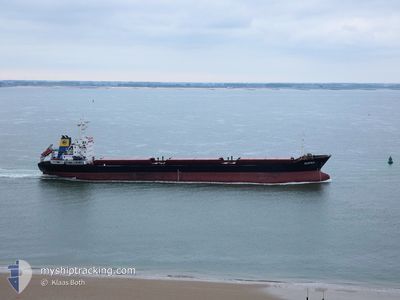
SUPRA
Bulk Carrier
Current Trip
| Time Travelled | 18 h, 17 mins |
|---|---|
| Remaining Time | 1 day |
| Distance Travelled | 192.63 nm |
| Remaining Distance | 345.51 nm |
| AVG Speed | 11.1 Knots |
| MAX Speed | 12 Knots |
| AVG Wind | 13 knots |
| MAX Wind | 17 knots |
| MIN Temp | 14.5°C / 58.1°F |
| MAX Temp | 16.5°C / 61.7°F |
| Dybgang | 5.2 m |
| Position Modtaget | 2 h, 40 m siden |
Current Position
| Longitude | --- |
|---|---|
| Latitude | --- |
| Status | Under way using engine |
| Fart | 11.6 Knots |
| Kurs | 217.4° |
| Område | Balearic Sea |
| Station | T-AIS |
| Position Modtaget | 2 h, 40 m siden |
Info
Information
The current position of SUPRA is in Balearic Sea with coordinates 40.77018° / 2.67762° as reported on 2025-12-09 07:10 by AIS to our vessel tracker app. The vessel's current speed is 11.6 Knots and is heading at the port of ARZEW. The estimated time of arrival as calculated by MyShipTracking vessel tracking app is 2025-12-10 17:16 LT
The vessel SUPRA (IMO: 9397200, MMSI: 636019547) is a Bulk Carrier that was built in 2006 ( 19 år gamle ). It's sailing under the flag of [LR] Liberia.
In this page you can find informations about the vessels current position, last detected port calls, and current voyage information. If the vessels is not in coverage by AIS you will find the latest position.
The current position of SUPRA is detected by our AIS receivers and we are not responsible for the reliability of the data. The last position was recorded while the vessel was in Coverage by the Ais receivers of our vessel tracking app.
The current draught of SUPRA as reported by AIS is 5.2 meters
Weather
| Temperature | 16.4°C / 61.52°F |
|---|---|
| Wind Speed | 13 knots |
| Direction | 212° SSW |
| Pressure | 1021 hPa |
| Humidity | 85.2 % |
| Cloud Coverage | --- |
Featured Company
Last Port Calls
| Port | Arrival | Departure | Time In Port |
|---|---|---|---|
| 2025-12-03 21:28 | 2025-12-08 16:33 | 4 d | |
| 2025-11-24 11:13 | 2025-11-29 04:26 | 4 d | |
| 2025-11-22 14:39 | 2025-11-22 16:42 | 2 h | |
| 2025-11-02 10:13 | 2025-11-06 19:54 | 4 d | |
| 2025-10-25 10:38 | 2025-10-29 18:20 | 4 d | |
| 2025-10-15 00:24 | 2025-10-18 12:40 | 3 d | |
| 2025-10-06 16:17 | 2025-10-09 12:24 | 2 d | |
| 2025-10-02 01:43 |
Last Trips
| Origin | Departure | Destination | Arrival | Distance | |
|---|---|---|---|---|---|
| 2025-11-29 04:26 | 2025-12-03 21:28 | 560.75 nm | |||
| 2025-11-22 16:42 | 2025-11-24 11:13 | 91.40 nm | |||
| 2025-11-06 19:54 | 2025-11-22 14:39 | 1880.28 nm | |||
| 2025-10-29 18:20 | 2025-11-02 10:13 | 834.97 nm | |||
| 2025-10-18 12:40 | 2025-10-25 10:38 | 816.73 nm | |||
| 2025-10-09 12:24 | 2025-10-15 00:24 | 1397.72 nm | |||
| 2025-10-02 01:43 | 2025-10-06 16:17 | 803.69 nm |
Events
| Tid | Hændelsen | Detaljer | Position / Dest | Info |
|---|---|---|---|---|
| 2025-12-09 07:13 | Status er ændret | Default Under way using engine |
40.76125 / 2.66841
DZ AZW
|
Fart: 11.6 kn Kurs: 217.4° |
| 2025-12-09 07:10 | Udenfor Dækning |
40.77018 / 2.67762
Balearic Sea
DZ AZW
|
Fart: 11.6 kn Kurs: 217.4° |
|
| 2025-12-09 06:49 | Status er ændret | Under way using engine Default |
40.82370 / 2.73096
DZ AZW
|
Fart: 11.7 kn Kurs: 215° |
| 2025-12-09 06:44 | Status er ændret | Default Under way using engine |
40.83549 / 2.74230
DZ AZW
|
Fart: 11.6 kn Kurs: 217° |
| 2025-12-09 06:16 | Status er ændret | Under way using engine Default |
40.90637 / 2.81442
DZ AZW
|
Fart: 11.2 kn Kurs: 221° |
| 2025-12-09 06:03 | Status er ændret | Default Under way using engine |
40.93842 / 2.85155
DZ AZW
|
Fart: 11.1 kn Kurs: 219.2° |
| 2025-12-09 05:50 | Status er ændret | Under way using engine Default |
40.96722 / 2.88359
DZ AZW
|
Fart: 11 kn Kurs: 203° |
| 2025-12-09 05:45 | Status er ændret | Default Under way using engine |
40.97833 / 2.89333
DZ AZW
|
Fart: 10.9 kn Kurs: 212.4° |
| 2025-12-09 05:26 | Status er ændret | Under way using engine Default |
41.02835 / 2.93482
DZ AZW
|
Fart: 11.4 kn Kurs: 214° |
| 2025-12-09 05:00 | Status er ændret | Default Under way using engine |
41.09667 / 2.99500
DZ AZW
|
Fart: 11.7 kn Kurs: 219.1° |