
SUNRAYS
Yacht
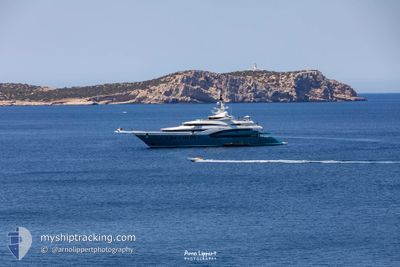
Current Trip
DUBAI
| Time Travelled | 8 days |
|---|---|
| Remaining Time | --- |
| Distance Travelled | 83.52 nm |
| Remaining Distance | --- |
| AVG Speed | 9.5 Knots |
| MAX Speed | 13.4 Knots |
| AVG Wind | 6.4 knots |
| MAX Wind | 16 knots |
| MIN Temp | 19.3°C / 66.74°F |
| MAX Temp | 23.3°C / 73.94°F |
| Dybgang | 3.9 m |
| Position Modtaget | 4 m siden |
Current Position
| Longitude | --- |
|---|---|
| Latitude | --- |
| Status | Moored |
| Fart | |
| Kurs | 312° |
| Område | Persian Gulf |
| Station | T-AIS |
| Position Modtaget | 4 m siden |
Info
Information
The current position of SUNRAYS is in Persian Gulf with coordinates 25.09828° / 55.14486° as reported on 2026-01-11 04:19 by AIS to our vessel tracker app. The vessel's current speed is 0 Knots
The vessel SUNRAYS (IMO: 1010351, MMSI: 319015100) is a Yacht that was built in 2010 ( 16 år gamle ). It's sailing under the flag of [KY] Cayman Is.
In this page you can find informations about the vessels current position, last detected port calls, and current voyage information. If the vessels is not in coverage by AIS you will find the latest position.
The current position of SUNRAYS is detected by our AIS receivers and we are not responsible for the reliability of the data. The last position was recorded while the vessel was in Coverage by the Ais receivers of our vessel tracking app.
The current draught of SUNRAYS as reported by AIS is 3.9 meters
Weather
| Temperature | 18.4°C / 65.12°F |
|---|---|
| Wind Speed | 1 knots |
| Direction | 90° E |
| Pressure | 1021.7 hPa |
| Humidity | 66 % |
| Cloud Coverage | 28 % |
Featured Company
Last Port Calls
| Port | Arrival | Departure | Time In Port |
|---|---|---|---|
| 2026-01-02 06:45 | 2026-01-02 21:17 | 14 h | |
| 2025-12-26 08:19 | 2025-12-27 22:20 | 1 d | |
| 2025-12-08 22:08 | 2025-12-17 20:14 | 8 d | |
| 2025-12-02 16:58 | 2025-12-08 21:10 | 6 d | |
| 2025-11-06 08:07 | 2025-11-06 17:16 | 9 h | |
| 2025-11-04 12:12 | 2025-11-04 18:00 | 5 h |
Most Visited Ports (Last year)
| Port | Arrivals | |
|---|---|---|
| 4 | ||
| 1 | ||
| 1 | ||
| 1 |
Last Trips
| Origin | Departure | Destination | Arrival | Distance | |
|---|---|---|---|---|---|
| 2025-12-27 22:20 | 2026-01-02 06:45 | 166.41 nm | |||
| 2025-12-17 20:14 | 2025-12-26 08:19 | 182.49 nm | |||
| 2025-12-08 21:10 | 2025-12-08 22:08 | 8.91 nm | |||
| 2025-11-04 18:00 | 2025-12-02 16:58 | 2387.23 nm | |||
| 2025-11-04 18:00 | 2025-11-06 08:07 | 372.17 nm | |||
| 2025-09-22 14:00 | 2025-11-04 12:12 | 984.90 nm |
Events
| Tid | Hændelsen | Detaljer | Position / Dest | Info |
|---|---|---|---|---|
| 2026-01-05 08:16 | Status er ændret | Moored Under way using engine |
25.09830 / 55.14486
DUBAI
|
Fart: Kurs: 312° |
| 2026-01-05 08:02 | STOP Sejllads | 1.16 nm, North of DUBAI MARINA |
25.09725 / 55.14604
DUBAI
|
Fart: 0.1 kn Kurs: 280° |
| 2026-01-05 07:46 | START Sejllads | 1.48 nm, North of DUBAI MARINA |
25.10348 / 55.14096
DUBAI
|
Fart: 4.1 kn Kurs: 50° |
| 2026-01-05 07:31 | Status er ændret | Under way using engine At anchor |
25.10279 / 55.13967
DUBAI
|
Fart: Kurs: 248° |
| 2026-01-05 04:54 | Status er ændret | At anchor Under way using engine |
25.10255 / 55.13922
DUBAI
|
Fart: 0.2 kn Kurs: 1° |
| 2026-01-05 04:52 | STOP Sejllads | 1.42 nm, North of DUBAI MARINA |
25.10254 / 55.13919
DUBAI
|
Fart: 0.2 kn Kurs: 4° |
| 2026-01-05 03:37 | START Sejllads | 1.06 nm, West of JUMEIRAH |
25.21341 / 55.22488
DUBAI
|
Fart: 5.1 kn Kurs: 248.4° |
| 2026-01-05 03:09 | Status er ændret | Under way using engine At anchor |
25.21417 / 55.22727
DUBAI
|
Fart: Kurs: 170° |
| 2026-01-03 15:22 | Destination er ændret | DUBAI DUBAI,UAE |
25.21424 / 55.22719
DUBAI
|
Fart: Kurs: 275° |
| 2026-01-02 23:34 | Status er ændret | At anchor Under way using engine |
25.21404 / 55.22664
DUBAI,UAE
|
Fart: 0.5 kn Kurs: 84° |