
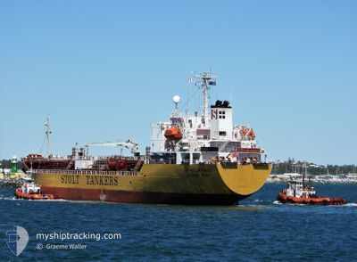
STOLT MOMIJI
Oil/Chemical Tanker
Current Trip
| Time Travelled | 1 day |
|---|---|
| Remaining Time | 10 days |
| Distance Travelled | 375.71 nm |
| Remaining Distance | 3464.41 nm |
| AVG Speed | 12.2 Knots |
| MAX Speed | 14 Knots |
| AVG Wind | 4.1 knots |
| MAX Wind | 11.2 knots |
| MIN Temp | 28°C / 82.4°F |
| MAX Temp | 30.2°C / 86.36°F |
| Dybgang | 8.1 m |
| Position Modtaget | 1 d siden |
Current Position
| Longitude | 104.22234° |
|---|---|
| Latitude | 1.27283° |
| Status | Under way using engine |
| Fart | 13.2 Knots |
| Kurs | 85.1° |
| Område | Singapore Strait |
| Station | T-AIS |
| Position Modtaget | 1 d siden |
Info
Information
The current position of STOLT MOMIJI is in Singapore Strait with coordinates 1.27283° / 104.22234° as reported on 2024-04-26 16:21 by AIS to our vessel tracker app. The vessel's current speed is 13.2 Knots and is heading at the port of BRISBANE. The estimated time of arrival as calculated by MyShipTracking vessel tracking app is 2024-05-08 16:53 LT
The vessel STOLT MOMIJI (IMO: 9470545, MMSI: 563206300) is a Oil/Chemical Tanker that was built in 2010 ( 14 år gamle ). It's sailing under the flag of [SG] Singapore.
In this page you can find informations about the vessels current position, last detected port calls, and current voyage information. If the vessels is not in coverage by AIS you will find the latest position.
The current position of STOLT MOMIJI is detected by our AIS receivers and we are not responsible for the reliability of the data. The last position was recorded while the vessel was in Coverage by the Ais receivers of our vessel tracking app.
The current draught of STOLT MOMIJI as reported by AIS is 8.1 meters
Weather
| Temperature | 28.8°C / 83.84°F |
|---|---|
| Wind Speed | 9 knots |
| Direction | 187° S |
| Pressure | 1006.9 hPa |
| Humidity | 78.6 % |
| Cloud Coverage | 100 % |
Featured Company
Last Port Calls
| Port | Arrival | Departure | Time In Port |
|---|---|---|---|
| 2024-04-26 00:52 | 2024-04-26 14:11 | 13 h | |
| 2024-04-23 03:56 | 2024-04-24 02:55 | 22 h | |
| 2024-04-22 15:19 | 2024-04-23 03:34 | 12 h | |
| 2024-04-22 01:43 | 2024-04-22 14:11 | 12 h | |
| 2024-04-20 05:00 | 2024-04-20 22:56 | 17 h | |
| 2024-04-17 08:59 | 2024-04-18 10:03 | 1 d | |
| 2024-04-09 17:19 | 2024-04-11 06:13 | 1 d | |
| 2024-03-30 02:43 | 2024-03-31 02:50 | 1 d | |
| 2024-03-23 03:28 | 2024-03-23 18:52 | 15 h | |
| 2024-03-20 22:31 | 2024-03-21 18:43 | 20 h |
Most Visited Ports (Last year)
| Port | Arrivals | |
|---|---|---|
| 4 | ||
| 3 | ||
| 3 | ||
| 2 | ||
| 2 | ||
| 2 |
Last Trips
| Origin | Departure | Destination | Arrival | Distance | |
|---|---|---|---|---|---|
| 2024-04-24 10:55 | 2024-04-26 08:52 | 79.31 nm | |||
| 2024-04-23 11:34 | 2024-04-23 11:56 | 1.39 nm | |||
| 2024-04-22 22:11 | 2024-04-22 23:19 | 8.78 nm | |||
| 2024-04-21 06:56 | 2024-04-22 09:43 | 246.91 nm | |||
| 2024-04-18 18:03 | 2024-04-20 13:00 | 334.22 nm | |||
| 2024-04-11 14:13 | 2024-04-17 16:59 | 1124.58 nm | |||
| 2024-03-31 10:50 | 2024-04-10 01:19 | 2351.19 nm | |||
| 2024-03-24 05:52 | 2024-03-30 10:43 | 1776.09 nm | |||
| 2024-03-22 05:43 | 2024-03-23 14:28 | 34.65 nm | |||
| 2024-03-17 18:01 | 2024-03-21 09:31 | 1099.76 nm |
Events
| Tid | Hændelsen | Detaljer | Position / Dest | Info |
|---|---|---|---|---|
| 2024-04-26 16:28 | Status er ændret | Default Under way using engine |
1.27451 / 104.24731
AU BNE
|
Fart: 13.2 kn Kurs: 85.1° |
| 2024-04-26 16:21 | Udenfor Dækning |
1.27283 / 104.22234
Singapore Strait
AU BNE
|
Fart: 13.2 kn Kurs: 85.1° |
|
| 2024-04-26 16:20 | Status er ændret | Under way using engine Default |
1.27221 / 104.21499
AU BNE
|
Fart: 13.2 kn Kurs: 86° |
| 2024-04-26 16:16 | Status er ændret | Default Under way using engine |
1.27123 / 104.20325
AU BNE
|
Fart: 13.1 kn Kurs: 84.7° |
| 2024-04-26 15:17 | Ændre havområde | Malaysian part of the Singapore Strait Singaporean part of the Singapore Strait |
1.35301 / 104.05356
Singapore Strait
AU BNE
|
Fart: 9.6 kn Kurs: 127.8° |
| 2024-04-26 14:26 | Ændre havområde | Singaporean part of the Singapore Strait Malaysian part of the Singapore Strait |
1.40813 / 103.93413
Singapore Strait
AU BNE
|
Fart: 10.3 kn Kurs: 133.6° |
| 2024-04-26 14:12 | START Sejllads | 1 nm, East of PASIR GUDANG |
1.42837 / 103.91125
AU BNE
|
Fart: 3.1 kn Kurs: 125° |
| 2024-04-26 14:11 | Afsejlet fra sidste havn |
|
1.42887 / 103.91059
AU BNE
|
Fart: 2.4 kn Kurs: 125° |
| 2024-04-26 13:35 | Dybgangen er ændret | 8.1 8.5 |
1.43351 / 103.90606
[MY] PASIR GUDANG
|
Fart: Kurs: 280° |
| 2024-04-26 13:35 | Destination er ændret | AU BNE MY PGU PJSB |
1.43351 / 103.90606
[MY] PASIR GUDANG
|
Fart: Kurs: 280° |