
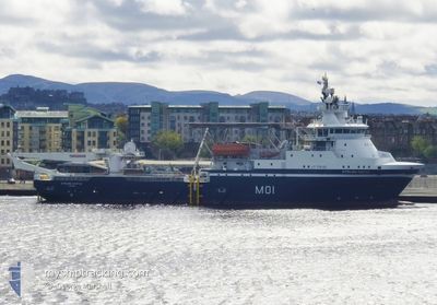
STIRLING CASTLE
Offshore Supply Ship
Current Trip
| Trip Time | 2 days |
|---|---|
| Trip Distance | 226.33 nm |
| AVG Speed | 8.3 Knots |
| MAX Speed | 8.3 Knots |
| Dybgang | 0 m |
| AVG Wind | 15.3 knots |
| MAX Wind | 39 knots |
| MIN Temp | 6.4°C / 43.52°F |
| MAX Temp | 13.1°C / 55.58°F |
| Position Modtaget | 1 d siden |
Current Position
| Longitude | --- |
|---|---|
| Latitude | --- |
| Status | Moored |
| Fart | |
| Kurs | 70° |
| Område | English Channel |
| Station | T-AIS |
| Position Modtaget | 1 d siden |
Info
Information
The current position of STIRLING CASTLE is in English Channel with coordinates 50.57265° / -2.43817° as reported on 2025-12-05 20:32 by AIS to our vessel tracker app. The vessel's current speed is 0 Knots and is currently inside the port of PORTLAND UK.
The vessel STIRLING CASTLE (IMO: 9630535, MMSI: 232047057) is a Offshore Supply Ship that was built in 2013 ( 12 år gamle ). It's sailing under the flag of [GB] United Kingdom.
In this page you can find informations about the vessels current position, last detected port calls, and current voyage information. If the vessels is not in coverage by AIS you will find the latest position.
The current position of STIRLING CASTLE is detected by our AIS receivers and we are not responsible for the reliability of the data. The last position was recorded while the vessel was in Coverage by the Ais receivers of our vessel tracking app.
Weather
| Temperature | 12.6°C / 54.68°F |
|---|---|
| Wind Speed | 29 knots |
| Direction | 239° WSW |
| Pressure | 994 hPa |
| Humidity | 81.3 % |
| Cloud Coverage | 52 % |
Featured Company
Last Port Calls
| Port | Arrival | Departure | Time In Port |
|---|---|---|---|
| 2025-12-05 19:20 | |||
| 2025-12-04 15:09 | 2025-12-05 11:55 | 20 h | |
| 2025-11-20 16:19 | 2025-12-03 09:14 | 12 d | |
| 2025-11-14 10:10 | 2025-11-17 10:14 | 3 d | |
| 2025-11-11 09:50 | 2025-11-12 10:14 | 1 d | |
| 2025-11-10 23:19 | 2025-11-11 09:14 | 9 h | |
| 2025-11-03 11:02 | 2025-11-10 10:19 | 6 d | |
| 2025-11-02 12:02 | 2025-11-03 10:22 | 22 h | |
| 2025-10-28 09:09 | 2025-10-28 15:18 | 6 h | |
| 2025-10-22 11:31 |
Most Visited Ports (Last year)
| Port | Arrivals | |
|---|---|---|
| 4 | ||
| 3 | ||
| 1 | ||
| 1 |
Last Trips
| Origin | Departure | Destination | Arrival | Distance | |
|---|---|---|---|---|---|
| 2025-12-03 09:14 | 2025-12-05 19:20 | 226.33 nm | |||
| 2025-12-03 09:14 | 2025-12-04 15:09 | 157.28 nm | |||
| 2025-11-17 10:14 | 2025-11-20 16:19 | 169.17 nm | |||
| 2025-11-12 10:14 | 2025-11-14 10:10 | 168.67 nm | |||
| 2025-11-10 10:19 | 2025-11-11 09:50 | 130.18 nm | |||
| 2025-11-10 10:19 | 2025-11-10 23:19 | 124.95 nm | |||
| 2025-10-28 15:18 | 2025-11-03 11:02 | 538.88 nm | |||
| 2025-10-28 15:18 | 2025-11-02 12:02 | 530.87 nm | |||
| 2025-10-22 11:31 | 2025-10-28 09:09 | 425.95 nm |
Events
| Tid | Hændelsen | Detaljer | Position / Dest | Info |
|---|---|---|---|---|
| 2025-12-05 20:32 | Udenfor Dækning |
50.57265 / -2.43817
English Channel
[GB] PORTLAND UK
|
Fart: Kurs: 20.8° |
|
| 2025-12-05 19:59 | Status er ændret | Moored Under way using engine |
50.57264 / -2.43818
[GB] PORTLAND UK
|
Fart: Kurs: 70° |
| 2025-12-05 19:53 | STOP Sejllads |
50.57247 / -2.43809
[GB] PORTLAND UK
|
Fart: 0.2 kn Kurs: 65° |
|
| 2025-12-05 19:20 | Skibe i havn |
|
50.58681 / -2.41525
[GB] PORTLAND UK
|
Fart: 6.3 kn Kurs: 205.5° |
| 2025-12-05 19:00 | START Sejllads | 1.09 nm, East of WEYMOUTH |
50.60390 / -2.41879
SEA
|
Fart: 5 kn Kurs: 46.1° |
| 2025-12-05 17:14 | STOP Sejllads | 1.1 nm, East of WEYMOUTH |
50.60195 / -2.41942
SEA
|
Fart: 0.3 kn Kurs: 185° |
| 2025-12-05 11:55 | Afsejlet fra sidste havn |
|
50.75116 / -1.09794
SEA
|
Fart: 9.7 kn Kurs: 130° |
| 2025-12-05 11:50 | START Sejllads |
50.75970 / -1.11262
[GB] PORTSMOUTH ANCH
|
Fart: 3.4 kn Kurs: 137° |
|
| 2025-12-05 11:42 | Status er ændret | Under way using engine At anchor |
50.75770 / -1.11059
[GB] PORTSMOUTH ANCH
|
Fart: 0.2 kn Kurs: 156° |
| 2025-12-04 15:16 | STOP Sejllads |
50.75663 / -1.10728
[GB] PORTSMOUTH ANCH
|
Fart: 0.3 kn Kurs: 301° |