
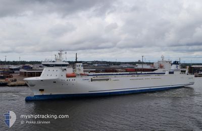
STELLAR MARI
Ro-Ro Cargo
Current Trip
LAVAN ANCHOREG
| Time Travelled | 1 day |
|---|---|
| Remaining Time | --- |
| Distance Travelled | 72.34 nm |
| Remaining Distance | --- |
| AVG Speed | 4.7 Knots |
| MAX Speed | 6 Knots |
| AVG Wind | 9.9 knots |
| MAX Wind | 12.8 knots |
| MIN Temp | 24.3°C / 75.74°F |
| MAX Temp | 26.2°C / 79.16°F |
| Dybgang | 0 m |
| Position Modtaget | 1 d siden |
Current Position
| Longitude | --- |
|---|---|
| Latitude | --- |
| Status | Default |
| Fart | 5.3 Knots |
| Kurs | 275.5° |
| Område | Persian Gulf |
| Station | T-AIS |
| Position Modtaget | 1 d siden |
Info
Information
The current position of STELLAR MARI is in Persian Gulf with coordinates 26.63642° / 53.34047° as reported on 2025-12-10 04:44 by AIS to our vessel tracker app. The vessel's current speed is 5.3 Knots
The vessel STELLAR MARI (IMO: 9132002, MMSI: 257653000) is a Ro-Ro Cargo that was built in 1998 ( 27 år gamle ). It's sailing under the flag of [NO] Norway.
In this page you can find informations about the vessels current position, last detected port calls, and current voyage information. If the vessels is not in coverage by AIS you will find the latest position.
The current position of STELLAR MARI is detected by our AIS receivers and we are not responsible for the reliability of the data. The last position was recorded while the vessel was in Coverage by the Ais receivers of our vessel tracking app.
Weather
| Temperature | 26.2°C / 79.16°F |
|---|---|
| Wind Speed | 7 knots |
| Direction | 133° SE |
| Pressure | 1016.5 hPa |
| Humidity | 58.2 % |
| Cloud Coverage | 100 % |
Featured Company
Most Visited Ports (Last year)
| Port | Arrivals | |
|---|---|---|
| 4 |
Events
| Tid | Hændelsen | Detaljer | Position / Dest | Info |
|---|---|---|---|---|
| 2025-12-10 04:44 | Udenfor Dækning |
26.63642 / 53.34047
Persian Gulf
|
Fart: 5.3 kn Kurs: 275.5° |
|
| 2025-12-10 04:44 | Indenfor Dækning |
26.63642 / 53.34047
Persian Gulf
|
Fart: 5.3 kn Kurs: 275.5° |
|
| 2025-12-09 21:26 | START Sejllads | 0.53 nm, North of KISH |
26.57954 / 54.00880
LAVAN ANCHOREG
|
Fart: 3.4 kn Kurs: -1° |
| 2025-12-09 21:12 | Afsejlet fra sidste havn |
|
26.57954 / 54.00880
LAVAN ANCHOREG
|
Fart: 0.2 kn Kurs: -1° |
| 2025-12-05 10:04 | Skibe i havn |
|
26.56822 / 54.00259
[IR] KISH
|
Fart: 5.6 kn Kurs: 185° |
| 2025-12-04 19:44 | STOP Sejllads | 2.02 nm, North West of KISH |
26.59166 / 53.97666
LAVAN ANCHOREG
|
Fart: Kurs: -1° |
| 2025-12-03 22:39 | START Sejllads |
26.66167 / 52.14667
LAVAN ANCHOREG
|
Fart: 5 kn Kurs: 96° |
|
| 2025-12-01 16:54 | STOP Sejllads |
26.65667 / 52.13667
LAVAN ANCHOREG
|
Fart: Kurs: -1° |