
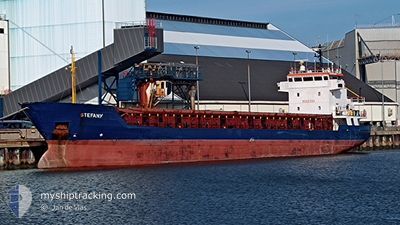
STEFANY
General Cargo
Current Trip
| Time Travelled | 7 days |
|---|---|
| Remaining Time | 19 h, 47 mins |
| Distance Travelled | 1501.42 nm |
| Remaining Distance | 225.28 nm |
| AVG Speed | 8.8 Knots |
| MAX Speed | 10.5 Knots |
| AVG Wind | 9.7 knots |
| MAX Wind | 20 knots |
| MIN Temp | 11.3°C / 52.34°F |
| MAX Temp | 19.8°C / 67.64°F |
| Dybgang | 5.2 m |
| Position Modtaget | 23 h, 39 m siden |
Current Position
| Longitude | --- |
|---|---|
| Latitude | --- |
| Status | Under way using engine |
| Fart | 7.6 Knots |
| Kurs | 91.1° |
| Område | Mediterranean Sea - Eastern Basin |
| Station | T-AIS |
| Position Modtaget | 23 h, 39 m siden |
Info
Information
The current position of STEFANY is in Mediterranean Sea - Eastern Basin with coordinates 35.93084° / 29.81777° as reported on 2025-12-04 13:20 by AIS to our vessel tracker app. The vessel's current speed is 7.6 Knots and is heading at the port of ISKENDERUN. The estimated time of arrival as calculated by MyShipTracking vessel tracking app is 2025-12-06 08:47 LT
The vessel STEFANY (IMO: 9006394, MMSI: 374608000) is a General Cargo that was built in 1995 ( 30 år gamle ). It's sailing under the flag of [PA] Panama.
In this page you can find informations about the vessels current position, last detected port calls, and current voyage information. If the vessels is not in coverage by AIS you will find the latest position.
The current position of STEFANY is detected by our AIS receivers and we are not responsible for the reliability of the data. The last position was recorded while the vessel was in Coverage by the Ais receivers of our vessel tracking app.
The current draught of STEFANY as reported by AIS is 5.2 meters
Weather
| Temperature | 20.4°C / 68.72°F |
|---|---|
| Wind Speed | 28 knots |
| Direction | 110° ESE |
| Pressure | 1013.6 hPa |
| Humidity | 63.4 % |
| Cloud Coverage | 64 % |
Featured Company
Last Port Calls
| Port | Arrival | Departure | Time In Port |
|---|---|---|---|
| 2025-11-25 11:34 | 2025-11-27 13:57 | 2 d | |
| 2025-11-18 06:18 | 2025-11-20 05:31 | 1 d | |
| 2025-11-08 07:03 | 2025-11-09 13:28 | 1 d | |
| 2025-11-01 15:46 | 2025-11-03 06:36 | 1 d | |
| 2025-10-19 14:40 | 2025-10-19 17:33 | 2 h | |
| 2025-10-05 17:55 | 2025-10-08 18:19 | 3 d |
Most Visited Ports (Last year)
| Port | Arrivals | |
|---|---|---|
| 3 | ||
| 3 | ||
| 2 | ||
| 2 | ||
| 1 | ||
| 1 |
Last Trips
| Origin | Departure | Destination | Arrival | Distance | |
|---|---|---|---|---|---|
| 2025-11-20 06:31 | 2025-11-25 12:34 | 759.09 nm | |||
| 2025-11-09 16:28 | 2025-11-18 07:18 | 1238.30 nm | |||
| 2025-11-03 09:36 | 2025-11-08 10:03 | 233.25 nm | |||
| 2025-10-19 19:33 | 2025-11-01 18:46 | 1883.52 nm | |||
| 2025-10-08 19:19 | 2025-10-19 16:40 | 1634.73 nm | |||
| 2025-09-19 21:58 | 2025-10-05 18:55 | 2128.89 nm |
Events
| Tid | Hændelsen | Detaljer | Position / Dest | Info |
|---|---|---|---|---|
| 2025-12-04 13:41 | Status er ændret | Default Under way using engine |
35.92987 / 29.87323
TRISK
|
Fart: 7.6 kn Kurs: 91.1° |
| 2025-12-04 13:20 | Udenfor Dækning |
35.93084 / 29.81777
Mediterranean Sea - Eastern Basin
TRISK
|
Fart: 7.6 kn Kurs: 91.1° |
|
| 2025-12-04 13:09 | Ændre havområde | Turkish part of the Mediterranean Sea - Eastern Basin Greek part of the Mediterranean Sea - Eastern Basin |
35.93111 / 29.78701
Mediterranean Sea - Eastern Basin
TRISK
|
Fart: 7.5 kn Kurs: 91.1° |
| 2025-12-04 13:09 | Status er ændret | Under way using engine Default |
35.93111 / 29.78701
TRISK
|
Fart: 7.4 kn Kurs: 84° |
| 2025-12-04 12:40 | Status er ændret | Default Under way using engine |
35.92641 / 29.71532
TRISK
|
Fart: 8.1 kn Kurs: 65.3° |
| 2025-12-04 11:44 | Status er ændret | Under way using engine Default |
35.87185 / 29.57473
TRISK
|
Fart: 8.4 kn Kurs: 66° |
| 2025-12-04 11:44 | Indenfor Dækning |
35.87304 / 29.57768
Mediterranean Sea - Eastern Basin
TRISK
|
Fart: 8 kn Kurs: 62.9° |
|
| 2025-12-04 05:18 | Status er ændret | Default Under way using engine |
35.50585 / 28.53722
TRISK
|
Fart: 8.7 kn Kurs: 67.5° |
| 2025-12-04 05:13 | Udenfor Dækning |
35.50121 / 28.52466
Mediterranean Sea - Eastern Basin
TRISK
|
Fart: 8.7 kn Kurs: 67.5° |
|
| 2025-12-04 05:02 | Status er ændret | Under way using engine Default |
35.49045 / 28.49432
TRISK
|
Fart: 8.9 kn Kurs: 65° |