
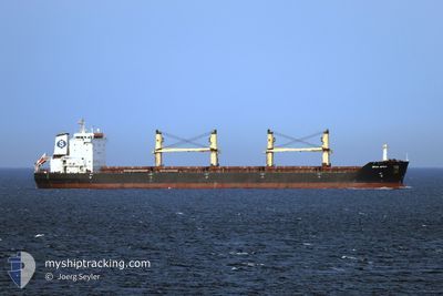
SPAR SPICA
Bulk Carrier
Current Trip
| Time Travelled | 21 h, 35 mins |
|---|---|
| Remaining Time | 8 h, 40 mins |
| Distance Travelled | 279.62 nm |
| Remaining Distance | 171.17 nm |
| AVG Speed | 13 Knots |
| MAX Speed | 15.8 Knots |
| AVG Wind | 9.5 knots |
| MAX Wind | 17.8 knots |
| MIN Temp | 27°C / 80.6°F |
| MAX Temp | 32.2°C / 89.96°F |
| Dybgang | 8 m |
| Position Modtaget | 1 d siden |
Current Position
| Longitude | 107.02892° |
|---|---|
| Latitude | 10.54172° |
| Status | Moored |
| Fart | |
| Kurs | 187° |
| Område | South China Sea |
| Station | T-AIS |
| Position Modtaget | 1 d siden |
Info
Information
The current position of SPAR SPICA is in South China Sea with coordinates 10.54172° / 107.02892° as reported on 2024-04-26 03:26 by AIS to our vessel tracker app. The vessel's current speed is 0 Knots and is heading at the port of DUNG QUAT. The estimated time of arrival as calculated by MyShipTracking vessel tracking app is 2024-04-27 12:19 LT
The vessel SPAR SPICA (IMO: 9328522, MMSI: 259933000) is a Bulk Carrier that was built in 2005 ( 19 år gamle ). It's sailing under the flag of [NO] Norway.
In this page you can find informations about the vessels current position, last detected port calls, and current voyage information. If the vessels is not in coverage by AIS you will find the latest position.
The current position of SPAR SPICA is detected by our AIS receivers and we are not responsible for the reliability of the data. The last position was recorded while the vessel was in Coverage by the Ais receivers of our vessel tracking app.
The current draught of SPAR SPICA as reported by AIS is 8 meters
Weather
| Temperature | 28.2°C / 82.76°F |
|---|---|
| Wind Speed | 18 knots |
| Direction | 160° SSE |
| Pressure | 1008 hPa |
| Humidity | 88 % |
| Cloud Coverage | 19 % |
Featured Company
Most Visited Ports (Last year)
| Port | Arrivals | |
|---|---|---|
| 3 | ||
| 2 | ||
| 2 | ||
| 1 | ||
| 1 | ||
| 1 |
Last Trips
| Origin | Departure | Destination | Arrival | Distance | |
|---|---|---|---|---|---|
| 2024-04-19 23:39 | 2024-04-24 10:12 | 1166.11 nm | |||
| 2024-01-31 13:08 | 2024-04-16 00:39 | 6319.76 nm |
Events
| Tid | Hændelsen | Detaljer | Position / Dest | Info |
|---|---|---|---|---|
| 2024-04-26 06:04 | START Sejllads | 0.18 nm, South West of CAI MEP |
10.53843 / 107.02591
DUNG QUAT
|
Fart: 4.4 kn Kurs: 200° |
| 2024-04-26 06:04 | Afsejlet fra sidste havn |
|
10.53843 / 107.02591
DUNG QUAT
|
Fart: 1.4 kn Kurs: 203° |
| 2024-04-26 03:31 | Status er ændret | Default Moored |
10.54166 / 107.02891
[VN] CAI MEP
|
Fart: Kurs: 187° |
| 2024-04-26 03:26 | Udenfor Dækning |
10.54172 / 107.02892
South China Sea
[VN] CAI MEP
|
Fart: Kurs: 107.5° |
|
| 2024-04-26 03:21 | Status er ændret | Moored Default |
10.54176 / 107.02889
[VN] CAI MEP
|
Fart: Kurs: 187° |
| 2024-04-26 03:16 | Indenfor Dækning |
10.54176 / 107.02889
South China Sea
[VN] CAI MEP
|
Fart: Kurs: 107.5° |
|
| 2024-04-26 01:48 | Status er ændret | Default Moored |
10.54171 / 107.02887
[VN] CAI MEP
|
Fart: Kurs: 186° |
| 2024-04-26 01:44 | Status er ændret | Moored Default |
10.54170 / 107.02889
[VN] CAI MEP
|
Fart: Kurs: 186° |
| 2024-04-26 01:44 | Udenfor Dækning |
10.54170 / 107.02889
South China Sea
[VN] CAI MEP
|
Fart: Kurs: 96.4° |
|
| 2024-04-26 01:39 | Indenfor Dækning |
10.54170 / 107.02889
South China Sea
[VN] CAI MEP
|
Fart: Kurs: 96.4° |