
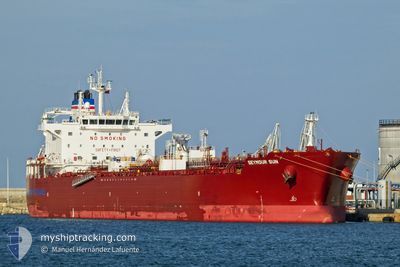
SEYMOUR SUN
Tanker
Current Trip
| Time Travelled | 17 days |
|---|---|
| Remaining Time | 1 day |
| Distance Travelled | 4373.60 nm |
| Remaining Distance | 388.61 nm |
| AVG Speed | 11.2 Knots |
| MAX Speed | 14.9 Knots |
| AVG Wind | 11.9 knots |
| MAX Wind | 22.6 knots |
| MIN Temp | 19.9°C / 67.82°F |
| MAX Temp | 31.7°C / 89.06°F |
| Dybgang | 12.1 m |
| Position Modtaget | 7 d siden |
Current Position
| Longitude | -59.25344° |
|---|---|
| Latitude | 11.14804° |
| Status | Under way using engine |
| Fart | 11.7 Knots |
| Kurs | 111.7° |
| Område | North Atlantic Ocean |
| Station | T-AIS |
| Position Modtaget | 7 d siden |
Info
Information
The current position of SEYMOUR SUN is in North Atlantic Ocean with coordinates 11.14804° / -59.25344° as reported on 2024-05-15 11:12 by AIS to our vessel tracker app. The vessel's current speed is 11.7 Knots and is heading at the port of ARATU. The estimated time of arrival as calculated by MyShipTracking vessel tracking app is 2024-05-24 02:44 LT
The vessel SEYMOUR SUN (IMO: 9911501, MMSI: 563145200) is a Tanker It's sailing under the flag of [SG] Singapore.
In this page you can find informations about the vessels current position, last detected port calls, and current voyage information. If the vessels is not in coverage by AIS you will find the latest position.
The current position of SEYMOUR SUN is detected by our AIS receivers and we are not responsible for the reliability of the data. The last position was recorded while the vessel was in Coverage by the Ais receivers of our vessel tracking app.
The current draught of SEYMOUR SUN as reported by AIS is 12.1 meters
Weather
| Temperature | 27.9°C / 82.22°F |
|---|---|
| Wind Speed | 14 knots |
| Direction | 136° SE |
| Pressure | 1014.2 hPa |
| Humidity | 75.4 % |
| Cloud Coverage | 27 % |
Featured Company
Last Port Calls
| Port | Arrival | Departure | Time In Port |
|---|---|---|---|
| 2024-05-04 12:47 | 2024-05-04 18:06 | 5 h | |
| 2024-04-20 20:23 | 2024-04-22 19:25 | 1 d | |
| 2024-04-05 19:37 | 2024-04-08 22:40 | 3 d | |
| 2024-03-29 07:00 | 2024-03-29 08:15 | 1 h | |
| 2024-03-28 00:16 | 2024-03-28 01:49 | 1 h | |
| 2024-03-24 00:47 | 2024-03-26 05:01 | 2 d | |
| 2024-03-01 07:37 | 2024-03-02 10:00 | 1 d |
Last Trips
| Origin | Departure | Destination | Arrival | Distance | |
|---|---|---|---|---|---|
| 2024-04-22 19:25 | 2024-05-04 12:47 | 3514.44 nm | |||
| 2024-04-08 22:40 | 2024-04-20 20:23 | 3407.00 nm | |||
| 2024-03-29 08:15 | 2024-04-05 19:37 | 533.06 nm | |||
| 2024-03-28 01:49 | 2024-03-29 07:00 | 3.34 nm | |||
| 2024-03-26 05:01 | 2024-03-28 00:16 | 307.97 nm | |||
| 2024-03-02 10:00 | 2024-03-24 00:47 | 5127.37 nm | |||
| 2024-02-23 22:35 | 2024-03-01 07:37 | 920.83 nm |
Events
| Tid | Hændelsen | Detaljer | Position / Dest | Info |
|---|---|---|---|---|
| 2024-05-15 11:21 | Status er ændret | Default Under way using engine |
11.13664 / -59.22425
BRARB
|
Fart: 11.7 kn Kurs: 111.7° |
| 2024-05-15 11:12 | Udenfor Dækning |
11.14804 / -59.25344
North Atlantic Ocean
BRARB
|
Fart: 11.7 kn Kurs: 111.7° |
|
| 2024-05-15 11:07 | Status er ændret | Under way using engine Default |
11.15372 / -59.26790
BRARB
|
Fart: 11 kn Kurs: 111° |
| 2024-05-15 10:42 | Status er ændret | Default Under way using engine |
11.18448 / -59.34386
BRARB
|
Fart: 11.4 kn Kurs: 111.2° |
| 2024-05-15 10:05 | Status er ændret | Under way using engine Default |
11.22698 / -59.45580
BRARB
|
Fart: 11.3 kn Kurs: 111° |
| 2024-05-15 10:00 | Status er ændret | Default Under way using engine |
11.23266 / -59.47085
BRARB
|
Fart: 11.3 kn Kurs: 109.9° |
| 2024-05-15 09:57 | Ændre havområde | Trinidad and Tobago part of the North Atlantic Ocean Bahamas part of the North Atlantic Ocean |
11.23558 / -59.47898
North Atlantic Ocean
BRARB
|
Fart: 11.3 kn Kurs: 109.9° |
| 2024-05-15 09:56 | Status er ændret | Under way using engine Default |
11.23665 / -59.48201
BRARB
|
Fart: 11.3 kn Kurs: 111° |
| 2024-05-15 09:46 | Indenfor Dækning |
11.23558 / -59.47898
North Atlantic Ocean
BRARB
|
Fart: 11.3 kn Kurs: 109.9° |