
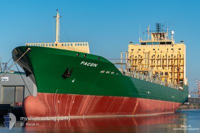
SC MARIGOT
Container Ship
Current Trip
| Trip Time | 17 h, 35 mins |
|---|---|
| Trip Distance | 244.16 nm |
| AVG Speed | 13.1 Knots |
| MAX Speed | 14.9 Knots |
| Dybgang | 9.4 m |
| AVG Wind | 7.8 knots |
| MAX Wind | 11 knots |
| MIN Temp | 26°C / 78.8°F |
| MAX Temp | 28.1°C / 82.58°F |
| Position Modtaget | 1 m siden |
Current Position
| Longitude | -97.88436° |
|---|---|
| Latitude | 22.47386° |
| Status | Moored |
| Fart | |
| Kurs | 347° |
| Område | Gulf of Mexico |
| Station | T-AIS |
| Position Modtaget | 1 m siden |
Info
Information
The current position of SC MARIGOT is in Gulf of Mexico with coordinates 22.47386° / -97.88436° as reported on 2024-05-12 18:28 by AIS to our vessel tracker app. The vessel's current speed is 0 Knots and is currently inside the port of ALTAMIRA.
The vessel SC MARIGOT (IMO: 9275115, MMSI: 636020666) is a Container Ship that was built in 2005 ( 19 år gamle ). It's sailing under the flag of [LR] Liberia.
In this page you can find informations about the vessels current position, last detected port calls, and current voyage information. If the vessels is not in coverage by AIS you will find the latest position.
The current position of SC MARIGOT is detected by our AIS receivers and we are not responsible for the reliability of the data. The last position was recorded while the vessel was in Coverage by the Ais receivers of our vessel tracking app.
The current draught of SC MARIGOT as reported by AIS is 9.4 meters
Weather
| Temperature | 35.3°C / 95.54°F |
|---|---|
| Wind Speed | 11 knots |
| Direction | 123° ESE |
| Pressure | 1004.8 hPa |
| Humidity | 41.8 % |
| Cloud Coverage | 2 % |
Featured Company
Last Port Calls
| Port | Arrival | Departure | Time In Port |
|---|---|---|---|
| 2024-05-12 09:06 | |||
| 2024-05-10 22:16 | 2024-05-11 15:31 | 17 h | |
| 2024-05-07 16:12 | 2024-05-08 06:26 | 14 h | |
| 2024-05-01 15:04 | 2024-05-02 05:56 | 14 h | |
| 2024-04-30 07:29 | 2024-04-30 23:53 | 16 h | |
| 2024-04-27 08:02 | 2024-04-28 07:38 | 23 h | |
| 2024-04-22 14:03 | 2024-04-23 08:34 | 18 h | |
| 2024-04-20 18:56 | 2024-04-21 12:34 | 17 h | |
| 2024-04-18 08:11 | 2024-04-19 07:19 | 23 h | |
| 2024-04-10 15:53 | 2024-04-11 04:13 | 12 h |
Most Visited Ports (Last year)
| Port | Arrivals | |
|---|---|---|
| 18 | ||
| 17 | ||
| 17 | ||
| 16 | ||
| 15 | ||
| 15 |
Last Trips
| Origin | Departure | Destination | Arrival | Distance | |
|---|---|---|---|---|---|
| 2024-05-11 15:31 | 2024-05-12 09:06 | 244.16 nm | |||
| 2024-05-08 06:26 | 2024-05-10 22:16 | 395.91 nm | |||
| 2024-05-02 05:56 | 2024-05-07 16:12 | 1213.91 nm | |||
| 2024-04-30 23:53 | 2024-05-01 15:04 | 215.41 nm | |||
| 2024-04-28 07:38 | 2024-04-30 07:29 | 641.52 nm | |||
| 2024-04-23 08:34 | 2024-04-27 08:02 | 1266.61 nm | |||
| 2024-04-21 12:34 | 2024-04-22 14:03 | 256.05 nm | |||
| 2024-04-19 07:19 | 2024-04-20 18:56 | 380.28 nm | |||
| 2024-04-11 04:13 | 2024-04-18 08:11 | 1224.13 nm | |||
| 2024-04-10 00:47 | 2024-04-10 15:53 | 220.18 nm |
Events
| Tid | Hændelsen | Detaljer | Position / Dest | Info |
|---|---|---|---|---|
| 2024-05-12 14:47 | Status er ændret | Moored Under way using engine |
22.47380 / -97.88432
[MX] ALTAMIRA
|
Fart: Kurs: 347° |
| 2024-05-12 14:39 | STOP Sejllads |
22.47381 / -97.88457
[MX] ALTAMIRA
|
Fart: 0.3 kn Kurs: 345° |
|
| 2024-05-12 14:06 | Skibe i havn |
|
22.48728 / -97.85850
[MX] ALTAMIRA
|
Fart: 9.3 kn Kurs: 270.4° |
| 2024-05-12 11:48 | Status er ændret | Under way using engine Default |
22.41254 / -97.39668
MXATM
|
Fart: 14.4 kn Kurs: 296° |
| 2024-05-12 11:33 | Indenfor Dækning |
22.41254 / -97.39668
Gulf of Mexico
MXATM
|
Fart: 14.3 kn Kurs: 294.8° |
|
| 2024-05-12 09:07 | Status er ændret | Default Under way using engine |
21.85106 / -97.06291
MXATM
|
Fart: 14.7 kn Kurs: 337.9° |
| 2024-05-12 08:59 | Udenfor Dækning |
21.81769 / -97.04791
Gulf of Mexico
MXATM
|
Fart: 14.7 kn Kurs: 337.9° |
|
| 2024-05-12 07:57 | Status er ændret | Under way using engine Default |
21.58247 / -96.94152
MXATM
|
Fart: 14.8 kn Kurs: 337° |
| 2024-05-12 07:53 | Status er ændret | Default Under way using engine |
21.56992 / -96.93587
MXATM
|
Fart: 14.8 kn Kurs: 337.1° |
| 2024-05-12 07:26 | Status er ændret | Under way using engine Default |
21.46699 / -96.88822
MXATM
|
Fart: 14.8 kn Kurs: 336° |