
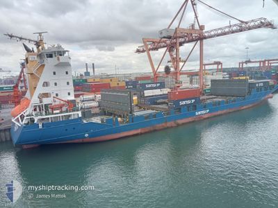
SAMSKIP EXPRESS
Container Ship
Current Trip
| Time Travelled | 1 day |
|---|---|
| Remaining Time | 2 h, 26 mins |
| Distance Travelled | 363.25 nm |
| Remaining Distance | 30.54 nm |
| AVG Speed | 12.2 Knots |
| MAX Speed | 15.9 Knots |
| AVG Wind | 14.8 knots |
| MAX Wind | 20.9 knots |
| MIN Temp | 6°C / 42.8°F |
| MAX Temp | 12.1°C / 53.78°F |
| Dybgang | 6.4 m |
| Position Modtaget | 1 m siden |
Current Position
| Longitude | 3.40294° |
|---|---|
| Latitude | 52.14549° |
| Status | Under way using engine |
| Fart | 11.5 Knots |
| Kurs | 139.4° |
| Område | North Sea |
| Station | T-AIS |
| Position Modtaget | 1 m siden |
Info
Information
The current position of SAMSKIP EXPRESS is in North Sea with coordinates 52.14549° / 3.40294° as reported on 2024-04-29 23:07 by AIS to our vessel tracker app. The vessel's current speed is 11.5 Knots and is heading at the port of ROTTERDAM. The estimated time of arrival as calculated by MyShipTracking vessel tracking app is 2024-04-30 01:34 LT
The vessel SAMSKIP EXPRESS (IMO: 9323479, MMSI: 255805840) is a Container Ship that was built in 2006 ( 18 år gamle ). It's sailing under the flag of [PT] Portugal.
In this page you can find informations about the vessels current position, last detected port calls, and current voyage information. If the vessels is not in coverage by AIS you will find the latest position.
The current position of SAMSKIP EXPRESS is detected by our AIS receivers and we are not responsible for the reliability of the data. The last position was recorded while the vessel was in Coverage by the Ais receivers of our vessel tracking app.
The current draught of SAMSKIP EXPRESS as reported by AIS is 6.4 meters
Weather
| Temperature | 12.3°C / 54.14°F |
|---|---|
| Wind Speed | 2 knots |
| Direction | 136° SE |
| Pressure | 1017.4 hPa |
| Humidity | 75.2 % |
| Cloud Coverage | 67 % |
Featured Company
Last Port Calls
| Port | Arrival | Departure | Time In Port |
|---|---|---|---|
| 2024-04-27 15:02 | 2024-04-28 17:29 | 1 d | |
| 2024-04-25 19:14 | 2024-04-26 05:16 | 10 h | |
| 2024-04-24 16:35 | 2024-04-25 05:01 | 12 h | |
| 2024-04-23 09:06 | 2024-04-23 23:06 | 14 h | |
| 2024-04-22 07:48 | 2024-04-22 21:48 | 13 h | |
| 2024-04-19 17:21 | 2024-04-20 06:29 | 13 h | |
| 2024-04-16 12:42 | 2024-04-16 20:11 | 7 h | |
| 2024-04-15 07:27 | 2024-04-15 21:53 | 14 h | |
| 2024-04-08 08:27 | 2024-04-13 07:58 | 4 d | |
| 2024-04-05 20:12 | 2024-04-06 07:52 | 11 h |
Most Visited Ports (Last year)
| Port | Arrivals | |
|---|---|---|
| 54 | ||
| 44 | ||
| 25 | ||
| 9 | ||
| 4 | ||
| 4 |
Last Trips
| Origin | Departure | Destination | Arrival | Distance | |
|---|---|---|---|---|---|
| 2024-04-26 07:16 | 2024-04-27 16:02 | 407.27 nm | |||
| 2024-04-25 06:01 | 2024-04-25 21:14 | 210.68 nm | |||
| 2024-04-24 01:06 | 2024-04-24 17:35 | 209.08 nm | |||
| 2024-04-22 22:48 | 2024-04-23 11:06 | 165.72 nm | |||
| 2024-04-20 08:29 | 2024-04-22 08:48 | 725.46 nm | |||
| 2024-04-16 22:11 | 2024-04-19 19:21 | 793.07 nm | |||
| 2024-04-15 22:53 | 2024-04-16 14:42 | 171.12 nm | |||
| 2024-04-13 09:58 | 2024-04-15 08:27 | 724.52 nm | |||
| 2024-04-06 09:52 | 2024-04-08 10:27 | 15.66 nm | |||
| 2024-04-03 11:50 | 2024-04-05 22:12 | 800.97 nm |
Events
| Tid | Hændelsen | Detaljer | Position / Dest | Info |
|---|---|---|---|---|
| 2024-04-29 22:25 | Ændre havområde | Dutch part of the North Sea United Kingdom part of the North Sea |
52.23246 / 3.24115
North Sea
ROTTERDAM
|
Fart: 11.4 kn Kurs: 125.1° |
| 2024-04-29 22:24 | Status er ændret | Under way using engine Default |
52.23430 / 3.23700
ROTTERDAM
|
Fart: 11 kn Kurs: 128° |
| 2024-04-29 22:18 | Indenfor Dækning |
52.23246 / 3.24115
North Sea
ROTTERDAM
|
Fart: 11.4 kn Kurs: 125.1° |
|
| 2024-04-29 19:37 | Status er ændret | Default Under way using engine |
52.58465 / 2.53225
ROTTERDAM
|
Fart: 12.5 kn Kurs: 129.9° |
| 2024-04-29 19:28 | Status er ændret | Under way using engine Default |
52.60401 / 2.49352
ROTTERDAM
|
Fart: 12.4 kn Kurs: 130° |
| 2024-04-29 19:28 | Udenfor Dækning |
52.60401 / 2.49352
North Sea
ROTTERDAM
|
Fart: 12.5 kn Kurs: 129.9° |
|
| 2024-04-29 19:20 | Indenfor Dækning |
52.60401 / 2.49352
North Sea
ROTTERDAM
|
Fart: 12.5 kn Kurs: 129.9° |
|
| 2024-04-29 18:12 | Status er ændret | Default Under way using engine |
52.78064 / 2.17504
ROTTERDAM
|
Fart: 12.2 kn Kurs: 142.3° |
| 2024-04-29 18:08 | Udenfor Dækning |
52.79315 / 2.15918
North Sea
ROTTERDAM
|
Fart: 12.2 kn Kurs: 142.3° |
|
| 2024-04-29 13:36 | Status er ændret | Under way using engine Default |
53.34692 / .96907
ROTTERDAM
|
Fart: 11 kn Kurs: 115° |