
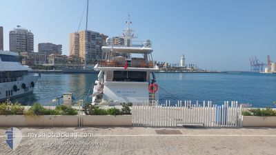
SAMA
Pleasure Craft
Current Trip
| Trip Time | 31 mins |
|---|---|
| Trip Distance | 6.11 nm |
| AVG Speed | 12.7 Knots |
| MAX Speed | 15 Knots |
| Dybgang | 0 m |
| AVG Wind | 0.4 knots |
| MAX Wind | 1 knots |
| MIN Temp | 13.7°C / 56.66°F |
| MAX Temp | 13.9°C / 57.02°F |
| Position Modtaget | 2 m siden |
Current Position
| Longitude | --- |
|---|---|
| Latitude | --- |
| Status | Default |
| Fart | |
| Kurs | --- |
| Område | Mediterranean Sea - Western Basin |
| Station | T-AIS |
| Position Modtaget | 2 m siden |
Info
Information
The current position of SAMA is in Mediterranean Sea - Western Basin with coordinates 43.69717° / 7.28416° as reported on 2025-12-13 17:57 by AIS to our vessel tracker app. The vessel's current speed is 0 Knots and is currently inside the port of NICE.
The vessel SAMA (IMO: 1073741823, MMSI: 232011045) is a Pleasure Craft It's sailing under the flag of [GB] United Kingdom.
In this page you can find informations about the vessels current position, last detected port calls, and current voyage information. If the vessels is not in coverage by AIS you will find the latest position.
The current position of SAMA is detected by our AIS receivers and we are not responsible for the reliability of the data. The last position was recorded while the vessel was in Coverage by the Ais receivers of our vessel tracking app.
Weather
| Temperature | 10.8°C / 51.44°F |
|---|---|
| Wind Speed | 3 knots |
| Direction | 349° N |
| Pressure | 1025.5 hPa |
| Humidity | 61.3 % |
| Cloud Coverage | 6 % |
Featured Company
Last Port Calls
| Port | Arrival | Departure | Time In Port |
|---|---|---|---|
| 2025-12-12 11:36 | |||
| 2025-12-08 09:49 | 2025-12-12 11:05 | 4 d | |
| 2025-11-03 12:02 | 2025-12-08 08:46 | ||
| 2025-10-08 15:05 | 2025-11-03 10:57 | 25 d | |
| 2025-10-08 14:16 |
Most Visited Ports (Last year)
| Port | Arrivals | |
|---|---|---|
| 21 | ||
| 5 | ||
| 4 | ||
| 2 | ||
| 2 | ||
| 1 |
Last Trips
| Origin | Departure | Destination | Arrival | Distance | |
|---|---|---|---|---|---|
| 2025-12-12 12:05 | 2025-12-12 12:36 | 6.11 nm | |||
| 2025-12-08 09:46 | 2025-12-08 10:49 | 12.90 nm | |||
| 2025-11-03 11:57 | 2025-11-03 13:02 | 4.74 nm | |||
| 2025-10-08 16:16 | 2025-10-08 17:05 | 7.02 nm |
Events
| Tid | Hændelsen | Detaljer | Position / Dest | Info |
|---|---|---|---|---|
| 2025-12-12 11:40 | STOP Sejllads |
43.69722 / 7.28423
[FR] NICE
|
Fart: 0.1 kn Kurs: 96° |
|
| 2025-12-12 11:36 | Skibe i havn |
|
43.69570 / 7.28461
[FR] NICE
|
Fart: 10 kn Kurs: 347.4° |
| 2025-12-12 11:05 | Afsejlet fra sidste havn |
|
43.70533 / 7.34325
|
Fart: 8.2 kn Kurs: 135° |
| 2025-12-12 11:04 | START Sejllads |
43.70748 / 7.34127
[FR] BEAULIEU-SUR-MER
|
Fart: 8.2 kn Kurs: 135° |
|
| 2025-12-12 10:27 | Indenfor Dækning |
43.70772 / 7.33668
Mediterranean Sea - Western Basin
[FR] BEAULIEU-SUR-MER
|
Fart: Kurs: 274.3° |
|
| 2025-12-11 07:10 | Udenfor Dækning |
43.70770 / 7.33669
Mediterranean Sea - Western Basin
[FR] BEAULIEU-SUR-MER
|
Fart: Kurs: 328.3° |
|
| 2025-12-11 07:10 | Indenfor Dækning |
43.70770 / 7.33669
Mediterranean Sea - Western Basin
[FR] BEAULIEU-SUR-MER
|
Fart: Kurs: 328.3° |
|
| 2025-12-11 04:22 | Udenfor Dækning |
43.70765 / 7.33646
Mediterranean Sea - Western Basin
[FR] BEAULIEU-SUR-MER
|
Fart: Kurs: 332.3° |
|
| 2025-12-11 04:22 | Indenfor Dækning |
43.70765 / 7.33646
Mediterranean Sea - Western Basin
[FR] BEAULIEU-SUR-MER
|
Fart: Kurs: 332.3° |
|
| 2025-12-10 09:43 | Udenfor Dækning |
43.70778 / 7.33632
Mediterranean Sea - Western Basin
[FR] BEAULIEU-SUR-MER
|
Fart: Kurs: 320.1° |