
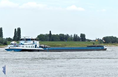
RONNY-O
Cargo
Current Trip
SAARHAFEN SAARLOUIS
| Time Travelled | 5 days |
|---|---|
| Remaining Time | --- |
| Distance Travelled | 31.58 nm |
| Remaining Distance | --- |
| AVG Speed | 5 Knots |
| MAX Speed | 7 Knots |
| AVG Wind | 3.2 knots |
| MAX Wind | 5 knots |
| MIN Temp | 16.3°C / 61.34°F |
| MAX Temp | 19.8°C / 67.64°F |
| Dybgang | 2.7 m |
| Position Modtaget | 4 d siden |
Current Position
| Longitude | 7.31870° |
|---|---|
| Latitude | 50.49844° |
| Status | Under way using engine |
| Fart | 5.2 Knots |
| Kurs | 138.4° |
| Område | North Sea |
| Station | T-AIS |
| Position Modtaget | 4 d siden |
Info
Information
The current position of RONNY-O is in North Sea with coordinates 50.49844° / 7.31870° as reported on 2024-07-22 08:42 by AIS to our vessel tracker app. The vessel's current speed is 5.2 Knots
The vessel RONNY-O (MMSI: 205484290) is a Cargo It's sailing under the flag of [BE] Belgium.
In this page you can find informations about the vessels current position, last detected port calls, and current voyage information. If the vessels is not in coverage by AIS you will find the latest position.
The current position of RONNY-O is detected by our AIS receivers and we are not responsible for the reliability of the data. The last position was recorded while the vessel was in Coverage by the Ais receivers of our vessel tracking app.
The current draught of RONNY-O as reported by AIS is 2.7 meters
Weather
| Temperature | 17.9°C / 64.22°F |
|---|---|
| Wind Speed | 3 knots |
| Direction | 325° NW |
| Pressure | 1017.1 hPa |
| Humidity | 80.9 % |
| Cloud Coverage | 82 % |
Featured Company
Last Port Calls
| Port | Arrival | Departure | Time In Port |
|---|---|---|---|
| 2024-07-21 21:48 | 2024-07-21 22:47 | 59 m | |
| 2024-07-21 11:54 | 2024-07-21 12:57 | 1 h | |
| 2024-07-20 21:45 | 2024-07-20 21:50 | 5 m | |
| 2024-07-19 22:32 | 2024-07-20 04:05 | 5 h | |
| 2024-07-19 18:53 | 2024-07-19 21:11 | 2 h | |
| 2024-07-19 11:08 | 2024-07-19 17:28 | 6 h | |
| 2024-07-14 14:52 | 2024-07-18 08:58 | 3 d | |
| 2024-07-13 17:08 | 2024-07-13 17:59 | 51 m | |
| 2024-07-05 22:01 | 2024-07-05 23:05 | 1 h | |
| 2024-07-05 12:02 | 2024-07-05 13:04 | 1 h |
Last Trips
| Origin | Departure | Destination | Arrival | Distance | |
|---|---|---|---|---|---|
| 2024-07-21 12:57 | 2024-07-21 21:48 | 45.32 nm | |||
| 2024-07-20 21:50 | 2024-07-21 11:54 | 39.12 nm | |||
| 2024-07-20 04:05 | 2024-07-20 21:45 | 101.87 nm | |||
| 2024-07-19 21:11 | 2024-07-19 22:32 | 11.08 nm | |||
| 2024-07-19 17:28 | 2024-07-19 18:53 | 9.41 nm | |||
| 2024-07-18 08:58 | 2024-07-19 11:08 | 33.67 nm | |||
| 2024-07-13 17:59 | 2024-07-14 14:52 | 97.83 nm | |||
| 2024-07-05 23:05 | 2024-07-13 17:08 | 164.53 nm | |||
| 2024-07-05 13:04 | 2024-07-05 22:01 | 44.11 nm | |||
| 2024-07-04 13:37 | 2024-07-05 12:02 | 95.78 nm |
Events
| Tid | Hændelsen | Detaljer | Position / Dest | Info |
|---|---|---|---|---|
| 2024-07-22 08:42 | Udenfor Dækning |
50.49844 / 7.31870
North Sea
SAARHAFEN SAARLOUIS
|
Fart: 5.2 kn Kurs: 138.4° |
|
| 2024-07-22 03:00 | START Sejllads | 2.01 nm, North East of GODORF |
50.86938 / 7.02620
SAARHAFEN SAARLOUIS
|
Fart: 4.3 kn Kurs: 229° |
| 2024-07-22 02:57 | Status er ændret | Under way using engine Moored |
50.87092 / 7.02842
SAARHAFEN SAARLOUIS
|
Fart: Kurs: 243° |
| 2024-07-21 21:47 | Status er ændret | Moored Under way using engine |
50.87094 / 7.02865
SAARHAFEN SAARLOUIS
|
Fart: Kurs: 243° |
| 2024-07-21 21:28 | STOP Sejllads | 2.14 nm, North East of GODORF |
50.87101 / 7.02851
SAARHAFEN SAARLOUIS
|
Fart: 0.3 kn Kurs: 238° |
| 2024-07-21 20:47 | Afsejlet fra sidste havn |
|
50.89384 / 7.01199
SAARHAFEN SAARLOUIS
|
Fart: 4.8 kn Kurs: 88° |
| 2024-07-21 19:48 | Skibe i havn |
|
50.95949 / 6.98898
[DE] KOELN
|
Fart: 5.6 kn Kurs: 237° |
| 2024-07-21 10:57 | Afsejlet fra sidste havn |
|
51.40397 / 6.74504
SAARHAFEN SAARLOUIS
|
Fart: 5.4 kn Kurs: 178° |
| 2024-07-21 09:54 | Skibe i havn |
|
51.47275 / 6.68606
[DE] DUISBURG
|
Fart: 5.6 kn Kurs: 124.8° |
| 2024-07-21 06:26 | Indenfor Dækning |
51.65795 / 6.54126
North Sea
SAARHAFEN SAARLOUIS
|
Fart: 5.5 kn Kurs: 108.5° |