
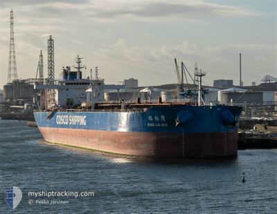
RONG LIN WAN
Tanker
Current Trip
| Time Travelled | 6 days |
|---|---|
| Remaining Time | --- |
| Distance Travelled | 101.01 nm |
| Remaining Distance | --- |
| AVG Speed | 8.9 Knots |
| MAX Speed | 14.1 Knots |
| AVG Wind | 9.9 knots |
| MAX Wind | 17 knots |
| MIN Temp | 25°C / 77°F |
| MAX Temp | 29°C / 84.2°F |
| Dybgang | 8.6 m |
| Position Modtaget | 5 d siden |
Current Position
| Longitude | --- |
|---|---|
| Latitude | --- |
| Status | Under way using engine |
| Fart | 12.7 Knots |
| Kurs | 53.9° |
| Område | Singapore Strait |
| Station | T-AIS |
| Position Modtaget | 5 d siden |
Info
Information
The current position of RONG LIN WAN is in Singapore Strait with coordinates 1.29121° / 104.33591° as reported on 2025-12-15 05:05 by AIS to our vessel tracker app. The vessel's current speed is 12.7 Knots
The vessel RONG LIN WAN (IMO: 9783423, MMSI: 563026200) is a Tanker It's sailing under the flag of [SG] Singapore.
In this page you can find informations about the vessels current position, last detected port calls, and current voyage information. If the vessels is not in coverage by AIS you will find the latest position.
The current position of RONG LIN WAN is detected by our AIS receivers and we are not responsible for the reliability of the data. The last position was recorded while the vessel was in Coverage by the Ais receivers of our vessel tracking app.
The current draught of RONG LIN WAN as reported by AIS is 8.6 meters
Weather
| Temperature | 27.4°C / 81.32°F |
|---|---|
| Wind Speed | 14 knots |
| Direction | 359° N |
| Pressure | 1008.4 hPa |
| Humidity | 81.3 % |
| Cloud Coverage | 81 % |
Featured Company
Last Port Calls
| Port | Arrival | Departure | Time In Port |
|---|---|---|---|
| 2025-12-13 01:31 | 2025-12-14 12:47 | 1 d | |
| 2025-12-05 15:12 | 2025-12-06 15:08 | 23 h | |
| 2025-11-23 04:08 | 2025-11-26 10:29 | 3 d | |
| 2025-11-02 07:22 | 2025-11-03 07:28 | 1 d | |
| 2025-10-26 11:08 | 2025-10-29 06:58 | 2 d | |
| 2025-10-14 13:57 | 2025-10-15 17:30 | 1 d | |
| 2025-10-01 13:54 |
Last Trips
| Origin | Departure | Destination | Arrival | Distance | |
|---|---|---|---|---|---|
| 2025-12-06 15:08 | 2025-12-13 01:31 | 1734.45 nm | |||
| 2025-11-26 10:29 | 2025-12-05 15:12 | 2558.30 nm | |||
| 2025-11-03 07:28 | 2025-11-23 04:08 | 5291.33 nm | |||
| 2025-10-29 06:58 | 2025-11-02 07:22 | 469.92 nm | |||
| 2025-10-15 17:30 | 2025-10-26 11:08 | 1092.05 nm | |||
| 2025-10-01 13:54 | 2025-10-14 13:57 | 3622.65 nm |
Events
| Tid | Hændelsen | Detaljer | Position / Dest | Info |
|---|---|---|---|---|
| 2025-12-19 12:04 | STOP Sejllads |
1.74259 / 104.90524
SINGAPORE
|
Fart: 0.1 kn Kurs: 355° |
|
| 2025-12-19 11:22 | START Sejllads |
1.70654 / 104.89055
SINGAPORE
|
Fart: 8.3 kn Kurs: 15° |
|
| 2025-12-15 08:52 | STOP Sejllads |
1.69060 / 104.88738
SINGAPORE
|
Fart: 0.3 kn Kurs: 353° |
|
| 2025-12-15 05:10 | Status er ændret | Default Under way using engine |
1.30418 / 104.35068
SINGAPORE
|
Fart: 12.7 kn Kurs: 53.9° |
| 2025-12-15 05:05 | Status er ændret | Under way using engine Default |
1.29121 / 104.33591
SINGAPORE
|
Fart: 12.8 kn Kurs: 74° |
| 2025-12-15 05:05 | Udenfor Dækning |
1.29121 / 104.33591
Singapore Strait
SINGAPORE
|
Fart: 12.7 kn Kurs: 53.9° |
|
| 2025-12-15 04:38 | Status er ændret | Default Under way using engine |
1.27459 / 104.23894
SINGAPORE
|
Fart: 14.1 kn Kurs: 81.1° |
| 2025-12-15 04:23 | Status er ændret | Under way using engine Default |
1.26705 / 104.18192
SINGAPORE
|
Fart: 14 kn Kurs: 84° |
| 2025-12-15 04:18 | Status er ændret | Default Under way using engine |
1.26469 / 104.16116
SINGAPORE
|
Fart: 13.9 kn Kurs: 83.3° |
| 2025-12-15 04:13 | Fundet i havområde | Malaysian part of the Singapore Strait |
1.26248 / 104.14282
Singapore Strait
SINGAPORE
|
Fart: 13.8 kn Kurs: 83.7° |