
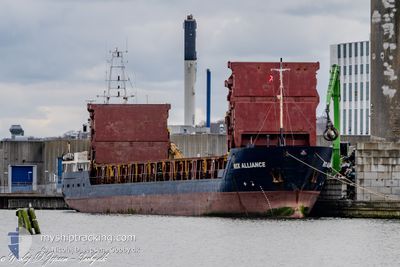
RIX ALLIANCE
General Cargo
Current Trip
DK NYF
| Time Travelled | 1 day |
|---|---|
| Remaining Time | --- |
| Distance Travelled | 275.26 nm |
| Remaining Distance | --- |
| AVG Speed | 6.7 Knots |
| MAX Speed | 9 Knots |
| AVG Wind | 16.7 knots |
| MAX Wind | 32.3 knots |
| MIN Temp | 4°C / 39.2°F |
| MAX Temp | 10.8°C / 51.44°F |
| Dybgang | 5.4 m |
| Position Modtaget | 1 m siden |
Current Position
| Longitude | 11.00267° |
|---|---|
| Latitude | 55.96218° |
| Status | Under way using engine |
| Fart | 7.4 Knots |
| Kurs | 212° |
| Område | Kattegat |
| Station | T-AIS |
| Position Modtaget | 1 m siden |
Info
Information
The current position of RIX ALLIANCE is in Kattegat with coordinates 55.96218° / 11.00267° as reported on 2024-04-29 17:32 by AIS to our vessel tracker app. The vessel's current speed is 7.4 Knots
The vessel RIX ALLIANCE (IMO: 9128403, MMSI: 209336000) is a General Cargo that was built in 1995 ( 29 år gamle ). It's sailing under the flag of [CY] Cyprus.
In this page you can find informations about the vessels current position, last detected port calls, and current voyage information. If the vessels is not in coverage by AIS you will find the latest position.
The current position of RIX ALLIANCE is detected by our AIS receivers and we are not responsible for the reliability of the data. The last position was recorded while the vessel was in Coverage by the Ais receivers of our vessel tracking app.
The current draught of RIX ALLIANCE as reported by AIS is 5.4 meters
Weather
| Temperature | 10.8°C / 51.44°F |
|---|---|
| Wind Speed | 10 knots |
| Direction | 165° SSE |
| Pressure | 1023.1 hPa |
| Humidity | 79.1 % |
| Cloud Coverage | 86 % |
Featured Company
Last Port Calls
| Port | Arrival | Departure | Time In Port |
|---|---|---|---|
| 2024-04-27 12:35 | 2024-04-28 00:00 | 11 h | |
| 2024-04-24 10:14 | 2024-04-25 18:12 | 1 d | |
| 2024-04-17 04:30 | 2024-04-21 09:37 | 4 d | |
| 2024-04-15 18:40 | 2024-04-16 14:21 | 19 h | |
| 2024-04-08 10:42 | 2024-04-10 10:13 | 1 d | |
| 2024-04-04 20:13 | 2024-04-06 04:30 | 1 d | |
| 2024-04-03 11:36 | 2024-04-03 21:00 | 9 h | |
| 2024-03-28 05:31 | 2024-03-30 06:56 | 2 d | |
| 2024-03-27 05:06 | 2024-03-27 16:31 | 11 h | |
| 2024-03-26 04:21 | 2024-03-26 14:16 | 9 h |
Last Trips
| Origin | Departure | Destination | Arrival | Distance | |
|---|---|---|---|---|---|
| 2024-04-25 19:12 | 2024-04-27 14:35 | 349.77 nm | |||
| 2024-04-21 11:37 | 2024-04-24 11:14 | 531.24 nm | |||
| 2024-04-16 16:21 | 2024-04-17 06:30 | 102.16 nm | |||
| 2024-04-10 12:13 | 2024-04-15 20:40 | 707.11 nm | |||
| 2024-04-06 07:30 | 2024-04-08 12:42 | 446.77 nm | |||
| 2024-04-03 23:00 | 2024-04-04 23:13 | 190.05 nm | |||
| 2024-03-30 07:56 | 2024-04-03 13:36 | 285.45 nm | |||
| 2024-03-27 17:31 | 2024-03-28 06:31 | 109.86 nm | |||
| 2024-03-26 15:16 | 2024-03-27 06:06 | 114.98 nm | |||
| 2024-03-25 15:10 | 2024-03-26 05:21 | 45.89 nm |
Events
| Tid | Hændelsen | Detaljer | Position / Dest | Info |
|---|---|---|---|---|
| 2024-04-29 06:40 | ETA er ændret | 2024/04/30 04:00 2024/04/30 03:00 |
57.19955 / 10.70562
DK NYF
|
Fart: 7.2 kn Kurs: 180.7° |
| 2024-04-29 01:56 | Ændre havområde | Danish part of the Kattegat Danish part of the Skaggerak |
57.75855 / 10.76441
Kattegat
DK NYF
|
Fart: 6.3 kn Kurs: 180.7° |
| 2024-04-28 18:43 | Ændre havområde | Danish part of the Skaggerak Norwegian part of the Skaggerak |
57.72796 / 8.94707
Skaggerak
DK NYF
|
Fart: 8 kn Kurs: 87.5° |
| 2024-04-28 09:03 | Fundet i havområde | Norwegian part of the Skaggerak |
57.74592 / 7.45868
Skaggerak
DK NYF
|
Fart: 4.9 kn Kurs: 119.4° |
| 2024-04-28 07:18 | ETA er ændret | 2024/04/30 03:00 2024/04/29 18:05 |
57.82407 / 7.21913
DK NYF
|
Fart: 5.4 kn Kurs: 120.1° |
| 2024-04-28 00:00 | Afsejlet fra sidste havn |
|
58.32432 / 6.25899
DK NYF
|
Fart: 4.5 kn Kurs: 167° |
| 2024-04-27 23:56 | START Sejllads |
58.32823 / 6.25804
[NO] REKEFJORD
|
Fart: 3.5 kn Kurs: 176° |
|
| 2024-04-27 23:32 | Status er ændret | Under way using engine Moored |
58.33063 / 6.25764
[NO] REKEFJORD
|
Fart: Kurs: 172° |
| 2024-04-27 23:21 | Dybgangen er ændret | 5.4 5 |
58.33062 / 6.25760
[NO] REKEFJORD
|
Fart: Kurs: 172° |
| 2024-04-27 21:37 | Dybgangen er ændret | 5 3 |
58.33016 / 6.25775
[NO] REKEFJORD
|
Fart: Kurs: 177° |