
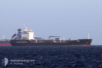
RINA
Oil/Chemical Tanker
Current Trip
| Time Travelled | 10 days |
|---|---|
| Remaining Time | -22 mins |
| Distance Travelled | 1004.54 nm |
| Remaining Distance | 14.97 nm |
| AVG Speed | 9.3 Knots |
| MAX Speed | 14.5 Knots |
| AVG Wind | 17 knots |
| MAX Wind | 40 knots |
| MIN Temp | 6°C / 42.8°F |
| MAX Temp | 11°C / 51.8°F |
| Dybgang | 6.8 m |
| Position Modtaget | 7 m siden |
Current Position
| Longitude | --- |
|---|---|
| Latitude | --- |
| Status | At anchor |
| Fart | |
| Kurs | 242° |
| Område | North Sea |
| Station | T-AIS |
| Position Modtaget | 7 m siden |
Info
Information
The current position of RINA is in North Sea with coordinates 51.95022° / 3.77280° as reported on 2025-12-13 09:14 by AIS to our vessel tracker app. The vessel's current speed is 0 Knots and is heading at the port of ROTTERDAM. The estimated time of arrival as calculated by MyShipTracking vessel tracking app is 2025-12-13 10:00 LT
The vessel RINA (IMO: 9152820, MMSI: 210051000) is a Oil/Chemical Tanker that was built in 1997 ( 28 år gamle ). It's sailing under the flag of [CY] Cyprus.
In this page you can find informations about the vessels current position, last detected port calls, and current voyage information. If the vessels is not in coverage by AIS you will find the latest position.
The current position of RINA is detected by our AIS receivers and we are not responsible for the reliability of the data. The last position was recorded while the vessel was in Coverage by the Ais receivers of our vessel tracking app.
The current draught of RINA as reported by AIS is 6.8 meters
Weather
| Temperature | 9.6°C / 49.28°F |
|---|---|
| Wind Speed | 7 knots |
| Direction | 276° W |
| Pressure | 1027.4 hPa |
| Humidity | 81.2 % |
| Cloud Coverage | 100 % |
Featured Company
Last Port Calls
| Port | Arrival | Departure | Time In Port |
|---|---|---|---|
| 2025-12-01 19:25 | 2025-12-03 06:58 | 1 d | |
| 2025-11-22 01:23 | 2025-11-22 21:21 | 19 h | |
| 2025-10-29 20:23 | 2025-11-21 22:29 | 23 d | |
| 2025-10-15 14:42 | 2025-10-29 20:08 | 14 d | |
| 2025-10-14 16:45 | 2025-10-15 13:15 | 20 h |
Most Visited Ports (Last year)
| Port | Arrivals | |
|---|---|---|
| 5 | ||
| 3 | ||
| 2 | ||
| 1 | ||
| 1 | ||
| 1 |
Last Trips
| Origin | Departure | Destination | Arrival | Distance | |
|---|---|---|---|---|---|
| 2025-11-22 21:21 | 2025-12-01 19:25 | 1218.04 nm | |||
| 2025-11-21 22:29 | 2025-11-22 01:23 | 26.28 nm | |||
| 2025-10-29 20:08 | 2025-10-29 20:23 | 0.49 nm | |||
| 2025-10-15 13:15 | 2025-10-15 14:42 | 12.10 nm | |||
| 2025-09-13 21:09 | 2025-10-14 16:45 | 1439.03 nm |
Events
| Tid | Hændelsen | Detaljer | Position / Dest | Info |
|---|---|---|---|---|
| 2025-12-13 09:20 | Status er ændret | Default At anchor |
51.95026 / 3.77292
NLRTM
|
Fart: Kurs: 242° |
| 2025-12-13 08:50 | Status er ændret | At anchor Default |
51.95026 / 3.77285
NLRTM
|
Fart: Kurs: 237° |
| 2025-12-13 08:47 | Status er ændret | Default At anchor |
51.95029 / 3.77282
NLRTM
|
Fart: Kurs: 238° |
| 2025-12-13 08:44 | Status er ændret | At anchor Default |
51.95027 / 3.77281
NLRTM
|
Fart: Kurs: 237° |
| 2025-12-13 08:38 | Status er ændret | Default At anchor |
51.95029 / 3.77279
NLRTM
|
Fart: Kurs: 238° |
| 2025-12-13 07:36 | Status er ændret | At anchor Under way using engine |
51.94877 / 3.77124
NLRTM
|
Fart: 0.1 kn Kurs: 261° |
| 2025-12-13 07:33 | STOP Sejllads | 10.91 nm, North West of OUDDORP |
51.94878 / 3.77133
NLRTM
|
Fart: 0.3 kn Kurs: 247° |
| 2025-12-13 06:36 | ETA er ændret | 2025/12/13 07:00 2025/12/13 04:00 |
52.05426 / 3.69277
NLRTM
|
Fart: 9.5 kn Kurs: 158.7° |
| 2025-12-13 06:34 | Status er ændret | Under way using engine Default |
52.05899 / 3.68940
NLRTM
|
Fart: 10.4 kn Kurs: 121° |
| 2025-12-13 06:01 | Status er ændret | Default Under way using engine |
52.10531 / 3.55531
NLRTM
|
Fart: 10.3 kn Kurs: 118.4° |