
RIBERA DUERO KNUTSEN
Lng Tanker
Current Trip
| Time Travelled | 10 days |
|---|---|
| Remaining Time | 1 day |
| Distance Travelled | 4918.82 nm |
| Remaining Distance | 675.89 nm |
| AVG Speed | 18.3 Knots |
| MAX Speed | 21.4 Knots |
| AVG Wind | 13.8 knots |
| MAX Wind | 35.2 knots |
| MIN Temp | 16.9°C / 62.42°F |
| MAX Temp | 27°C / 80.6°F |
| Dybgang | 11.8 m |
| Position Modtaget | Nu |
Current Position
| Longitude | -4.77317° |
|---|---|
| Latitude | 36.05024° |
| Status | Under way using engine |
| Fart | 20.9 Knots |
| Kurs | 74.3° |
| Område | Alboran Sea |
| Station | T-AIS |
| Position Modtaget | Nu |
Info
Information
The current position of RIBERA DUERO KNUTSEN is in Alboran Sea with coordinates 36.05024° / -4.77317° as reported on 2024-05-10 20:42 by AIS to our vessel tracker app. The vessel's current speed is 20.9 Knots and is heading at the port of FOS. The estimated time of arrival as calculated by MyShipTracking vessel tracking app is 2024-05-12 06:46 LT
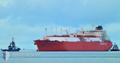
The vessel RIBERA DUERO KNUTSEN (IMO: 9477593, MMSI: 259082000) is a Lng Tanker that was built in 2010 ( 14 år gamle ). It's sailing under the flag of [NO] Norway.
In this page you can find informations about the vessels current position, last detected port calls, and current voyage information. If the vessels is not in coverage by AIS you will find the latest position.
The current position of RIBERA DUERO KNUTSEN is detected by our AIS receivers and we are not responsible for the reliability of the data. The last position was recorded while the vessel was in Coverage by the Ais receivers of our vessel tracking app.
The current draught of RIBERA DUERO KNUTSEN as reported by AIS is 11.8 meters
Weather
| Temperature | 18°C / 64.4°F |
|---|---|
| Wind Speed | 16 knots |
| Direction | 107° ESE |
| Pressure | 1015.9 hPa |
| Humidity | 81.5 % |
| Cloud Coverage | 100 % |
Featured Company
Last Port Calls
| Port | Arrival | Departure | Time In Port |
|---|---|---|---|
| 2024-04-26 05:19 | 2024-04-29 22:02 | 3 d | |
| 2024-04-10 14:56 | 2024-04-11 18:04 | 1 d | |
| 2024-03-11 10:09 | 2024-03-12 13:51 | 1 d |
Events
| Tid | Hændelsen | Detaljer | Position / Dest | Info |
|---|---|---|---|---|
| 2024-05-10 19:23 | Ændre havområde | Spanish part of the Alboran Sea Spanish part of the Strait of Gibraltar |
35.98931 / -5.30798
Alboran Sea
FRFOS
|
Fart: 17 kn Kurs: 75.3° |
| 2024-05-10 19:11 | Ændre havområde | Spanish part of the Strait of Gibraltar Moroccan part of the Strait of Gibraltar |
35.97382 / -5.36836
Strait of Gibraltar
FRFOS
|
Fart: 14.7 kn Kurs: 67° |
| 2024-05-10 17:57 | Status er ændret | Under way using engine Default |
35.90627 / -5.85002
FRFOS
|
Fart: 18.6 kn Kurs: 83° |
| 2024-05-10 17:46 | Status er ændret | Default Under way using engine |
35.89776 / -5.91644
FRFOS
|
Fart: 18.6 kn Kurs: 77.1° |
| 2024-05-10 17:41 | Ændre havområde | Moroccan part of the Strait of Gibraltar Moroccan part of the North Atlantic Ocean |
35.89167 / -5.94802
Strait of Gibraltar
FRFOS
|
Fart: 18.6 kn Kurs: 77.1° |
| 2024-05-10 17:40 | Status er ændret | Under way using engine Default |
35.88982 / -5.95795
FRFOS
|
Fart: 18.5 kn Kurs: 77° |
| 2024-05-10 17:31 | Status er ændret | Default Under way using engine |
35.88144 / -6.01441
FRFOS
|
Fart: 17.8 kn Kurs: 82.6° |
| 2024-05-10 17:20 | Status er ændret | Under way using engine Default |
35.87469 / -6.07620
FRFOS
|
Fart: 17.6 kn Kurs: 90° |
| 2024-05-10 17:19 | Status er ændret | Default Under way using engine |
35.87450 / -6.08768
FRFOS
|
Fart: 17.8 kn Kurs: 91.9° |
| 2024-05-10 17:14 | Ændre havområde | Moroccan part of the North Atlantic Ocean Portuguese part of the North Atlantic Ocean |
35.87521 / -6.11681
North Atlantic Ocean
FRFOS
|
Fart: 17.8 kn Kurs: 91.9° |