
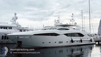
REGULUS
Pleasure Craft
Current Trip
| Time Travelled | 1 day |
|---|---|
| Remaining Time | --- |
| Distance Travelled | 3.74 nm |
| Remaining Distance | --- |
| AVG Speed | 7.9 Knots |
| MAX Speed | 8.2 Knots |
| AVG Wind | 9.4 knots |
| MAX Wind | 9.9 knots |
| MIN Temp | 20.4°C / 68.72°F |
| MAX Temp | 20.6°C / 69.08°F |
| Dybgang | 2.8 m |
| Position Modtaget | 1 d siden |
Current Position
| Longitude | 14.36970° |
|---|---|
| Latitude | 40.57793° |
| Status | Under way using engine |
| Fart | 8.2 Knots |
| Kurs | 241° |
| Område | Tyrrhenian Sea |
| Station | T-AIS |
| Position Modtaget | 1 d siden |
Info
Information
The current position of REGULUS is in Tyrrhenian Sea with coordinates 40.57793° / 14.36970° as reported on 2024-06-03 17:20 by AIS to our vessel tracker app. The vessel's current speed is 8.2 Knots
The vessel REGULUS (MMSI: 319474000) is a Pleasure Craft It's sailing under the flag of [KY] Cayman Is.
In this page you can find informations about the vessels current position, last detected port calls, and current voyage information. If the vessels is not in coverage by AIS you will find the latest position.
The current position of REGULUS is detected by our AIS receivers and we are not responsible for the reliability of the data. The last position was recorded while the vessel was in Coverage by the Ais receivers of our vessel tracking app.
The current draught of REGULUS as reported by AIS is 2.8 meters
Weather
| Temperature | 20.4°C / 68.72°F |
|---|---|
| Wind Speed | 7 knots |
| Direction | 299° WNW |
| Pressure | 1015.2 hPa |
| Humidity | 70.6 % |
| Cloud Coverage | --- |
Featured Company
Most Visited Ports (Last year)
| Port | Arrivals | |
|---|---|---|
| 4 | ||
| 2 | ||
| 2 | ||
| 1 | ||
| 1 |
Events
| Tid | Hændelsen | Detaljer | Position / Dest | Info |
|---|---|---|---|---|
| 2024-06-03 17:20 | Udenfor Dækning |
40.57793 / 14.36970
Tyrrhenian Sea
|
Fart: 8.2 kn Kurs: 241° |
|
| 2024-06-03 17:02 | Destination er ændret | POSITANO CAGLIARI |
40.59319 / 14.42311
POSITANO
|
Fart: 7.8 kn Kurs: 248.7° |
| 2024-06-03 17:02 | ETA er ændret | 2024/06/02 20:00 2024/04/07 13:00 |
40.59319 / 14.42311
POSITANO
|
Fart: 7.8 kn Kurs: 248.7° |
| 2024-06-03 16:53 | Ændre havområde | Italian part of the Tyrrhenian Sea Italian part of the Ionian Sea |
40.60052 / 14.44365
Tyrrhenian Sea
|
Fart: 7.8 kn Kurs: 243.3° |
| 2024-06-03 16:52 | Indenfor Dækning |
40.60052 / 14.44365
Tyrrhenian Sea
|
Fart: 7.8 kn Kurs: 243.3° |
|
| 2024-06-03 16:32 | Afsejlet fra sidste havn |
|
40.60114 / 14.44542
CAGLIARI
|
Fart: 0.5 kn Kurs: 193° |
| 2024-06-03 13:11 | Udenfor Dækning |
40.62288 / 14.49747
Ionian Sea
[IT] POSITANO
|
Fart: 0.5 kn Kurs: 123.3° |
|
| 2024-06-03 12:33 | Indenfor Dækning |
40.62288 / 14.49743
Ionian Sea
[IT] POSITANO
|
Fart: 0.4 kn Kurs: 179.5° |
|
| 2024-06-02 17:34 | Udenfor Dækning |
38.22539 / 15.62381
Ionian Sea
|
Fart: 6.3 kn Kurs: 345.3° |
|
| 2024-06-02 16:20 | Indenfor Dækning |
38.06415 / 15.54026
Ionian Sea
|
Fart: 8.5 kn Kurs: 36.6° |