
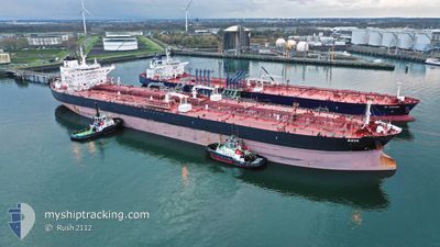
RAVA
Tanker
Current Trip
| Time Travelled | 7 days |
|---|---|
| Remaining Time | --- |
| Distance Travelled | 564.63 nm |
| Remaining Distance | --- |
| AVG Speed | 11.2 Knots |
| MAX Speed | 15.2 Knots |
| AVG Wind | 8.2 knots |
| MAX Wind | 29 knots |
| MIN Temp | 9.1°C / 48.38°F |
| MAX Temp | 18.7°C / 65.66°F |
| Dybgang | 9 m |
| Position Modtaget | Nu |
Current Position
| Longitude | --- |
|---|---|
| Latitude | --- |
| Status | Under way using engine |
| Fart | 0.3 Knots |
| Kurs | 47° |
| Område | Mediterranean Sea - Eastern Basin |
| Station | T-AIS |
| Position Modtaget | Nu |
Info
Information
The current position of RAVA is in Mediterranean Sea - Eastern Basin with coordinates 36.00077° / 28.66042° as reported on 2025-12-08 23:39 by AIS to our vessel tracker app. The vessel's current speed is 0.3 Knots
The vessel RAVA (IMO: 9796743, MMSI: 238019000) is a Tanker It's sailing under the flag of [HR] Croatia.
In this page you can find informations about the vessels current position, last detected port calls, and current voyage information. If the vessels is not in coverage by AIS you will find the latest position.
The current position of RAVA is detected by our AIS receivers and we are not responsible for the reliability of the data. The last position was recorded while the vessel was in Coverage by the Ais receivers of our vessel tracking app.
The current draught of RAVA as reported by AIS is 9 meters
Weather
| Temperature | 18.7°C / 65.66°F |
|---|---|
| Wind Speed | 6 knots |
| Direction | 337° NNW |
| Pressure | 1013 hPa |
| Humidity | 59.6 % |
| Cloud Coverage | 80 % |
Featured Company
Last Port Calls
| Port | Arrival | Departure | Time In Port |
|---|---|---|---|
| 2025-12-01 08:17 | 2025-12-01 09:26 | 1 h | |
| 2025-11-26 07:59 | 2025-11-26 09:24 | 1 h | |
| 2025-11-18 00:20 | 2025-11-19 02:40 | 1 d | |
| 2025-11-10 11:50 | 2025-11-11 15:17 | 1 d | |
| 2025-10-19 21:01 | 2025-10-21 02:28 | 1 d | |
| 2025-10-06 10:03 | 2025-10-07 05:28 | 19 h |
Last Trips
| Origin | Departure | Destination | Arrival | Distance | |
|---|---|---|---|---|---|
| 2025-11-26 09:24 | 2025-12-01 08:17 | 405.98 nm | |||
| 2025-11-19 02:40 | 2025-11-26 07:59 | 1007.26 nm | |||
| 2025-11-11 15:17 | 2025-11-18 00:20 | 1459.96 nm | |||
| 2025-10-21 02:28 | 2025-11-10 11:50 | 2878.82 nm | |||
| 2025-10-07 05:28 | 2025-10-19 21:01 | 1455.68 nm | |||
| 2025-09-29 11:59 | 2025-10-06 10:03 | 1409.42 nm |
Events
| Tid | Hændelsen | Detaljer | Position / Dest | Info |
|---|---|---|---|---|
| 2025-12-08 19:40 | Fundet i havområde | Greek part of the Mediterranean Sea - Eastern Basin |
35.98925 / 28.71589
Mediterranean Sea - Eastern Basin
TR CEY
|
Fart: 0.7 kn Kurs: 295.3° |
| 2025-12-08 01:26 | Status er ændret | Under way using engine Default |
35.96894 / 28.82266
TR CEY
|
Fart: Kurs: -1° |
| 2025-12-08 01:19 | Status er ændret | Default Under way using engine |
35.96833 / 28.82167
TR CEY
|
Fart: 0.3 kn Kurs: 131° |
| 2025-12-07 15:46 | Ændre havområde | Turkish part of the Mediterranean Sea - Eastern Basin Greek part of the Mediterranean Sea - Eastern Basin |
35.95210 / 28.72692
Mediterranean Sea - Eastern Basin
TR CEY
|
Fart: 0.4 kn Kurs: 63.1° |
| 2025-12-07 14:34 | STOP Sejllads |
35.95272 / 28.72238
TR CEY
|
Fart: 0.3 kn Kurs: 177° |
|
| 2025-12-07 12:31 | START Sejllads |
36.11389 / 28.59201
TR CEY
|
Fart: 3.1 kn Kurs: 233° |
|
| 2025-12-07 09:47 | Ændre havområde | Greek part of the Mediterranean Sea - Eastern Basin Greek part of the Aegean Sea |
36.07449 / 28.61491
Mediterranean Sea - Eastern Basin
TR CEY
|
Fart: 0.9 kn Kurs: 331.2° |
| 2025-12-07 09:45 | Status er ændret | Under way using engine Default |
36.07390 / 28.61533
TR CEY
|
Fart: 0.9 kn Kurs: 39° |
| 2025-12-07 09:35 | Indenfor Dækning |
36.07449 / 28.61491
Mediterranean Sea - Eastern Basin
TR CEY
|
Fart: 0.9 kn Kurs: 331.2° |
|
| 2025-12-06 17:19 | STOP Sejllads |
35.78667 / 28.69667
TR CEY
|
Fart: Kurs: -1° |