
PROMITHEAS
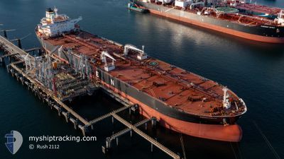
Oil Products Tanker
Current Trip
NLRTM
| Time Travelled | 2 days |
|---|---|
| Remaining Time | --- |
| Distance Travelled | 227.89 nm |
| Remaining Distance | --- |
| AVG Speed | 6 Knots |
| MAX Speed | 15.4 Knots |
| AVG Wind | 21 knots |
| MAX Wind | 37 knots |
| MIN Temp | 3°C / 37.4°F |
| MAX Temp | 6.8°C / 44.24°F |
| Dybgang | 13.2 m |
| Position Modtaget | 2 d siden |
Current Position
| Longitude | --- |
|---|---|
| Latitude | --- |
| Status | Under way using engine |
| Fart | 11 Knots |
| Kurs | 309° |
| Område | North Sea |
| Station | T-AIS |
| Position Modtaget | 2 d siden |
Info
Information
The current position of PROMITHEAS is in North Sea with coordinates 52.10655° / 3.61857° as reported on 2026-01-06 23:30 by AIS to our vessel tracker app. The vessel's current speed is 11 Knots
The vessel PROMITHEAS (IMO: 9305611, MMSI: 240547000) is a Oil Products Tanker that was built in 2006 ( 20 år gamle ). It's sailing under the flag of [GR] Greece.
In this page you can find informations about the vessels current position, last detected port calls, and current voyage information. If the vessels is not in coverage by AIS you will find the latest position.
The current position of PROMITHEAS is detected by our AIS receivers and we are not responsible for the reliability of the data. The last position was recorded while the vessel was in Coverage by the Ais receivers of our vessel tracking app.
The current draught of PROMITHEAS as reported by AIS is 13.2 meters
Weather
| Temperature | 5.4°C / 41.72°F |
|---|---|
| Wind Speed | 19 knots |
| Direction | 61° ENE |
| Pressure | 982.1 hPa |
| Humidity | 94.7 % |
| Cloud Coverage | 100 % |
Featured Company
Events
| Tid | Hændelsen | Detaljer | Position / Dest | Info |
|---|---|---|---|---|
| 2026-01-08 18:01 | START Sejllads |
52.48672 / 3.05309
NLRTM
|
Fart: 4 kn Kurs: 139° |
|
| 2026-01-08 15:31 | STOP Sejllads |
52.46333 / 3.06833
NLRTM
|
Fart: Kurs: -1° |
|
| 2026-01-06 23:37 | Status er ændret | Default Under way using engine |
52.11821 / 3.59106
NLRTM
|
Fart: 11 kn Kurs: 309° |
| 2026-01-06 23:30 | Udenfor Dækning |
52.10655 / 3.61857
North Sea
|
Fart: 11 kn Kurs: 309° |
|
| 2026-01-06 23:22 | Status er ændret | Under way using engine Default |
52.09166 / 3.64853
NLRTM
|
Fart: 11.1 kn Kurs: 308° |
| 2026-01-06 23:17 | Status er ændret | Default Under way using engine |
52.08075 / 3.67093
NLRTM
|
Fart: 11.3 kn Kurs: 308.2° |
| 2026-01-06 23:10 | Status er ændret | Under way using engine Default |
52.06841 / 3.69581
NLRTM
|
Fart: 11.2 kn Kurs: 307° |
| 2026-01-06 23:09 | Status er ændret | Default Under way using engine |
52.06527 / 3.70228
NLRTM
|
Fart: 10.9 kn Kurs: 303° |
| 2026-01-06 22:58 | Status er ændret | Under way using engine Default |
52.04793 / 3.74575
NLRTM
|
Fart: 11.7 kn Kurs: 266° |
| 2026-01-06 22:49 | Status er ændret | Default Under way using engine |
52.04887 / 3.79581
NLRTM
|
Fart: 11.3 kn Kurs: 270.3° |