
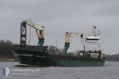
ONEGO BAYOU
General Cargo
Current Trip
CA SHH
| Time Travelled | 6 days |
|---|---|
| Remaining Time | --- |
| Distance Travelled | 1792.26 nm |
| Remaining Distance | --- |
| AVG Speed | 11.9 Knots |
| MAX Speed | 14 Knots |
| AVG Wind | 14.5 knots |
| MAX Wind | 25 knots |
| MIN Temp | 19.6°C / 67.28°F |
| MAX Temp | 26.3°C / 79.34°F |
| Dybgang | 4.8 m |
| Position Modtaget | 2 d siden |
Current Position
| Longitude | -79.37686° |
|---|---|
| Latitude | 26.33605° |
| Status | Under way using engine |
| Fart | 12.9 Knots |
| Kurs | 0.3° |
| Område | North Atlantic Ocean |
| Station | T-AIS |
| Position Modtaget | 2 d siden |
Info
Information
The current position of ONEGO BAYOU is in North Atlantic Ocean with coordinates 26.33605° / -79.37686° as reported on 2024-04-28 07:03 by AIS to our vessel tracker app. The vessel's current speed is 12.9 Knots
The vessel ONEGO BAYOU (IMO: 9369069, MMSI: 305024000) is a General Cargo that was built in 2007 ( 17 år gamle ). It's sailing under the flag of [AG] Antigua Barbuda.
In this page you can find informations about the vessels current position, last detected port calls, and current voyage information. If the vessels is not in coverage by AIS you will find the latest position.
The current position of ONEGO BAYOU is detected by our AIS receivers and we are not responsible for the reliability of the data. The last position was recorded while the vessel was in Coverage by the Ais receivers of our vessel tracking app.
The current draught of ONEGO BAYOU as reported by AIS is 4.8 meters
Weather
| Temperature | 21.7°C / 71.06°F |
|---|---|
| Wind Speed | 11 knots |
| Direction | 267° W |
| Pressure | 1019.7 hPa |
| Humidity | 79.7 % |
| Cloud Coverage | --- |
Featured Company
Last Port Calls
| Port | Arrival | Departure | Time In Port |
|---|---|---|---|
| 2024-04-21 16:50 | 2024-04-24 08:44 | 2 d | |
| 2024-04-07 23:26 | 2024-04-11 13:02 | 3 d | |
| 2024-04-01 17:43 | 2024-04-04 11:42 | 2 d | |
| 2024-03-28 15:10 | 2024-03-30 07:33 | 1 d | |
| 2024-03-14 17:59 | 2024-03-17 14:49 | 2 d | |
| 2024-03-07 00:09 | 2024-03-08 17:17 | 1 d | |
| 2024-03-02 18:13 | 2024-03-02 23:07 | 4 h | |
| 2024-03-02 11:43 | 2024-03-02 13:01 | 1 h | |
| 2024-03-02 06:19 | 2024-03-02 10:43 | 4 h | |
| 2024-02-06 13:56 | 2024-02-16 17:41 | 10 d |
Last Trips
| Origin | Departure | Destination | Arrival | Distance | |
|---|---|---|---|---|---|
| 2024-04-11 08:02 | 2024-04-21 11:50 | 1185.76 nm | |||
| 2024-04-04 06:42 | 2024-04-07 18:26 | 722.22 nm | |||
| 2024-03-30 01:33 | 2024-04-01 12:43 | 705.37 nm | |||
| 2024-03-17 08:49 | 2024-03-28 09:10 | 1200.31 nm | |||
| 2024-03-08 12:17 | 2024-03-14 11:59 | 1498.54 nm | |||
| 2024-03-02 18:07 | 2024-03-06 19:09 | 633.04 nm | |||
| 2024-03-02 08:01 | 2024-03-02 13:13 | 0.10 nm | |||
| 2024-03-02 05:43 | 2024-03-02 06:43 | 0.10 nm | |||
| 2024-02-16 18:41 | 2024-03-02 01:19 | 3621.51 nm | |||
| 2024-02-01 21:00 | 2024-02-06 14:56 | 6.56 nm |
Events
| Tid | Hændelsen | Detaljer | Position / Dest | Info |
|---|---|---|---|---|
| 2024-04-28 07:07 | Status er ændret | Default Under way using engine |
26.34833 / -79.37666
CA SHH
|
Fart: 12.9 kn Kurs: 0.3° |
| 2024-04-28 07:03 | Udenfor Dækning |
26.33605 / -79.37686
North Atlantic Ocean
CA SHH
|
Fart: 12.9 kn Kurs: 0.3° |
|
| 2024-04-28 05:40 | Status er ændret | Under way using engine Default |
26.05267 / -79.40505
CA SHH
|
Fart: 13 kn Kurs: 7° |
| 2024-04-28 05:22 | Status er ændret | Default Under way using engine |
25.99000 / -79.41333
CA SHH
|
Fart: 12.1 kn Kurs: 7° |
| 2024-04-28 05:16 | Status er ændret | Under way using engine Default |
25.97092 / -79.41574
CA SHH
|
Fart: 12 kn Kurs: 7° |
| 2024-04-28 05:13 | Status er ændret | Default Under way using engine |
25.95833 / -79.41666
CA SHH
|
Fart: 12.5 kn Kurs: 6.6° |
| 2024-04-28 02:58 | Status er ændret | Under way using engine Default |
25.47322 / -79.47650
CA SHH
|
Fart: 13 kn Kurs: 6° |
| 2024-04-28 02:51 | Status er ændret | Default Under way using engine |
25.44833 / -79.47833
CA SHH
|
Fart: 13.4 kn Kurs: 4.3° |
| 2024-04-28 02:47 | Ændre havområde | Bahamas part of the North Atlantic Ocean Mexican part of the Gulf of Mexico |
25.43260 / -79.48067
North Atlantic Ocean
CA SHH
|
Fart: 13.4 kn Kurs: 4.3° |
| 2024-04-28 02:47 | Status er ændret | Under way using engine Default |
25.43260 / -79.48067
CA SHH
|
Fart: 13 kn Kurs: 5° |