
OLYMPUS
Tanker
Current Trip
| Time Travelled | 51 days |
|---|---|
| Remaining Time | --- |
| Distance Travelled | 11836.47 nm |
| Remaining Distance | --- |
| AVG Speed | 12 Knots |
| MAX Speed | 17.3 Knots |
| AVG Wind | 9.2 knots |
| MAX Wind | 29.1 knots |
| MIN Temp | 19.5°C / 67.1°F |
| MAX Temp | 30.7°C / 87.26°F |
| Dybgang | 20.4 m |
| Position Modtaget | 9 d siden |
Current Position
| Longitude | 104.25018° |
|---|---|
| Latitude | 1.27345° |
| Status | Constrained by her draught |
| Fart | 12.1 Knots |
| Kurs | 83.1° |
| Område | Singapore Strait |
| Station | T-AIS |
| Position Modtaget | 9 d siden |
Info
Information
The current position of OLYMPUS is in Singapore Strait with coordinates 1.27345° / 104.25018° as reported on 2024-05-22 05:32 by AIS to our vessel tracker app. The vessel's current speed is 12.1 Knots and is heading at the port of ZHOUSHAN. The estimated time of arrival as calculated by MyShipTracking vessel tracking app is 2024-05-28 14:10 LT
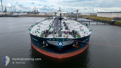
The vessel OLYMPUS (IMO: 9941661, MMSI: 636022487) is a Tanker It's sailing under the flag of [LR] Liberia.
In this page you can find informations about the vessels current position, last detected port calls, and current voyage information. If the vessels is not in coverage by AIS you will find the latest position.
The current position of OLYMPUS is detected by our AIS receivers and we are not responsible for the reliability of the data. The last position was recorded while the vessel was in Coverage by the Ais receivers of our vessel tracking app.
The current draught of OLYMPUS as reported by AIS is 20.4 meters
Weather
| Temperature | 25.6°C / 78.08°F |
|---|---|
| Wind Speed | 9 knots |
| Direction | 8° N |
| Pressure | 1011.4 hPa |
| Humidity | 92.5 % |
| Cloud Coverage | 100 % |
Featured Company
Most Visited Ports (Last year)
| Port | Arrivals | |
|---|---|---|
| 1 | ||
| 1 | ||
| 1 | ||
| 1 | ||
| 1 |
Last Trips
| Origin | Departure | Destination | Arrival | Distance |
|---|
Events
| Tid | Hændelsen | Detaljer | Position / Dest | Info |
|---|---|---|---|---|
| 2024-05-31 00:54 | START Sejllads | 8.16 nm, East of NINGBO |
29.93025 / 122.00236
IQ BSR > CN ZOS
|
Fart: 3.9 kn Kurs: 56° |
| 2024-05-29 08:22 | STOP Sejllads | 7.97 nm, East of NINGBO |
29.92342 / 121.99770
IQ BSR > CN ZOS
|
Fart: 0.2 kn Kurs: 315° |
| 2024-05-29 00:24 | START Sejllads |
29.76386 / 123.03150
IQ BSR > CN ZOS
|
Fart: 6 kn Kurs: 256° |
|
| 2024-05-28 17:01 | STOP Sejllads |
29.76014 / 123.03779
IQ BSR > CN ZOS
|
Fart: 0.3 kn Kurs: 122° |
|
| 2024-05-22 05:37 | Status er ændret | Default Constrained by her draught |
1.27538 / 104.26470
IQ BSR > CN ZOS
|
Fart: 12.1 kn Kurs: 83.1° |
| 2024-05-22 05:32 | Status er ændret | Constrained by her draught Default |
1.27345 / 104.25018
IQ BSR > CN ZOS
|
Fart: 12 kn Kurs: 83° |
| 2024-05-22 05:32 | Udenfor Dækning |
1.27345 / 104.25018
Singapore Strait
IQ BSR > CN ZOS
|
Fart: 12.1 kn Kurs: 83.1° |
|
| 2024-05-22 05:24 | Status er ændret | Default Constrained by her draught |
1.27012 / 104.22395
IQ BSR > CN ZOS
|
Fart: 11.9 kn Kurs: 82.6° |
| 2024-05-22 05:01 | Ændre havområde | Malaysian part of the Singapore Strait Indonesian part of the Singapore Strait |
1.26042 / 104.14919
Singapore Strait
IQ BSR > CN ZOS
|
Fart: 11.2 kn Kurs: 82.6° |
| 2024-05-22 03:20 | Ændre havområde | Indonesian part of the Singapore Strait Singaporean part of the Singapore Strait |
1.19006 / 103.84710
Singapore Strait
IQ BSR > CN ZOS
|
Fart: 11.4 kn Kurs: 66.9° |