
OLYMPIC FLAG
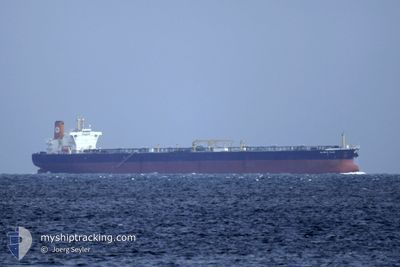
Crude Oil Tanker
Current Trip
| Time Travelled | 17 days |
|---|---|
| Remaining Time | --- |
| Distance Travelled | 3772.73 nm |
| Remaining Distance | --- |
| AVG Speed | 12.6 Knots |
| MAX Speed | 12.6 Knots |
| AVG Wind | 11.3 knots |
| MAX Wind | 25.3 knots |
| MIN Temp | 16.9°C / 62.42°F |
| MAX Temp | 36.4°C / 97.52°F |
| Dybgang | 9.2 m |
| Position Modtaget | 1 d siden |
Current Position
| Longitude | 30.46009° |
|---|---|
| Latitude | 32.42679° |
| Status | Under way using engine |
| Fart | 12.6 Knots |
| Kurs | 283.9° |
| Område | Mediterranean Sea - Eastern Basin |
| Station | T-AIS |
| Position Modtaget | 1 d siden |
Info
Information
The current position of OLYMPIC FLAG is in Mediterranean Sea - Eastern Basin with coordinates 32.42679° / 30.46009° as reported on 2024-04-26 08:50 by AIS to our vessel tracker app. The vessel's current speed is 12.6 Knots and is heading at the port of SKAGEN. The estimated time of arrival as calculated by MyShipTracking vessel tracking app is 2024-05-08 05:00 LT
The vessel OLYMPIC FLAG (IMO: 9271341, MMSI: 240168000) is a Crude Oil Tanker that was built in 2004 ( 20 år gamle ). It's sailing under the flag of [GR] Greece.
In this page you can find informations about the vessels current position, last detected port calls, and current voyage information. If the vessels is not in coverage by AIS you will find the latest position.
The current position of OLYMPIC FLAG is detected by our AIS receivers and we are not responsible for the reliability of the data. The last position was recorded while the vessel was in Coverage by the Ais receivers of our vessel tracking app.
The current draught of OLYMPIC FLAG as reported by AIS is 9.2 meters
Weather
| Temperature | 17.3°C / 63.14°F |
|---|---|
| Wind Speed | 10 knots |
| Direction | 316° NW |
| Pressure | 1015.2 hPa |
| Humidity | 70.8 % |
| Cloud Coverage | 3 % |
Featured Company
Last Port Calls
| Port | Arrival | Departure | Time In Port |
|---|---|---|---|
| 2024-04-25 12:57 | 2024-04-25 22:09 | 9 h | |
| 2024-04-10 01:51 | 2024-04-10 07:40 | 5 h | |
| 2024-03-22 13:15 | 2024-04-09 18:43 | 18 d | |
| 2024-03-10 16:12 | 2024-03-22 12:36 | 11 d | |
| 2024-02-18 05:15 | 2024-02-18 14:13 | 8 h |
Most Visited Ports (Last year)
| Port | Arrivals | |
|---|---|---|
| 9 | ||
| 3 | ||
| 1 | ||
| 1 | ||
| 1 | ||
| 1 |
Last Trips
| Origin | Departure | Destination | Arrival | Distance | |
|---|---|---|---|---|---|
| 2024-04-10 10:40 | 2024-04-25 14:57 | 3245.31 nm | |||
| 2024-04-09 21:43 | 2024-04-10 04:51 | 0.61 nm | |||
| 2024-03-22 15:36 | 2024-03-22 16:15 | 1.29 nm | |||
| 2024-01-31 00:59 | 2024-03-10 19:12 | 8860.71 nm | |||
| 2024-01-31 00:59 | 2024-02-18 07:15 | 4798.98 nm |
Events
| Tid | Hændelsen | Detaljer | Position / Dest | Info |
|---|---|---|---|---|
| 2024-04-26 08:56 | Status er ændret | Default Under way using engine |
32.43204 / 30.43531
DKSKA
|
Fart: 12.6 kn Kurs: 283.9° |
| 2024-04-26 08:50 | Udenfor Dækning |
32.42679 / 30.46009
Mediterranean Sea - Eastern Basin
DKSKA
|
Fart: 12.6 kn Kurs: 283.9° |
|
| 2024-04-26 07:55 | Status er ændret | Under way using engine Default |
32.38297 / 30.67591
DKSKA
|
Fart: 12.3 kn Kurs: 284° |
| 2024-04-26 07:37 | Indenfor Dækning |
32.38321 / 30.67468
Mediterranean Sea - Eastern Basin
DKSKA
|
Fart: 13.3 kn Kurs: 299° |
|
| 2024-04-26 06:24 | Status er ændret | Default Under way using engine |
32.30377 / 31.03194
DKSKA
|
Fart: 12.3 kn Kurs: 283.9° |
| 2024-04-26 06:16 | Udenfor Dækning |
32.29735 / 31.06158
Mediterranean Sea - Eastern Basin
DKSKA
|
Fart: 12.3 kn Kurs: 283.9° |
|
| 2024-04-26 06:11 | Status er ændret | Under way using engine Default |
32.29333 / 31.08056
DKSKA
|
Fart: 13.1 kn Kurs: 281° |
| 2024-04-26 06:05 | Indenfor Dækning |
32.29333 / 31.08056
Mediterranean Sea - Eastern Basin
DKSKA
|
Fart: 24.2 kn Kurs: 260.2° |
|
| 2024-04-26 00:56 | Status er ændret | Default Under way using engine |
31.64588 / 32.11362
DKSKA
|
Fart: 12.3 kn Kurs: 315° |
| 2024-04-26 00:48 | Udenfor Dækning |
31.62599 / 32.13720
Mediterranean Sea - Eastern Basin
DKSKA
|
Fart: 12.3 kn Kurs: 315° |