
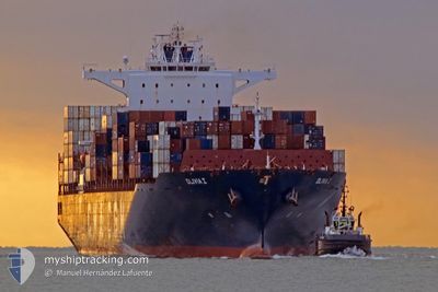
OLIVIA I
Cargo
Current Trip
| Time Travelled | 11 days |
|---|---|
| Remaining Time | --- |
| Distance Travelled | 5027.09 nm |
| Remaining Distance | --- |
| AVG Speed | 17.4 Knots |
| MAX Speed | 18.8 Knots |
| AVG Wind | 12.1 knots |
| MAX Wind | 30.5 knots |
| MIN Temp | 16.2°C / 61.16°F |
| MAX Temp | 29.2°C / 84.56°F |
| Dybgang | 10.5 m |
| Position Modtaget | 5 d siden |
Current Position
| Longitude | -17.69163° |
|---|---|
| Latitude | 11.87320° |
| Status | Under way using engine |
| Fart | 18.1 Knots |
| Kurs | 170.8° |
| Område | North Atlantic Ocean |
| Station | T-AIS |
| Position Modtaget | 5 d siden |
Info
Information
The current position of OLIVIA I is in North Atlantic Ocean with coordinates 11.87320° / -17.69163° as reported on 2024-04-21 10:03 by AIS to our vessel tracker app. The vessel's current speed is 18.1 Knots and is heading at the port of PORT KLANG. The estimated time of arrival as calculated by MyShipTracking vessel tracking app is 2024-05-12 16:00 LT
The vessel OLIVIA I (IMO: 9686912, MMSI: 538005959) is a Cargo It's sailing under the flag of [MH] Marshall Is.
In this page you can find informations about the vessels current position, last detected port calls, and current voyage information. If the vessels is not in coverage by AIS you will find the latest position.
The current position of OLIVIA I is detected by our AIS receivers and we are not responsible for the reliability of the data. The last position was recorded while the vessel was in Coverage by the Ais receivers of our vessel tracking app.
The current draught of OLIVIA I as reported by AIS is 10.5 meters
Weather
| Temperature | 21.4°C / 70.52°F |
|---|---|
| Wind Speed | 17 knots |
| Direction | 145° SE |
| Pressure | 1012.6 hPa |
| Humidity | 82.3 % |
| Cloud Coverage | 33 % |
Featured Company
Last Port Calls
| Port | Arrival | Departure | Time In Port |
|---|---|---|---|
| 2024-04-12 18:23 | 2024-04-15 03:52 | 2 d | |
| 2024-04-09 11:19 | 2024-04-10 05:12 | 17 h | |
| 2024-03-30 09:29 | 2024-03-31 03:13 | 17 h | |
| 2024-03-23 00:27 | 2024-03-24 21:21 | 1 d | |
| 2024-03-20 17:28 | 2024-03-21 04:05 | 10 h | |
| 2024-03-19 04:04 | 2024-03-19 04:16 | 12 m | |
| 2024-03-18 17:29 | 2024-03-18 17:43 | 14 m | |
| 2024-03-14 16:56 | 2024-03-15 04:42 | 11 h | |
| 2024-03-11 18:03 | 2024-03-12 15:07 | 21 h | |
| 2024-03-09 11:34 | 2024-03-10 10:48 | 23 h |
Most Visited Ports (Last year)
| Port | Arrivals | |
|---|---|---|
| 13 | ||
| 7 | ||
| 7 | ||
| 6 | ||
| 6 | ||
| 6 |
Last Trips
| Origin | Departure | Destination | Arrival | Distance | |
|---|---|---|---|---|---|
| 2024-04-10 07:12 | 2024-04-12 20:23 | 1004.11 nm | |||
| 2024-03-30 22:13 | 2024-04-09 13:19 | 4128.09 nm | |||
| 2024-03-24 16:21 | 2024-03-30 04:29 | 1511.24 nm | |||
| 2024-03-20 23:05 | 2024-03-22 19:27 | 221.53 nm | |||
| 2024-03-18 23:16 | 2024-03-20 12:28 | 656.95 nm | |||
| 2024-03-18 12:43 | 2024-03-18 23:04 | 0.89 nm | |||
| 2024-03-14 23:42 | 2024-03-18 12:29 | 677.87 nm | |||
| 2024-03-12 10:07 | 2024-03-14 11:56 | 490.29 nm | |||
| 2024-03-10 06:48 | 2024-03-11 13:03 | 442.44 nm | |||
| 2024-03-07 21:44 | 2024-03-09 07:34 | 514.22 nm |
Events
| Tid | Hændelsen | Detaljer | Position / Dest | Info |
|---|---|---|---|---|
| 2024-04-21 10:08 | Status er ændret | Default Under way using engine |
11.84833 / -17.68667
MTMAR>MYPKG
|
Fart: 18.1 kn Kurs: 170.8° |
| 2024-04-21 10:03 | Udenfor Dækning |
11.87320 / -17.69163
North Atlantic Ocean
MTMAR>MYPKG
|
Fart: 18.1 kn Kurs: 170.8° |
|
| 2024-04-21 09:45 | Status er ændret | Under way using engine Default |
11.96125 / -17.70653
MTMAR>MYPKG
|
Fart: 17.8 kn Kurs: 171° |
| 2024-04-21 09:26 | Indenfor Dækning |
11.96125 / -17.70653
North Atlantic Ocean
MTMAR>MYPKG
|
Fart: 17.9 kn Kurs: 170.9° |
|
| 2024-04-21 08:06 | Status er ændret | Default Under way using engine |
12.44395 / -17.78819
MTMAR>MYPKG
|
Fart: 17.6 kn Kurs: 171.4° |
| 2024-04-21 08:00 | Udenfor Dækning |
12.47500 / -17.79309
North Atlantic Ocean
MTMAR>MYPKG
|
Fart: 17.6 kn Kurs: 171.4° |
|
| 2024-04-21 07:47 | Status er ændret | Under way using engine Default |
12.53454 / -17.80205
MTMAR>MYPKG
|
Fart: 17.8 kn Kurs: 172° |
| 2024-04-21 07:43 | Status er ændret | Default Under way using engine |
12.55667 / -17.80531
MTMAR>MYPKG
|
Fart: 17.7 kn Kurs: 172.2° |
| 2024-04-21 07:03 | Status er ændret | Under way using engine Default |
12.74952 / -17.83499
MTMAR>MYPKG
|
Fart: 17.4 kn Kurs: 171° |
| 2024-04-21 06:54 | Status er ændret | Default Under way using engine |
12.79242 / -17.84149
MTMAR>MYPKG
|
Fart: 18.3 kn Kurs: 171.6° |