
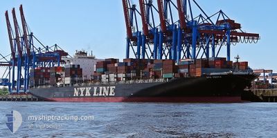
NYK VESTA
Container Ship
Current Trip
| Time Travelled | 30 days |
|---|---|
| Remaining Time | 16 h, 50 mins |
| Distance Travelled | 11021.53 nm |
| Remaining Distance | 222.56 nm |
| AVG Speed | 15.1 Knots |
| MAX Speed | 22.2 Knots |
| AVG Wind | 12 knots |
| MAX Wind | 31.1 knots |
| MIN Temp | 9.2°C / 48.56°F |
| MAX Temp | 29.8°C / 85.64°F |
| Dybgang | 13.8 m |
| Position Modtaget | Nu |
Current Position
| Longitude | -0.70310° |
|---|---|
| Latitude | 50.29718° |
| Status | Under way using engine |
| Fart | 12.8 Knots |
| Kurs | 85.7° |
| Område | English Channel |
| Station | T-AIS |
| Position Modtaget | Nu |
Info
Information
The current position of NYK VESTA is in English Channel with coordinates 50.29718° / -0.70310° as reported on 2024-05-01 13:59 by AIS to our vessel tracker app. The vessel's current speed is 12.8 Knots and is heading at the port of ROTTERDAM. The estimated time of arrival as calculated by MyShipTracking vessel tracking app is 2024-05-02 06:49 LT
The vessel NYK VESTA (IMO: 9312808, MMSI: 372531000) is a Container Ship that was built in 2007 ( 17 år gamle ). It's sailing under the flag of [PA] Panama.
In this page you can find informations about the vessels current position, last detected port calls, and current voyage information. If the vessels is not in coverage by AIS you will find the latest position.
The current position of NYK VESTA is detected by our AIS receivers and we are not responsible for the reliability of the data. The last position was recorded while the vessel was in Coverage by the Ais receivers of our vessel tracking app.
The current draught of NYK VESTA as reported by AIS is 13.8 meters
Weather
| Temperature | 11°C / 51.8°F |
|---|---|
| Wind Speed | 12 knots |
| Direction | 300° WNW |
| Pressure | 1007.5 hPa |
| Humidity | 87.8 % |
| Cloud Coverage | 100 % |
Featured Company
Last Port Calls
| Port | Arrival | Departure | Time In Port |
|---|---|---|---|
| 2024-03-31 14:36 | 2024-04-01 11:53 | 21 h | |
| 2024-03-29 06:59 | 2024-03-29 19:44 | 12 h | |
| 2024-03-25 00:20 | 2024-03-26 02:08 | 1 d | |
| 2024-03-17 03:17 | 2024-03-19 00:19 | 1 d |
Most Visited Ports (Last year)
| Port | Arrivals | |
|---|---|---|
| 8 | ||
| 8 | ||
| 7 | ||
| 6 | ||
| 5 | ||
| 5 |
Last Trips
| Origin | Departure | Destination | Arrival | Distance | |
|---|---|---|---|---|---|
| 2024-03-30 01:14 | 2024-03-31 20:06 | 17.68 nm | |||
| 2024-03-26 07:38 | 2024-03-29 12:29 | 437.82 nm | |||
| 2024-03-19 04:19 | 2024-03-25 05:50 | 1402.82 nm | |||
| 2024-02-11 00:24 | 2024-03-17 07:17 | 11652.82 nm |
Events
| Tid | Hændelsen | Detaljer | Position / Dest | Info |
|---|---|---|---|---|
| 2024-05-01 09:18 | ETA er ændret | 2024/05/02 07:00 2024/05/02 06:00 |
50.40242 / -2.27623
NL RTM
|
Fart: 14.4 kn Kurs: 90.9° |
| 2024-05-01 01:07 | Ændre havområde | United Kingdom part of the English Channel French part of the English Channel |
49.53841 / -3.96266
English Channel
NL RTM
|
Fart: 10.8 kn Kurs: 46.1° |
| 2024-05-01 00:55 | Status er ændret | Under way using engine Default |
49.50404 / -3.98763
NL RTM
|
Fart: 11.5 kn Kurs: 24° |
| 2024-05-01 00:31 | Status er ændret | Default Under way using engine |
49.43315 / -4.03535
NL RTM
|
Fart: 10.5 kn Kurs: 31.9° |
| 2024-05-01 00:15 | Status er ændret | Under way using engine Default |
49.39797 / -4.07985
NL RTM
|
Fart: 11.1 kn Kurs: 56° |
| 2024-05-01 00:10 | Status er ændret | Default Under way using engine |
49.38971 / -4.09833
NL RTM
|
Fart: 11.5 kn Kurs: 54.2° |
| 2024-04-30 23:57 | Status er ændret | Under way using engine Default |
49.36518 / -4.15270
NL RTM
|
Fart: 11.9 kn Kurs: 55° |
| 2024-04-30 23:42 | Indenfor Dækning |
49.36654 / -4.14995
English Channel
NL RTM
|
Fart: 11.7 kn Kurs: 52.8° |
|
| 2024-04-30 22:42 | Status er ændret | Default Under way using engine |
49.23749 / -4.47657
NL RTM
|
Fart: 11.9 kn Kurs: 60° |
| 2024-04-30 22:37 | Udenfor Dækning |
49.22839 / -4.50095
English Channel
NL RTM
|
Fart: 11.9 kn Kurs: 60° |