
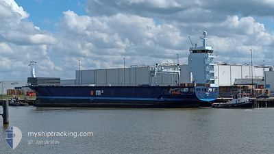
NORDIC
General Cargo
Current Trip
| Time Travelled | 21 days |
|---|---|
| Remaining Time | 1 day |
| Distance Travelled | 5078.52 nm |
| Remaining Distance | 547.96 nm |
| AVG Speed | 9.5 Knots |
| MAX Speed | 12.2 Knots |
| AVG Wind | 12 knots |
| MAX Wind | 25 knots |
| MIN Temp | 16.5°C / 61.7°F |
| MAX Temp | 29°C / 84.2°F |
| Dybgang | 4.3 m |
| Position Modtaget | 1 d siden |
Current Position
| Longitude | 18.62531° |
|---|---|
| Latitude | -34.52164° |
| Status | Under way using engine |
| Fart | 9.4 Knots |
| Kurs | 118.3° |
| Område | South Atlantic Ocean |
| Station | T-AIS |
| Position Modtaget | 1 d siden |
Info
Information
The current position of NORDIC is in South Atlantic Ocean with coordinates -34.52164° / 18.62531° as reported on 2024-05-10 20:40 by AIS to our vessel tracker app. The vessel's current speed is 9.4 Knots and is heading at the port of CAPE TOWN. The estimated time of arrival as calculated by MyShipTracking vessel tracking app is 2024-05-14 19:43 LT
The vessel NORDIC (IMO: 9663001, MMSI: 244868000) is a General Cargo that was built in 2013 ( 11 år gamle ). It's sailing under the flag of [NL] Netherlands.
In this page you can find informations about the vessels current position, last detected port calls, and current voyage information. If the vessels is not in coverage by AIS you will find the latest position.
The current position of NORDIC is detected by our AIS receivers and we are not responsible for the reliability of the data. The last position was recorded while the vessel was in Coverage by the Ais receivers of our vessel tracking app.
The current draught of NORDIC as reported by AIS is 4.3 meters
Weather
| Temperature | 17.5°C / 63.5°F |
|---|---|
| Wind Speed | 8 knots |
| Direction | 142° SE |
| Pressure | 1027 hPa |
| Humidity | 56.4 % |
| Cloud Coverage | 11 % |
Featured Company
Last Port Calls
| Port | Arrival | Departure | Time In Port |
|---|---|---|---|
| 2024-04-20 22:57 | 2024-04-21 07:24 | 8 h | |
| 2024-04-04 04:30 | 2024-04-05 13:15 | 1 d | |
| 2024-03-20 01:54 | 2024-03-20 21:35 | 19 h | |
| 2024-03-15 05:23 | 2024-03-15 06:34 | 1 h | |
| 2024-03-14 04:52 | 2024-03-14 16:33 | 11 h | |
| 2024-03-13 13:43 | 2024-03-13 15:18 | 1 h | |
| 2024-03-02 06:28 | 2024-03-03 03:47 | 21 h |
Most Visited Ports (Last year)
| Port | Arrivals | |
|---|---|---|
| 4 | ||
| 2 | ||
| 2 | ||
| 2 | ||
| 2 | ||
| 2 |
Last Trips
| Origin | Departure | Destination | Arrival | Distance | |
|---|---|---|---|---|---|
| 2024-04-05 15:15 | 2024-04-20 23:57 | 1935.92 nm | |||
| 2024-03-21 00:35 | 2024-04-04 06:30 | 3006.99 nm | |||
| 2024-03-15 09:34 | 2024-03-20 04:54 | 94.84 nm | |||
| 2024-03-14 18:33 | 2024-03-15 08:23 | 112.52 nm | |||
| 2024-03-13 18:18 | 2024-03-14 06:52 | 122.81 nm | |||
| 2024-03-03 05:47 | 2024-03-13 16:43 | 736.25 nm | |||
| 2024-02-27 21:14 | 2024-03-02 08:28 | 700.59 nm |
Events
| Tid | Hændelsen | Detaljer | Position / Dest | Info |
|---|---|---|---|---|
| 2024-05-10 20:47 | Status er ændret | Default Under way using engine |
-34.53057 / 18.64429
CAPE TOWN / ZA CPT
|
Fart: 9.4 kn Kurs: 118.3° |
| 2024-05-10 20:40 | Status er ændret | Under way using engine Default |
-34.52164 / 18.62531
CAPE TOWN / ZA CPT
|
Fart: 9.3 kn Kurs: 116° |
| 2024-05-10 20:40 | Udenfor Dækning |
-34.52164 / 18.62531
South Atlantic Ocean
|
Fart: 9.4 kn Kurs: 118.3° |
|
| 2024-05-10 20:34 | Indenfor Dækning |
-34.52164 / 18.62531
South Atlantic Ocean
|
Fart: 9.4 kn Kurs: 118.3° |
|
| 2024-05-10 19:35 | Status er ændret | Default Under way using engine |
-34.43750 / 18.44397
CAPE TOWN / ZA CPT
|
Fart: 9 kn Kurs: 117° |
| 2024-05-10 19:27 | Status er ændret | Under way using engine Default |
-34.42736 / 18.42283
CAPE TOWN / ZA CPT
|
Fart: 9 kn Kurs: 130° |
| 2024-05-10 19:27 | Udenfor Dækning |
-34.42736 / 18.42283
South Atlantic Ocean
|
Fart: 9 kn Kurs: 117° |
|
| 2024-05-10 18:43 | Status er ændret | Default Under way using engine |
-34.35500 / 18.32167
CAPE TOWN / ZA CPT
|
Fart: 9.1 kn Kurs: 134.7° |
| 2024-05-10 18:34 | Status er ændret | Under way using engine Default |
-34.33753 / 18.30582
CAPE TOWN / ZA CPT
|
Fart: 8 kn Kurs: 135° |
| 2024-05-10 17:50 | Status er ændret | Default Under way using engine |
-34.25224 / 18.22163
CAPE TOWN / ZA CPT
|
Fart: 9.1 kn Kurs: 144.7° |