
NONDAS
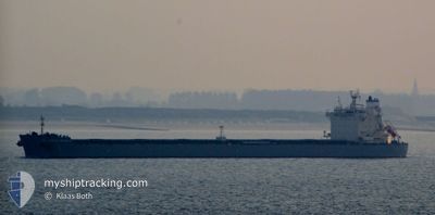
Bulk Carrier
Current Trip
| Time Travelled | 32 days |
|---|---|
| Remaining Time | 32 days |
| Distance Travelled | 5178.19 nm |
| Remaining Distance | 8727.11 nm |
| AVG Speed | 10.8 Knots |
| MAX Speed | 17.2 Knots |
| AVG Wind | 13.2 knots |
| MAX Wind | 29 knots |
| MIN Temp | 14.6°C / 58.28°F |
| MAX Temp | 28.9°C / 84.02°F |
| Dybgang | 7.5 m |
| Position Modtaget | 18 h, 14 m siden |
Current Position
| Longitude | --- |
|---|---|
| Latitude | --- |
| Status | Under way using engine |
| Fart | 9.9 Knots |
| Kurs | 319.3° |
| Område | Malacca Strait |
| Station | T-AIS |
| Position Modtaget | 18 h, 14 m siden |
Info
Information
The current position of NONDAS is in Malacca Strait with coordinates 2.14338° / 102.03971° as reported on 2026-01-07 13:41 by AIS to our vessel tracker app. The vessel's current speed is 9.9 Knots and is heading at the port of SANTOS. The estimated time of arrival as calculated by MyShipTracking vessel tracking app is 2026-02-09 16:23 LT
The vessel NONDAS (IMO: 9643300, MMSI: 538007419) is a Bulk Carrier that was built in 2013 ( 13 år gamle ). It's sailing under the flag of [MH] Marshall Is.
In this page you can find informations about the vessels current position, last detected port calls, and current voyage information. If the vessels is not in coverage by AIS you will find the latest position.
The current position of NONDAS is detected by our AIS receivers and we are not responsible for the reliability of the data. The last position was recorded while the vessel was in Coverage by the Ais receivers of our vessel tracking app.
The current draught of NONDAS as reported by AIS is 7.5 meters
Weather
| Temperature | 25.2°C / 77.36°F |
|---|---|
| Wind Speed | 10 knots |
| Direction | 300° WNW |
| Pressure | 1011.2 hPa |
| Humidity | 89.8 % |
| Cloud Coverage | 100 % |
Featured Company
Events
| Tid | Hændelsen | Detaljer | Position / Dest | Info |
|---|---|---|---|---|
| 2026-01-07 13:53 | Status er ændret | Default Under way using engine |
2.16591 / 102.01783
BR SSZ
|
Fart: 9.9 kn Kurs: 319.3° |
| 2026-01-07 13:41 | Udenfor Dækning |
2.14338 / 102.03971
Malacca Strait
|
Fart: 9.9 kn Kurs: 319.3° |
|
| 2026-01-07 12:34 | ETA er ændret | 2026/02/11 23:59 2026/02/11 09:00 |
2.00716 / 102.18195
BR SSZ
|
Fart: 11.3 kn Kurs: 311.6° |
| 2026-01-07 12:02 | Status er ændret | Under way using engine Default |
1.94149 / 102.26149
BR SSZ
|
Fart: 11.6 kn Kurs: 308° |
| 2026-01-07 12:01 | Status er ændret | Default Under way using engine |
1.93876 / 102.26492
BR SSZ
|
Fart: 11.6 kn Kurs: 308° |
| 2026-01-07 11:26 | Status er ændret | Under way using engine Default |
1.88991 / 102.37067
BR SSZ
|
Fart: 12.6 kn Kurs: 296° |
| 2026-01-07 10:52 | Status er ændret | Default Under way using engine |
1.83736 / 102.47649
BR SSZ
|
Fart: 12.9 kn Kurs: 296.5° |
| 2026-01-07 10:46 | Ændre havområde | Malaysian part of the Malacca Strait Malaysian part of the Singapore Strait |
1.82626 / 102.49834
Malacca Strait
|
Fart: 12.8 kn Kurs: 297.1° |
| 2026-01-07 10:45 | Status er ændret | Under way using engine Default |
1.82548 / 102.49986
BR SSZ
|
Fart: 12.6 kn Kurs: 297° |
| 2026-01-07 10:45 | Indenfor Dækning |
1.82626 / 102.49834
Malacca Strait
|
Fart: 12.8 kn Kurs: 297.1° |