
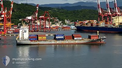
NEW MING ZHOU 60
Cargo A
Current Trip
| Time Travelled | 8 days |
|---|---|
| Remaining Time | --- |
| Distance Travelled | 1723.13 nm |
| Remaining Distance | --- |
| AVG Speed | 13.7 Knots |
| MAX Speed | 16.6 Knots |
| AVG Wind | 12.7 knots |
| MAX Wind | 34 knots |
| MIN Temp | 2.9°C / 37.22°F |
| MAX Temp | 19.4°C / 66.92°F |
| Dybgang | 6.6 m |
| Position Modtaget | 7 d siden |
Current Position
| Longitude | --- |
|---|---|
| Latitude | --- |
| Status | Under way using engine |
| Fart | 12.5 Knots |
| Kurs | 9.2° |
| Område | Inland Sea |
| Station | T-AIS |
| Position Modtaget | 7 d siden |
Info
Information
The current position of NEW MING ZHOU 60 is in Inland Sea with coordinates 34.42925° / 135.05677° as reported on 2025-12-03 17:10 by AIS to our vessel tracker app. The vessel's current speed is 12.5 Knots and is heading at the port of NINGBO. The estimated time of arrival as calculated by MyShipTracking vessel tracking app is 2025-12-06 14:00 LT
The vessel NEW MING ZHOU 60 (IMO: 9757321, MMSI: 477348700) is a Cargo A It's sailing under the flag of [HK] Hong Kong.
In this page you can find informations about the vessels current position, last detected port calls, and current voyage information. If the vessels is not in coverage by AIS you will find the latest position.
The current position of NEW MING ZHOU 60 is detected by our AIS receivers and we are not responsible for the reliability of the data. The last position was recorded while the vessel was in Coverage by the Ais receivers of our vessel tracking app.
The current draught of NEW MING ZHOU 60 as reported by AIS is 6.6 meters
Weather
| Temperature | 19.4°C / 66.92°F |
|---|---|
| Wind Speed | 11 knots |
| Direction | 56° NE |
| Pressure | 1019.4 hPa |
| Humidity | 82.3 % |
| Cloud Coverage | --- |
Featured Company
Last Port Calls
| Port | Arrival | Departure | Time In Port |
|---|---|---|---|
| 2025-12-02 15:10 | 2025-12-02 23:56 | 8 h | |
| 2025-12-02 06:16 | 2025-12-02 13:49 | 7 h | |
| 2025-12-01 11:02 | 2025-12-01 19:41 | 8 h | |
| 2025-11-30 19:44 | 2025-12-01 02:13 | 6 h | |
| 2025-11-27 10:55 | 2025-11-28 00:20 | 13 h | |
| 2025-11-20 06:25 | 2025-11-20 12:15 | 5 h | |
| 2025-11-19 11:41 | 2025-11-20 05:02 | 17 h | |
| 2025-11-18 07:32 | 2025-11-18 21:04 | 13 h | |
| 2025-11-13 18:03 | 2025-11-14 10:17 | 16 h | |
| 2025-11-04 16:32 | 2025-11-05 06:42 | 14 h |
Last Trips
| Origin | Departure | Destination | Arrival | Distance | |
|---|---|---|---|---|---|
| 2025-12-02 13:49 | 2025-12-02 15:10 | 17.61 nm | |||
| 2025-12-01 19:41 | 2025-12-02 06:16 | 122.03 nm | |||
| 2025-12-01 02:13 | 2025-12-01 11:02 | 129.41 nm | |||
| 2025-11-28 00:20 | 2025-11-30 19:44 | 945.16 nm | |||
| 2025-11-20 12:15 | 2025-11-27 10:55 | 1171.58 nm | |||
| 2025-11-20 05:02 | 2025-11-20 06:25 | 15.53 nm | |||
| 2025-11-18 21:04 | 2025-11-19 11:41 | 216.75 nm | |||
| 2025-11-14 10:17 | 2025-11-18 07:32 | 990.33 nm | |||
| 2025-11-05 06:42 | 2025-11-13 18:03 | 566.41 nm | |||
| 2025-11-04 07:37 | 2025-11-04 16:32 | 116.22 nm |
Events
| Tid | Hændelsen | Detaljer | Position / Dest | Info |
|---|---|---|---|---|
| 2025-12-09 11:29 | START Sejllads | 13.84 nm, South East of NINGBO |
29.78314 / 122.03687
CN NGB
|
Fart: 5 kn Kurs: 95° |
| 2025-12-08 11:07 | STOP Sejllads | 13.27 nm, South East of NINGBO |
29.78535 / 122.02405
CN NGB
|
Fart: 0.2 kn Kurs: 49° |
| 2025-12-08 06:57 | START Sejllads |
29.51301 / 122.68457
CN NGB
|
Fart: 6.4 kn Kurs: 329° |
|
| 2025-12-06 01:40 | STOP Sejllads |
29.51240 / 122.67817
CN NGB
|
Fart: Kurs: -1° |
|
| 2025-12-03 17:17 | Status er ændret | Default Under way using engine |
34.45415 / 135.06146
CN NGB
|
Fart: 12.5 kn Kurs: 9.2° |
| 2025-12-03 17:10 | Udenfor Dækning |
34.42925 / 135.05677
Inland Sea
CN NGB
|
Fart: 12.5 kn Kurs: 9.2° |
|
| 2025-12-03 17:09 | Status er ændret | Under way using engine Default |
34.42690 / 135.05630
CN NGB
|
Fart: 12.4 kn Kurs: 10° |
| 2025-12-03 16:25 | Status er ændret | Default Under way using engine |
34.28860 / 134.98750
CN NGB
|
Fart: 10.2 kn Kurs: 4.2° |
| 2025-12-03 16:19 | Ændre havområde | Japanese part of the Inland Sea Japanese part of the Philippine Sea |
34.27111 / 134.98294
Inland Sea
CN NGB
|
Fart: 10.2 kn Kurs: 4.2° |
| 2025-12-03 15:05 | Status er ændret | Under way using engine Default |
34.04091 / 134.98928
CN NGB
|
Fart: 12 kn Kurs: 346° |