
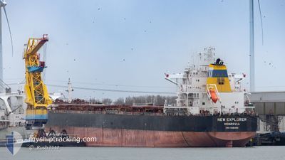
NEW EXPLORER
Cargo
Current Trip
| Time Travelled | 9 days |
|---|---|
| Remaining Time | 22 h, 27 mins |
| Distance Travelled | 2780.41 nm |
| Remaining Distance | 331.51 nm |
| AVG Speed | 11.5 Knots |
| MAX Speed | 14.5 Knots |
| AVG Wind | 16.4 knots |
| MAX Wind | 33 knots |
| MIN Temp | 4.3°C / 39.74°F |
| MAX Temp | 17.3°C / 63.14°F |
| Dybgang | 7.5 m |
| Position Modtaget | 2 h, 38 m siden |
Current Position
| Longitude | --- |
|---|---|
| Latitude | --- |
| Status | Under way using engine |
| Fart | 13.5 Knots |
| Kurs | 57° |
| Område | English Channel |
| Station | T-AIS |
| Position Modtaget | 2 h, 38 m siden |
Info
Information
The current position of NEW EXPLORER is in English Channel with coordinates 49.30428° / -4.23930° as reported on 2026-01-07 17:43 by AIS to our vessel tracker app. The vessel's current speed is 13.5 Knots and is heading at the port of VLISSINGEN. The estimated time of arrival as calculated by MyShipTracking vessel tracking app is 2026-01-08 19:49 LT
The vessel NEW EXPLORER (IMO: 9481489, MMSI: 636016450) is a Cargo It's sailing under the flag of [LR] Liberia.
In this page you can find informations about the vessels current position, last detected port calls, and current voyage information. If the vessels is not in coverage by AIS you will find the latest position.
The current position of NEW EXPLORER is detected by our AIS receivers and we are not responsible for the reliability of the data. The last position was recorded while the vessel was in Coverage by the Ais receivers of our vessel tracking app.
The current draught of NEW EXPLORER as reported by AIS is 7.5 meters
Weather
| Temperature | 12°C / 53.6°F |
|---|---|
| Wind Speed | 23 knots |
| Direction | 290° WNW |
| Pressure | 1008.1 hPa |
| Humidity | 93.2 % |
| Cloud Coverage | 100 % |
Featured Company
Most Visited Ports (Last year)
| Port | Arrivals | |
|---|---|---|
| 8 | ||
| 7 | ||
| 5 | ||
| 3 | ||
| 2 | ||
| 2 |
Events
| Tid | Hændelsen | Detaljer | Position / Dest | Info |
|---|---|---|---|---|
| 2026-01-07 17:59 | Status er ændret | Default Under way using engine |
49.33540 / -4.16163
FLUSHING
|
Fart: 13.5 kn Kurs: 57° |
| 2026-01-07 17:43 | Udenfor Dækning |
49.30428 / -4.23930
English Channel
FLUSHING
|
Fart: 13.5 kn Kurs: 57° |
|
| 2026-01-07 17:25 | Status er ændret | Under way using engine Default |
49.26940 / -4.32778
FLUSHING
|
Fart: 13.5 kn Kurs: 63° |
| 2026-01-07 17:17 | Status er ændret | Default Under way using engine |
49.25396 / -4.36908
FLUSHING
|
Fart: 13.4 kn Kurs: 59° |
| 2026-01-07 17:12 | Status er ændret | Under way using engine Default |
49.24350 / -4.39602
FLUSHING
|
Fart: 13.4 kn Kurs: 58° |
| 2026-01-07 17:05 | Status er ændret | Default Under way using engine |
49.23095 / -4.42947
FLUSHING
|
Fart: 13.4 kn Kurs: 64° |
| 2026-01-07 16:36 | ETA er ændret | 2026/01/08 18:00 2026/01/08 11:00 |
49.17648 / -4.57907
FLUSHING
|
Fart: 13.1 kn Kurs: 61° |
| 2026-01-07 15:28 | Ændre havområde | French part of the English Channel French part of the Celtic Sea |
49.05690 / -4.89878
English Channel
FLUSHING
|
Fart: 12.3 kn Kurs: 59° |
| 2026-01-07 15:28 | Status er ændret | Under way using engine Default |
49.05690 / -4.89878
FLUSHING
|
Fart: 12 kn Kurs: 58° |
| 2026-01-07 15:17 | Status er ændret | Default Under way using engine |
49.03867 / -4.94825
FLUSHING
|
Fart: 12 kn Kurs: 59° |