
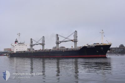
NAXOS
Bulk Carrier
Current Trip
MANZANILO
| Time Travelled | 22 days |
|---|---|
| Remaining Time | --- |
| Distance Travelled | 5368.08 nm |
| Remaining Distance | --- |
| AVG Speed | 11.7 Knots |
| MAX Speed | 17.2 Knots |
| AVG Wind | 8.9 knots |
| MAX Wind | 27.6 knots |
| MIN Temp | 13.7°C / 56.66°F |
| MAX Temp | 28.2°C / 82.76°F |
| Dybgang | 10 m |
| Position Modtaget | 7 d siden |
Current Position
| Longitude | -17.54435° |
|---|---|
| Latitude | 27.39171° |
| Status | Under way using engine |
| Fart | 12.7 Knots |
| Kurs | 247.2° |
| Område | North Atlantic Ocean |
| Station | T-AIS |
| Position Modtaget | 7 d siden |
Info
Information
The current position of NAXOS is in North Atlantic Ocean with coordinates 27.39171° / -17.54435° as reported on 2024-06-03 10:56 by AIS to our vessel tracker app. The vessel's current speed is 12.7 Knots
The vessel NAXOS (IMO: 9610224, MMSI: 314601000) is a Bulk Carrier that was built in 2012 ( 12 år gamle ). It's sailing under the flag of [BB] Barbados.
In this page you can find informations about the vessels current position, last detected port calls, and current voyage information. If the vessels is not in coverage by AIS you will find the latest position.
The current position of NAXOS is detected by our AIS receivers and we are not responsible for the reliability of the data. The last position was recorded while the vessel was in Coverage by the Ais receivers of our vessel tracking app.
The current draught of NAXOS as reported by AIS is 10 meters
Weather
| Temperature | 27.6°C / 81.68°F |
|---|---|
| Wind Speed | 12 knots |
| Direction | 94° E |
| Pressure | 1016.8 hPa |
| Humidity | 67.4 % |
| Cloud Coverage | 99 % |
Featured Company
Most Visited Ports (Last year)
| Port | Arrivals | |
|---|---|---|
| 1 | ||
| 1 | ||
| 1 | ||
| 1 | ||
| 1 | ||
| 1 |
Events
| Tid | Hændelsen | Detaljer | Position / Dest | Info |
|---|---|---|---|---|
| 2024-06-03 11:01 | Status er ændret | Default Under way using engine |
27.38563 / -17.56215
MANZANILO
|
Fart: 12.7 kn Kurs: 247.2° |
| 2024-06-03 10:56 | Status er ændret | Under way using engine Default |
27.39171 / -17.54435
MANZANILO
|
Fart: 12.6 kn Kurs: 251° |
| 2024-06-03 10:56 | Udenfor Dækning |
27.39171 / -17.54435
North Atlantic Ocean
MANZANILO
|
Fart: 12.7 kn Kurs: 247.2° |
|
| 2024-06-03 10:17 | Status er ændret | Default Under way using engine |
27.44112 / -17.40354
MANZANILO
|
Fart: 11.9 kn Kurs: 249.2° |
| 2024-06-03 10:10 | Status er ændret | Under way using engine Default |
27.44912 / -17.37976
MANZANILO
|
Fart: 11.9 kn Kurs: 249° |
| 2024-06-03 10:09 | Status er ændret | Default Under way using engine |
27.45064 / -17.37514
MANZANILO
|
Fart: 12 kn Kurs: 250.4° |
| 2024-06-02 18:17 | Status er ændret | Under way using engine Default |
29.57864 / -14.63160
MANZANILO
|
Fart: 12.4 kn Kurs: 229° |
| 2024-06-02 18:16 | Status er ændret | Default Under way using engine |
29.58046 / -14.62912
MANZANILO
|
Fart: 12.5 kn Kurs: 231.6° |
| 2024-06-02 15:58 | Status er ændret | Under way using engine Default |
29.89825 / -14.21286
MANZANILO
|
Fart: 12.6 kn Kurs: 229° |
| 2024-06-02 15:54 | Status er ændret | Default Under way using engine |
29.90568 / -14.20322
MANZANILO
|
Fart: 12.7 kn Kurs: 229.5° |