
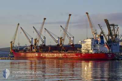
REK ELITE
Bulk Carrier
Current Trip
| Time Travelled | 12 days |
|---|---|
| Remaining Time | 2 days |
| Distance Travelled | 3496.57 nm |
| Remaining Distance | 541.40 nm |
| AVG Speed | 11.1 Knots |
| MAX Speed | 13.2 Knots |
| AVG Wind | 8.6 knots |
| MAX Wind | 20.8 knots |
| MIN Temp | 26.8°C / 80.24°F |
| MAX Temp | 30.6°C / 87.08°F |
| Dybgang | 8.8 m |
| Position Modtaget | Nu |
Current Position
| Longitude | 37.40958° |
|---|---|
| Latitude | 22.32238° |
| Status | Under way using engine |
| Fart | 10.6 Knots |
| Kurs | 332° |
| Område | Red Sea |
| Station | T-AIS |
| Position Modtaget | Nu |
Info
Information
The current position of REK ELITE is in Red Sea with coordinates 22.32238° / 37.40958° as reported on 2024-05-07 20:34 by AIS to our vessel tracker app. The vessel's current speed is 10.6 Knots and is heading at the port of SUEZ CANAL. The estimated time of arrival as calculated by MyShipTracking vessel tracking app is 2024-05-09 22:33 LT
The vessel REK ELITE (IMO: 9498626, MMSI: 373526000) is a Bulk Carrier that was built in 2012 ( 12 år gamle ). It's sailing under the flag of [PA] Panama.
In this page you can find informations about the vessels current position, last detected port calls, and current voyage information. If the vessels is not in coverage by AIS you will find the latest position.
The current position of REK ELITE is detected by our AIS receivers and we are not responsible for the reliability of the data. The last position was recorded while the vessel was in Coverage by the Ais receivers of our vessel tracking app.
The current draught of REK ELITE as reported by AIS is 8.8 meters
Weather
| Temperature | 26.8°C / 80.24°F |
|---|---|
| Wind Speed | 15 knots |
| Direction | 338° NNW |
| Pressure | 1012.3 hPa |
| Humidity | 55.7 % |
| Cloud Coverage | 1 % |
Featured Company
Last Port Calls
| Port | Arrival | Departure | Time In Port |
|---|---|---|---|
| 2024-04-23 02:03 | 2024-04-24 20:56 | 1 d | |
| 2024-04-18 06:43 | 2024-04-21 04:32 | 2 d | |
| 2024-03-02 01:42 |
Last Trips
| Origin | Departure | Destination | Arrival | Distance | |
|---|---|---|---|---|---|
| 2024-04-21 10:02 | 2024-04-23 07:33 | 323.41 nm | |||
| 2024-03-02 05:42 | 2024-04-18 12:13 | 4093.08 nm |
Events
| Tid | Hændelsen | Detaljer | Position / Dest | Info |
|---|---|---|---|---|
| 2024-05-07 20:32 | Status er ændret | Under way using engine Default |
22.31803 / 37.41207
SUEZ
|
Fart: 10.5 kn Kurs: 331° |
| 2024-05-07 19:38 | Status er ændret | Default Under way using engine |
22.17615 / 37.49038
SUEZ
|
Fart: 10.4 kn Kurs: 331° |
| 2024-05-07 19:33 | Status er ændret | Under way using engine Default |
22.16278 / 37.49778
SUEZ
|
Fart: 10.4 kn Kurs: 332° |
| 2024-05-07 19:33 | Indenfor Dækning |
22.16278 / 37.49778
Red Sea
SUEZ
|
Fart: 10.4 kn Kurs: 331° |
|
| 2024-05-07 19:33 | Udenfor Dækning |
22.16278 / 37.49778
Red Sea
SUEZ
|
Fart: 10.4 kn Kurs: 331° |
|
| 2024-05-07 18:19 | Status er ændret | Default Under way using engine |
21.97193 / 37.60175
SUEZ
|
Fart: 10.4 kn Kurs: 333° |
| 2024-05-07 18:14 | Udenfor Dækning |
21.96118 / 37.60768
Red Sea
SUEZ
|
Fart: 10.4 kn Kurs: 333° |
|
| 2024-05-07 18:02 | Ændre havområde | Disputed Sudan-Egypt part of the Red Sea Sudanese part of the Red Sea |
21.92697 / 37.62642
Red Sea
SUEZ
|
Fart: 10.9 kn Kurs: 333° |
| 2024-05-07 17:08 | Status er ændret | Under way using engine Default |
21.78433 / 37.70645
SUEZ
|
Fart: 10.6 kn Kurs: 333° |
| 2024-05-07 16:54 | Indenfor Dækning |
21.79052 / 37.70295
Red Sea
SUEZ
|
Fart: 10.7 kn Kurs: 331° |