
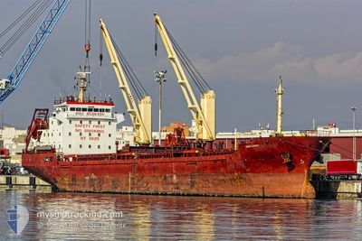
NAVIN HARRIER
Cargo
Current Trip
| Time Travelled | 13 h, 46 mins |
|---|---|
| Remaining Time | --- |
| Distance Travelled | 122.68 nm |
| Remaining Distance | --- |
| AVG Speed | 8.9 Knots |
| MAX Speed | 10.5 Knots |
| AVG Wind | 11.5 knots |
| MAX Wind | 17.9 knots |
| MIN Temp | 20.1°C / 68.18°F |
| MAX Temp | 24.4°C / 75.92°F |
| Dybgang | 7 m |
| Position Modtaget | 2 m siden |
Current Position
| Longitude | 3.72593° |
|---|---|
| Latitude | 37.21857° |
| Status | Under way using engine |
| Fart | 8.9 Knots |
| Kurs | 78.3° |
| Område | Mediterranean Sea - Western Basin |
| Station | T-AIS |
| Position Modtaget | 2 m siden |
Info
Information
The current position of NAVIN HARRIER is in Mediterranean Sea - Western Basin with coordinates 37.21857° / 3.72593° as reported on 2024-06-05 20:19 by AIS to our vessel tracker app. The vessel's current speed is 8.9 Knots and is heading at the port of REGGIO.
The vessel NAVIN HARRIER (MMSI: 538007989) is a Cargo It's sailing under the flag of [MH] Marshall Is.
In this page you can find informations about the vessels current position, last detected port calls, and current voyage information. If the vessels is not in coverage by AIS you will find the latest position.
The current position of NAVIN HARRIER is detected by our AIS receivers and we are not responsible for the reliability of the data. The last position was recorded while the vessel was in Coverage by the Ais receivers of our vessel tracking app.
The current draught of NAVIN HARRIER as reported by AIS is 7 meters
Weather
| Temperature | 21.1°C / 69.98°F |
|---|---|
| Wind Speed | 18 knots |
| Direction | 88° E |
| Pressure | 1016.7 hPa |
| Humidity | 78.3 % |
| Cloud Coverage | --- |
Featured Company
Last Port Calls
| Port | Arrival | Departure | Time In Port |
|---|---|---|---|
| 2024-05-31 07:54 | 2024-06-05 07:36 | 4 d | |
| 2024-05-03 05:40 | 2024-05-03 17:50 | 12 h | |
| 2024-04-25 07:53 | 2024-04-29 19:14 | 4 d | |
| 2024-04-20 19:20 | 2024-04-23 18:35 | 2 d | |
| 2024-04-13 10:12 | 2024-04-15 16:20 | 2 d | |
| 2024-04-08 08:59 | 2024-04-11 11:41 | 3 d |
Last Trips
| Origin | Departure | Destination | Arrival | Distance | |
|---|---|---|---|---|---|
| 2024-05-03 17:50 | 2024-05-31 07:54 | 1016.31 nm | |||
| 2024-04-29 19:14 | 2024-05-03 05:40 | 870.90 nm | |||
| 2024-04-23 18:35 | 2024-04-25 07:53 | 74.06 nm | |||
| 2024-04-15 16:20 | 2024-04-20 19:20 | 578.32 nm | |||
| 2024-04-11 11:41 | 2024-04-13 10:12 | 197.88 nm | |||
| 2024-03-21 11:56 | 2024-04-08 08:59 | 1914.46 nm |
Events
| Tid | Hændelsen | Detaljer | Position / Dest | Info |
|---|---|---|---|---|
| 2024-06-05 19:56 | Indenfor Dækning |
37.20706 / 3.65493
Mediterranean Sea - Western Basin
|
Fart: 8.8 kn Kurs: 79.6° |
|
| 2024-06-05 18:55 | Udenfor Dækning |
37.18220 / 3.46902
Mediterranean Sea - Western Basin
|
Fart: 8.9 kn Kurs: 81.8° |
|
| 2024-06-05 16:36 | Indenfor Dækning |
37.10541 / 3.03649
Mediterranean Sea - Western Basin
|
Fart: 8.9 kn Kurs: 69° |
|
| 2024-06-05 15:29 | Status er ændret | Default Under way using engine |
37.04644 / 2.84109
ITREG
|
Fart: 8.7 kn Kurs: 70.3° |
| 2024-06-05 15:25 | Udenfor Dækning |
37.04243 / 2.82769
Mediterranean Sea - Western Basin
|
Fart: 8.7 kn Kurs: 70.3° |
|
| 2024-06-05 10:56 | Dybgangen er ændret | 7 7.1 |
36.81596 / 2.07710
ITREG
|
Fart: 7.9 kn Kurs: 68° |
| 2024-06-05 10:44 | Dybgangen er ændret | 7.1 7 |
36.80399 / 2.04308
ITREG
|
Fart: 9 kn Kurs: 65.8° |
| 2024-06-05 10:44 | ETA er ændret | 2024/06/08 08:00 |
36.80399 / 2.04308
ITREG
|
Fart: 9 kn Kurs: 65.8° |
| 2024-06-05 10:32 | Dybgangen er ændret | 7 7.1 |
36.79146 / 2.00885
ITREG
|
Fart: 9.1 kn Kurs: 65.7° |
| 2024-06-05 09:50 | Dybgangen er ændret | 7.1 4.4 |
36.74517 / 1.88718
ITREG
|
Fart: 9.5 kn Kurs: 64.4° |