
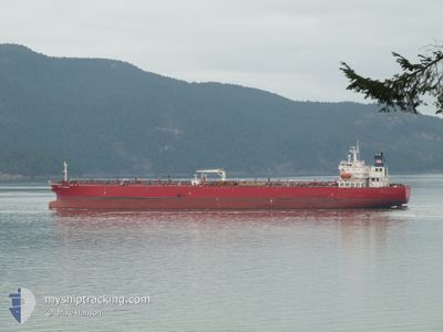
NAVE ARIADNE
Oil Products Tanker
Current Trip
| Time Travelled | 9 days |
|---|---|
| Remaining Time | --- |
| Distance Travelled | 1303.50 nm |
| Remaining Distance | --- |
| AVG Speed | 11.1 Knots |
| MAX Speed | 15.1 Knots |
| AVG Wind | 10.5 knots |
| MAX Wind | 19.4 knots |
| MIN Temp | 7.8°C / 46.04°F |
| MAX Temp | 25.5°C / 77.9°F |
| Dybgang | 10.6 m |
| Position Modtaget | 12 m siden |
Current Position
| Longitude | -78.84192° |
|---|---|
| Latitude | 26.45756° |
| Status | Under way using engine |
| Fart | 12.3 Knots |
| Kurs | 241.2° |
| Område | North Atlantic Ocean |
| Station | T-AIS |
| Position Modtaget | 12 m siden |
Info
Information
The current position of NAVE ARIADNE is in North Atlantic Ocean with coordinates 26.45756° / -78.84192° as reported on 2024-05-06 22:12 by AIS to our vessel tracker app. The vessel's current speed is 12.3 Knots and is heading at the port of PUERTO CORTES. The estimated time of arrival as calculated by MyShipTracking vessel tracking app is 2024-05-09 18:00 LT
The vessel NAVE ARIADNE (IMO: 9301964, MMSI: 319768000) is a Oil Products Tanker that was built in 2007 ( 17 år gamle ). It's sailing under the flag of [KY] Cayman Is.
In this page you can find informations about the vessels current position, last detected port calls, and current voyage information. If the vessels is not in coverage by AIS you will find the latest position.
The current position of NAVE ARIADNE is detected by our AIS receivers and we are not responsible for the reliability of the data. The last position was recorded while the vessel was in Coverage by the Ais receivers of our vessel tracking app.
The current draught of NAVE ARIADNE as reported by AIS is 10.6 meters
Weather
| Temperature | 25°C / 77°F |
|---|---|
| Wind Speed | 11 knots |
| Direction | 115° ESE |
| Pressure | 1015.5 hPa |
| Humidity | 71.6 % |
| Cloud Coverage | 1 % |
Featured Company
Last Port Calls
| Port | Arrival | Departure | Time In Port |
|---|---|---|---|
| 2024-04-21 14:00 | 2024-04-26 23:24 | 5 d | |
| 2024-04-09 04:11 | 2024-04-16 04:56 | 7 d | |
| 2024-03-08 12:14 | 2024-03-09 21:55 | 1 d | |
| 2024-03-03 19:17 | 2024-03-07 10:28 | 3 d |
Most Visited Ports (Last year)
| Port | Arrivals | |
|---|---|---|
| 2 | ||
| 2 | ||
| 2 | ||
| 1 | ||
| 1 | ||
| 1 |
Last Trips
| Origin | Departure | Destination | Arrival | Distance | |
|---|---|---|---|---|---|
| 2024-04-16 00:56 | 2024-04-21 10:00 | 1514.95 nm | |||
| 2024-03-09 18:55 | 2024-04-09 00:11 | 6843.93 nm | |||
| 2024-03-07 07:28 | 2024-03-08 09:14 | 30.87 nm | |||
| 2024-02-29 06:18 | 2024-03-03 16:17 | 262.76 nm |
Events
| Tid | Hændelsen | Detaljer | Position / Dest | Info |
|---|---|---|---|---|
| 2024-05-06 22:18 | Status er ændret | Default Under way using engine |
26.44700 / -78.86442
HNPCR K
|
Fart: 12.3 kn Kurs: 241.2° |
| 2024-05-06 21:43 | START Sejllads | 1.17 nm, South of FREEPORT (BS) |
26.50503 / -78.78253
HNPCR K
|
Fart: 3.2 kn Kurs: 205° |
| 2024-05-06 21:41 | Dybgangen er ændret | 10.6 8.3 |
26.50636 / -78.78161
HNPCR K
|
Fart: 2.6 kn Kurs: 205° |
| 2024-05-06 21:41 | Destination er ændret | HNPCR K BSFPO |
26.50636 / -78.78161
HNPCR K
|
Fart: 2.6 kn Kurs: 205° |
| 2024-05-06 21:41 | ETA er ændret | 2024/05/09 18:00 2024/04/30 13:00 |
26.50636 / -78.78161
HNPCR K
|
Fart: 2.6 kn Kurs: 205° |
| 2024-05-06 21:24 | Status er ændret | Under way using engine Moored |
26.50787 / -78.77778
BSFPO
|
Fart: Kurs: 127° |
| 2024-05-06 20:55 | Status er ændret | Moored Default |
26.50788 / -78.77778
BSFPO
|
Fart: Kurs: 127° |
| 2024-05-06 20:52 | Status er ændret | Default Moored |
26.50786 / -78.77776
BSFPO
|
Fart: Kurs: 127° |
| 2024-05-06 19:19 | Status er ændret | Moored Default |
26.50790 / -78.77778
BSFPO
|
Fart: Kurs: 127° |
| 2024-05-06 19:16 | Status er ændret | Default Moored |
26.50787 / -78.77776
BSFPO
|
Fart: Kurs: 127° |