
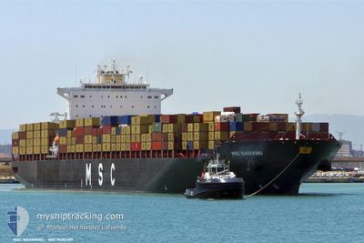
NAVARINO
Container Ship
Current Trip
| Time Travelled | 9 h, 18 mins |
|---|---|
| Remaining Time | 7 days |
| Distance Travelled | 11.50 nm |
| Remaining Distance | 1858.15 nm |
| AVG Speed | 7.2 Knots |
| MAX Speed | 11.3 Knots |
| AVG Wind | 5.9 knots |
| MAX Wind | 7.9 knots |
| MIN Temp | 26.4°C / 79.52°F |
| MAX Temp | 27.8°C / 82.04°F |
| Dybgang | 11 m |
| Position Modtaget | 5 d siden |
Current Position
| Longitude | -80.81528° |
|---|---|
| Latitude | 6.99180° |
| Status | Under way using engine |
| Fart | 20.6 Knots |
| Kurs | 271.9° |
| Område | North Pacific Ocean |
| Station | T-AIS |
| Position Modtaget | 5 d siden |
Info
Information
The current position of NAVARINO is in North Pacific Ocean with coordinates 6.99180° / -80.81528° as reported on 2024-05-27 09:49 by AIS to our vessel tracker app. The vessel's current speed is 20.6 Knots and is heading at the port of BUENAVENTURA. The estimated time of arrival as calculated by MyShipTracking vessel tracking app is 2024-06-09 10:39 LT
The vessel NAVARINO (IMO: 9400289, MMSI: 636022114) is a Container Ship that was built in 2010 ( 14 år gamle ). It's sailing under the flag of [LR] Liberia.
In this page you can find informations about the vessels current position, last detected port calls, and current voyage information. If the vessels is not in coverage by AIS you will find the latest position.
The current position of NAVARINO is detected by our AIS receivers and we are not responsible for the reliability of the data. The last position was recorded while the vessel was in Coverage by the Ais receivers of our vessel tracking app.
The current draught of NAVARINO as reported by AIS is 11 meters
Weather
| Temperature | 26.5°C / 79.7°F |
|---|---|
| Wind Speed | 7 knots |
| Direction | 307° NW |
| Pressure | 1010.5 hPa |
| Humidity | 80.3 % |
| Cloud Coverage | 7 % |
Featured Company
Last Port Calls
| Port | Arrival | Departure | Time In Port |
|---|---|---|---|
| 2024-06-01 15:15 | 2024-06-01 15:31 | 16 m | |
| 2024-05-25 23:50 | 2024-05-26 19:55 | 20 h | |
| 2024-05-22 10:34 | 2024-05-23 04:38 | 18 h | |
| 2024-05-18 15:13 | 2024-05-21 00:29 | 2 d | |
| 2024-05-13 15:45 | 2024-05-14 21:25 | 1 d | |
| 2024-05-08 09:26 | 2024-05-09 18:24 | 1 d | |
| 2024-05-04 22:28 | 2024-05-06 03:22 | 1 d | |
| 2024-04-30 18:50 | 2024-05-02 09:12 | 1 d | |
| 2024-04-17 06:45 | 2024-04-17 21:15 | 14 h | |
| 2024-04-12 09:50 | 2024-04-14 02:11 | 1 d |
Most Visited Ports (Last year)
| Port | Arrivals | |
|---|---|---|
| 5 | ||
| 4 | ||
| 3 | ||
| 3 | ||
| 2 | ||
| 2 |
Last Trips
| Origin | Departure | Destination | Arrival | Distance | |
|---|---|---|---|---|---|
| 2024-05-26 19:55 | 2024-06-01 15:15 | 1780.45 nm | |||
| 2024-05-23 04:38 | 2024-05-25 23:50 | 369.78 nm | |||
| 2024-05-21 00:29 | 2024-05-22 10:34 | 578.67 nm | |||
| 2024-05-14 21:25 | 2024-05-18 15:13 | 724.90 nm | |||
| 2024-05-09 18:24 | 2024-05-13 15:45 | 1763.59 nm | |||
| 2024-05-06 03:22 | 2024-05-08 09:26 | 878.57 nm | |||
| 2024-05-02 09:12 | 2024-05-04 22:28 | 1094.84 nm | |||
| 2024-04-17 21:15 | 2024-04-30 18:50 | 5312.72 nm | |||
| 2024-04-14 02:11 | 2024-04-17 06:45 | 870.07 nm | |||
| 2024-04-08 21:01 | 2024-04-12 09:50 | 595.99 nm |
Events
| Tid | Hændelsen | Detaljer | Position / Dest | Info |
|---|---|---|---|---|
| 2024-06-01 21:51 | STOP Sejllads | 10.82 nm, South West of MANZANILLO |
18.96065 / -104.48045
COBUN
|
Fart: 0.3 kn Kurs: 250° |
| 2024-06-01 20:31 | Afsejlet fra sidste havn |
|
19.04420 / -104.38806
COBUN
|
Fart: 8.6 kn Kurs: 270° |
| 2024-06-01 20:15 | Skibe i havn |
|
19.04200 / -104.35941
[MX] MANZANILLO
|
Fart: 1.7 kn Kurs: 17° |
| 2024-06-01 18:03 | START Sejllads | 16.04 nm, South West of MANZANILLO |
18.93675 / -104.57635
COBUN
|
Fart: 3.4 kn Kurs: 143° |
| 2024-06-01 15:14 | STOP Sejllads | 14.67 nm, South West of MANZANILLO |
18.94148 / -104.55067
COBUN
|
Fart: 0.3 kn Kurs: 217° |
| 2024-06-01 13:31 | START Sejllads | 12.94 nm, South West of MANZANILLO |
18.96110 / -104.52788
COBUN
|
Fart: 4.1 kn Kurs: 221° |
| 2024-06-01 02:12 | STOP Sejllads | 15.56 nm, South West of MANZANILLO |
18.91580 / -104.54988
COBUN
|
Fart: 0.3 kn Kurs: 237° |
| 2024-06-01 00:43 | START Sejllads | 6.46 nm, South West of MANZANILLO |
19.00326 / -104.41717
COBUN
|
Fart: 4.8 kn Kurs: 305° |
| 2024-05-31 19:54 | STOP Sejllads | 8.39 nm, South West of MANZANILLO |
18.96855 / -104.42635
COBUN
|
Fart: 0.3 kn Kurs: 286° |
| 2024-05-27 09:49 | Udenfor Dækning |
6.99180 / -80.81528
North Pacific Ocean
|
Fart: 20.6 kn Kurs: 271.9° |