
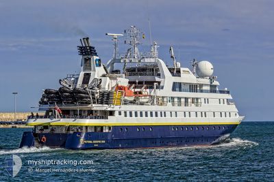
NAT-GEO ORION
Passengers Ship
Current Trip
KADAVU ISLAND
| Time Travelled | 5 days |
|---|---|
| Remaining Time | --- |
| Distance Travelled | 1655.05 nm |
| Remaining Distance | --- |
| AVG Speed | 12.2 Knots |
| MAX Speed | 17.3 Knots |
| AVG Wind | 17.4 knots |
| MAX Wind | 23 knots |
| MIN Temp | 24.4°C / 75.92°F |
| MAX Temp | 29.9°C / 85.82°F |
| Dybgang | 3.9 m |
| Position Modtaget | 15 d siden |
Current Position
| Longitude | 178.49542° |
|---|---|
| Latitude | -18.56533° |
| Status | Under way using engine |
| Fart | 12.1 Knots |
| Kurs | 63.6° |
| Område | South Pacific Ocean |
| Station | T-AIS |
| Position Modtaget | 15 d siden |
Info
Information
The current position of NAT-GEO ORION is in South Pacific Ocean with coordinates -18.56533° / 178.49542° as reported on 2024-04-29 06:53 by AIS to our vessel tracker app. The vessel's current speed is 12.1 Knots
The vessel NAT-GEO ORION (IMO: 9273076, MMSI: 311603000) is a Passengers Ship that was built in 2003 ( 21 år gamle ). It's sailing under the flag of [BS] Bahamas.
In this page you can find informations about the vessels current position, last detected port calls, and current voyage information. If the vessels is not in coverage by AIS you will find the latest position.
The current position of NAT-GEO ORION is detected by our AIS receivers and we are not responsible for the reliability of the data. The last position was recorded while the vessel was in Coverage by the Ais receivers of our vessel tracking app.
The current draught of NAT-GEO ORION as reported by AIS is 3.9 meters
Weather
| Temperature | 29.2°C / 84.56°F |
|---|---|
| Wind Speed | 4 knots |
| Direction | 77° ENE |
| Pressure | 1010.6 hPa |
| Humidity | 67.3 % |
| Cloud Coverage | 52 % |
Featured Company
Last Trips
| Origin | Departure | Destination | Arrival | Distance | |
|---|---|---|---|---|---|
| 2024-05-04 10:14 | 2024-05-09 06:14 | 905.45 nm | |||
| 2024-04-28 18:08 | 2024-05-04 06:50 | 1167.08 nm | |||
| 2024-04-21 21:05 | 2024-04-28 07:00 | 1049.53 nm | |||
| 2024-03-02 17:09 | 2024-04-21 08:25 | 6723.76 nm | |||
| 2024-02-25 17:58 | 2024-03-02 09:21 | 947.15 nm |
Events
| Tid | Hændelsen | Detaljer | Position / Dest | Info |
|---|---|---|---|---|
| 2024-05-11 07:06 | START Sejllads |
-10.61125 / 150.64706
KADAVU ISLAND
|
Fart: 8.6 kn Kurs: 6° |
|
| 2024-05-11 02:26 | STOP Sejllads |
-10.61500 / 150.64166
KADAVU ISLAND
|
Fart: Kurs: -1° |
|
| 2024-05-09 07:15 | START Sejllads | 0.4 nm, North of HONIARA |
-9.42258 / 159.96376
KADAVU ISLAND
|
Fart: 9.4 kn Kurs: 30° |
| 2024-05-09 07:15 | Afsejlet fra sidste havn |
|
-9.42258 / 159.96376
KADAVU ISLAND
|
Fart: 2.3 kn Kurs: 5° |
| 2024-05-08 19:23 | STOP Sejllads |
-9.42833 / 159.95833
[SB] HONIARA
|
Fart: Kurs: -1° |
|
| 2024-05-08 19:14 | Skibe i havn |
|
-9.42824 / 159.96167
[SB] HONIARA
|
Fart: 2.5 kn Kurs: 189° |
| 2024-05-08 04:58 | START Sejllads |
-10.83195 / 162.44934
KADAVU ISLAND
|
Fart: 6.3 kn Kurs: 275° |
|
| 2024-05-07 19:29 | STOP Sejllads |
-10.83333 / 162.45166
KADAVU ISLAND
|
Fart: Kurs: -1° |
|
| 2024-05-06 04:22 | START Sejllads |
-15.51994 / 167.19679
KADAVU ISLAND
|
Fart: 9.8 kn Kurs: 112° |
|
| 2024-05-05 19:39 | STOP Sejllads |
-15.51580 / 167.18932
KADAVU ISLAND
|
Fart: 0.1 kn Kurs: 101° |