
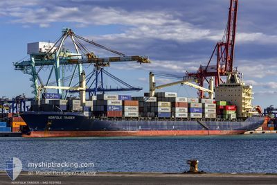
MSC PAMIRA III
Container Ship
Current Trip
| Time Travelled | 2 days |
|---|---|
| Remaining Time | --- |
| Distance Travelled | 764.83 nm |
| Remaining Distance | 14.83 nm |
| AVG Speed | 12.8 Knots |
| MAX Speed | 17.3 Knots |
| AVG Wind | 22 knots |
| MAX Wind | 36 knots |
| MIN Temp | 14.3°C / 57.74°F |
| MAX Temp | 20.1°C / 68.18°F |
| Dybgang | 8.2 m |
| Position Modtaget | 1 d siden |
Current Position
| Longitude | 27.70828° |
|---|---|
| Latitude | 35.30027° |
| Status | Under way using engine |
| Fart | 14.4 Knots |
| Kurs | 153.1° |
| Område | Mediterranean Sea - Eastern Basin |
| Station | T-AIS |
| Position Modtaget | 1 d siden |
Info
Information
The current position of MSC PAMIRA III is in Mediterranean Sea - Eastern Basin with coordinates 35.30027° / 27.70828° as reported on 2024-05-11 16:27 by AIS to our vessel tracker app. The vessel's current speed is 14.4 Knots and is heading at the port of ALEXANDRIA. The estimated time of arrival as calculated by MyShipTracking vessel tracking app is 2024-05-12 15:00 LT
The vessel MSC PAMIRA III (IMO: 9239903, MMSI: 636021246) is a Container Ship that was built in 2002 ( 22 år gamle ). It's sailing under the flag of [LR] Liberia.
In this page you can find informations about the vessels current position, last detected port calls, and current voyage information. If the vessels is not in coverage by AIS you will find the latest position.
The current position of MSC PAMIRA III is detected by our AIS receivers and we are not responsible for the reliability of the data. The last position was recorded while the vessel was in Coverage by the Ais receivers of our vessel tracking app.
The current draught of MSC PAMIRA III as reported by AIS is 8.2 meters
Weather
| Temperature | 19.6°C / 67.28°F |
|---|---|
| Wind Speed | 16 knots |
| Direction | 316° NW |
| Pressure | 1014.1 hPa |
| Humidity | 62.1 % |
| Cloud Coverage | --- |
Featured Company
Last Port Calls
| Port | Arrival | Departure | Time In Port |
|---|---|---|---|
| 2024-05-10 02:42 | 2024-05-10 10:26 | 7 h | |
| 2024-05-04 04:03 | 2024-05-06 15:38 | 2 d | |
| 2024-04-24 14:44 | 2024-04-25 17:12 | 1 d | |
| 2024-04-23 10:26 | 2024-04-24 14:08 | 1 d | |
| 2024-04-18 22:30 | 2024-04-19 15:01 | 16 h | |
| 2024-04-17 00:19 | 2024-04-17 21:55 | 21 h | |
| 2024-04-09 22:58 | 2024-04-12 00:53 | 2 d | |
| 2024-03-31 05:48 | 2024-04-01 01:39 | 19 h | |
| 2024-03-28 07:04 | 2024-03-30 07:34 | 2 d | |
| 2024-03-21 16:28 | 2024-03-22 06:52 | 14 h |
Most Visited Ports (Last year)
| Port | Arrivals | |
|---|---|---|
| 9 | ||
| 8 | ||
| 7 | ||
| 7 | ||
| 4 | ||
| 3 |
Last Trips
| Origin | Departure | Destination | Arrival | Distance | |
|---|---|---|---|---|---|
| 2024-05-06 15:38 | 2024-05-10 02:42 | 565.92 nm | |||
| 2024-04-25 17:12 | 2024-05-04 04:03 | 1426.68 nm | |||
| 2024-04-24 14:08 | 2024-04-24 14:44 | 3.94 nm | |||
| 2024-04-19 15:01 | 2024-04-23 10:26 | 534.08 nm | |||
| 2024-04-17 21:55 | 2024-04-18 22:30 | 304.70 nm | |||
| 2024-04-12 00:53 | 2024-04-17 00:19 | 631.32 nm | |||
| 2024-04-01 01:39 | 2024-04-09 22:58 | 2203.63 nm | |||
| 2024-03-30 07:34 | 2024-03-31 05:48 | 296.52 nm | |||
| 2024-03-22 06:52 | 2024-03-28 07:04 | 830.34 nm | |||
| 2024-03-01 13:35 | 2024-03-04 03:30 | 358.86 nm |
Events
| Tid | Hændelsen | Detaljer | Position / Dest | Info |
|---|---|---|---|---|
| 2024-05-11 16:40 | Status er ændret | Default Under way using engine |
35.25441 / 27.73719
ALEXANDRIA
|
Fart: 14.4 kn Kurs: 153.1° |
| 2024-05-11 16:27 | Udenfor Dækning |
35.30027 / 27.70828
Mediterranean Sea - Eastern Basin
ALEXANDRIA
|
Fart: 14.4 kn Kurs: 153.1° |
|
| 2024-05-11 14:28 | Ændre havområde | Greek part of the Mediterranean Sea - Eastern Basin Greek part of the Aegean Sea |
35.73012 / 27.46108
Mediterranean Sea - Eastern Basin
ALEXANDRIA
|
Fart: 13.8 kn Kurs: 157.4° |
| 2024-05-11 01:29 | ETA er ændret | 2024/05/12 13:00 2024/05/12 12:00 |
38.16185 / 25.46883
ALEXANDRIA
|
Fart: 13.6 kn Kurs: 160.3° |
| 2024-05-10 21:00 | ETA er ændret | 2024/05/12 12:00 2024/05/12 06:00 |
39.15998 / 25.53326
ALEXANDRIA
|
Fart: 14.2 kn Kurs: 195.9° |
| 2024-05-10 17:49 | Ændre havområde | Greek part of the Aegean Sea Turkish part of the Aegean Sea |
39.88334 / 25.79656
Aegean Sea
ALEXANDRIA
|
Fart: 14.7 kn Kurs: 219.6° |
| 2024-05-10 17:19 | Status er ændret | Under way using engine Default |
39.96843 / 25.91207
ALEXANDRIA
|
Fart: 15.4 kn Kurs: 230° |
| 2024-05-10 16:52 | Status er ændret | Default Under way using engine |
40.01923 / 26.04570
ALEXANDRIA
|
Fart: 16.1 kn Kurs: 265.9° |
| 2024-05-10 16:38 | Status er ændret | Under way using engine Default |
40.02387 / 26.12503
ALEXANDRIA
|
Fart: 16.4 kn Kurs: 264° |
| 2024-05-10 16:33 | Status er ændret | Default Under way using engine |
40.02558 / 26.15171
ALEXANDRIA
|
Fart: 16.5 kn Kurs: 261.1° |