
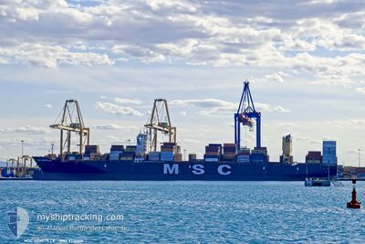
MSC DOMITILLE
Cargo D
Current Trip
| Trip Time | 1 day |
|---|---|
| Trip Distance | 107.52 nm |
| AVG Speed | 6.9 Knots |
| MAX Speed | 6.9 Knots |
| Dybgang | 10.9 m |
| AVG Wind | 9 knots |
| MAX Wind | 16 knots |
| MIN Temp | 25.4°C / 77.72°F |
| MAX Temp | 30.9°C / 87.62°F |
| Position Modtaget | 3 h, 9 m siden |
Current Position
| Longitude | -79.57361° |
|---|---|
| Latitude | 8.95663° |
| Status | Under way using engine |
| Fart | 0.5 Knots |
| Kurs | 158° |
| Område | North Pacific Ocean |
| Station | T-AIS |
| Position Modtaget | 3 h, 9 m siden |
Info
Information
The current position of MSC DOMITILLE is in North Pacific Ocean with coordinates 8.95663° / -79.57361° as reported on 2024-05-20 19:26 by AIS to our vessel tracker app. The vessel's current speed is 0.5 Knots and is currently inside the port of RODMAN.
The vessel MSC DOMITILLE (IMO: 9720201, MMSI: 255806507) is a Cargo D It's sailing under the flag of [PT] Portugal.
In this page you can find informations about the vessels current position, last detected port calls, and current voyage information. If the vessels is not in coverage by AIS you will find the latest position.
The current position of MSC DOMITILLE is detected by our AIS receivers and we are not responsible for the reliability of the data. The last position was recorded while the vessel was in Coverage by the Ais receivers of our vessel tracking app.
The current draught of MSC DOMITILLE as reported by AIS is 10.9 meters
Weather
| Temperature | 26°C / 78.8°F |
|---|---|
| Wind Speed | 4 knots |
| Direction | 287° WNW |
| Pressure | 1005.1 hPa |
| Humidity | 96 % |
| Cloud Coverage | 100 % |
Featured Company
Last Port Calls
| Port | Arrival | Departure | Time In Port |
|---|---|---|---|
| 2024-05-20 19:26 | |||
| 2024-05-18 05:30 | 2024-05-19 02:14 | 20 h | |
| 2024-05-12 15:22 | 2024-05-14 10:18 | 1 d | |
| 2024-05-06 07:02 | 2024-05-06 23:17 | 16 h | |
| 2024-05-03 11:23 | 2024-05-04 02:12 | 14 h | |
| 2024-05-01 13:02 | 2024-05-02 12:29 | 23 h | |
| 2024-04-29 09:38 | 2024-04-30 01:58 | 16 h | |
| 2024-04-21 10:06 | 2024-04-22 01:55 | 15 h | |
| 2024-04-18 19:17 | 2024-04-20 11:16 | 1 d | |
| 2024-04-17 05:06 | 2024-04-17 19:43 | 14 h |
Last Trips
| Origin | Departure | Destination | Arrival | Distance | |
|---|---|---|---|---|---|
| 2024-05-18 21:14 | 2024-05-20 14:26 | 107.52 nm | |||
| 2024-05-14 06:18 | 2024-05-18 00:30 | 1258.23 nm | |||
| 2024-05-06 19:17 | 2024-05-12 11:22 | 1017.75 nm | |||
| 2024-05-03 22:12 | 2024-05-06 03:02 | 294.60 nm | |||
| 2024-05-02 08:29 | 2024-05-03 07:23 | 259.86 nm | |||
| 2024-04-29 21:58 | 2024-05-01 09:02 | 386.76 nm | |||
| 2024-04-22 03:55 | 2024-04-29 05:38 | 3004.82 nm | |||
| 2024-04-20 13:16 | 2024-04-21 12:06 | 268.53 nm | |||
| 2024-04-17 21:43 | 2024-04-18 21:17 | 378.64 nm | |||
| 2024-04-14 14:10 | 2024-04-17 07:06 | 971.36 nm |
Events
| Tid | Hændelsen | Detaljer | Position / Dest | Info |
|---|---|---|---|---|
| 2024-05-20 19:34 | Status er ændret | Default Under way using engine |
8.95636 / -79.57409
[PA] RODMAN
|
Fart: 0.5 kn Kurs: 158° |
| 2024-05-20 19:34 | STOP Sejllads |
8.95636 / -79.57409
[PA] RODMAN
|
Fart: Kurs: 152° |
|
| 2024-05-20 19:26 | Status er ændret | Under way using engine Default |
8.95663 / -79.57361
[PA] RODMAN
|
Fart: 0.4 kn Kurs: 177° |
| 2024-05-20 19:26 | Udenfor Dækning |
8.95663 / -79.57361
North Pacific Ocean
[PA] RODMAN
|
Fart: 0.5 kn Kurs: 226.9° |
|
| 2024-05-20 19:26 | Skibe i havn |
|
8.95663 / -79.57361
[PA] RODMAN
|
Fart: 0.4 kn Kurs: 177° |
| 2024-05-20 19:23 | Indenfor Dækning |
8.95663 / -79.57361
North Pacific Ocean
[PA] RODMAN
|
Fart: 0.5 kn Kurs: 226.9° |
|
| 2024-05-20 18:18 | START Sejllads | 3.28 nm, North East of TABOGUILLA |
8.85379 / -79.48988
BSFPO
|
Fart: 5.1 kn Kurs: 308° |
| 2024-05-20 18:11 | STOP Sejllads | 3.3 nm, North East of TABOGUILLA |
8.85214 / -79.48709
BSFPO
|
Fart: 0.2 kn Kurs: 331° |
| 2024-05-20 17:14 | START Sejllads | 7.04 nm, East of TABOGUILLA |
8.78913 / -79.40434
BSFPO
|
Fart: 3.2 kn Kurs: 289° |
| 2024-05-20 16:50 | STOP Sejllads | 7.52 nm, East of TABOGUILLA |
8.78667 / -79.39667
BSFPO
|
Fart: Kurs: -1° |