
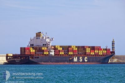
MSC BHAVYA V
Container Ship
Current Trip
| Time Travelled | 2 days |
|---|---|
| Remaining Time | 15 h, 5 mins |
| Distance Travelled | 867.48 nm |
| Remaining Distance | 257.40 nm |
| AVG Speed | 17.3 Knots |
| MAX Speed | 19.9 Knots |
| AVG Wind | 12.2 knots |
| MAX Wind | 27 knots |
| MIN Temp | 11.7°C / 53.06°F |
| MAX Temp | 18°C / 64.4°F |
| Dybgang | 11.2 m |
| Position Modtaget | 1 m siden |
Current Position
| Longitude | -2.73625° |
|---|---|
| Latitude | 49.84376° |
| Status | Under way using engine |
| Fart | 11.5 Knots |
| Kurs | 74.3° |
| Område | English Channel |
| Station | T-AIS |
| Position Modtaget | 1 m siden |
Info
Information
The current position of MSC BHAVYA V is in English Channel with coordinates 49.84376° / -2.73625° as reported on 2024-05-05 11:34 by AIS to our vessel tracker app. The vessel's current speed is 11.5 Knots and is heading at the port of THAMES. The estimated time of arrival as calculated by MyShipTracking vessel tracking app is 2024-05-06 02:41 LT
The vessel MSC BHAVYA V (IMO: 9297876, MMSI: 636016423) is a Container Ship that was built in 2005 ( 19 år gamle ). It's sailing under the flag of [LR] Liberia.
In this page you can find informations about the vessels current position, last detected port calls, and current voyage information. If the vessels is not in coverage by AIS you will find the latest position.
The current position of MSC BHAVYA V is detected by our AIS receivers and we are not responsible for the reliability of the data. The last position was recorded while the vessel was in Coverage by the Ais receivers of our vessel tracking app.
The current draught of MSC BHAVYA V as reported by AIS is 11.2 meters
Weather
| Temperature | 12.1°C / 53.78°F |
|---|---|
| Wind Speed | 13 knots |
| Direction | 215° SW |
| Pressure | 1006.3 hPa |
| Humidity | 86.9 % |
| Cloud Coverage | 100 % |
Featured Company
Last Port Calls
| Port | Arrival | Departure | Time In Port |
|---|---|---|---|
| 2024-05-02 18:31 | 2024-05-03 10:14 | 15 h | |
| 2024-04-25 19:39 | 2024-04-27 07:51 | 1 d | |
| 2024-04-24 01:46 | 2024-04-24 18:09 | 16 h | |
| 2024-04-23 08:28 | 2024-04-23 21:17 | 12 h | |
| 2024-04-22 13:18 | 2024-04-23 01:54 | 12 h | |
| 2024-04-20 04:55 | 2024-04-21 13:29 | 1 d | |
| 2024-04-17 01:18 | 2024-04-18 12:17 | 1 d | |
| 2024-04-12 22:37 | 2024-04-13 19:38 | 21 h | |
| 2024-04-08 05:55 | 2024-04-09 10:56 | 1 d | |
| 2024-04-06 05:03 | 2024-04-06 18:51 | 13 h |
Last Trips
| Origin | Departure | Destination | Arrival | Distance | |
|---|---|---|---|---|---|
| 2024-04-27 10:51 | 2024-05-02 19:31 | 1916.96 nm | |||
| 2024-04-24 21:09 | 2024-04-25 22:39 | 294.71 nm | |||
| 2024-04-24 00:17 | 2024-04-24 04:46 | 47.84 nm | |||
| 2024-04-23 04:54 | 2024-04-23 11:28 | 63.37 nm | |||
| 2024-04-21 16:29 | 2024-04-22 16:18 | 315.34 nm | |||
| 2024-04-18 14:17 | 2024-04-20 07:55 | 512.49 nm | |||
| 2024-04-13 20:38 | 2024-04-17 03:18 | 1332.03 nm | |||
| 2024-04-09 12:56 | 2024-04-12 23:37 | 1212.48 nm | |||
| 2024-04-06 20:51 | 2024-04-08 07:55 | 381.06 nm | |||
| 2024-04-05 21:27 | 2024-04-06 07:03 | 116.19 nm |
Events
| Tid | Hændelsen | Detaljer | Position / Dest | Info |
|---|---|---|---|---|
| 2024-05-05 11:25 | ETA er ændret | 2024/05/06 11:00 2024/05/06 04:00 |
49.83555 / -2.78054
PTSIE>GBLGP
|
Fart: 12 kn Kurs: 75.7° |
| 2024-05-05 10:58 | Status er ændret | Under way using engine Default |
49.79935 / -2.94272
PTSIE>GBLGP
|
Fart: 16.9 kn Kurs: 73° |
| 2024-05-05 10:54 | Status er ændret | Default Under way using engine |
49.79341 / -2.96752
PTSIE>GBLGP
|
Fart: 16.9 kn Kurs: 73.4° |
| 2024-05-05 10:36 | Status er ændret | Under way using engine Default |
49.76980 / -3.09463
PTSIE>GBLGP
|
Fart: 17 kn Kurs: 65° |
| 2024-05-05 09:50 | Status er ændret | Default Under way using engine |
49.68233 / -3.40074
PTSIE>GBLGP
|
Fart: 17.1 kn Kurs: 65.7° |
| 2024-05-05 09:43 | Ændre havområde | Guernsey part of the English Channel United Kingdom part of the English Channel |
49.66892 / -3.44855
English Channel
PTSIE>GBLGP
|
Fart: 17.2 kn Kurs: 66.1° |
| 2024-05-05 09:43 | Status er ændret | Under way using engine Default |
49.66892 / -3.44855
PTSIE>GBLGP
|
Fart: 17.2 kn Kurs: 66° |
| 2024-05-05 09:14 | Status er ændret | Default Under way using engine |
49.61083 / -3.64217
PTSIE>GBLGP
|
Fart: 17.2 kn Kurs: 64.9° |
| 2024-05-05 08:46 | Fundet i havområde | United Kingdom part of the English Channel |
49.55293 / -3.83454
English Channel
PTSIE>GBLGP
|
Fart: 17.1 kn Kurs: 65.1° |
| 2024-05-05 08:45 | Status er ændret | Under way using engine Default |
49.55217 / -3.83710
PTSIE>GBLGP
|
Fart: 17.2 kn Kurs: 65° |