
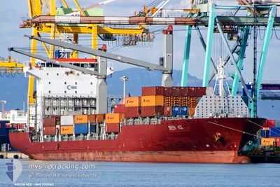
MSC ACE II
Container Ship
Current Trip
TAMATAVE
| Time Travelled | 3 h, 49 mins |
|---|---|
| Remaining Time | --- |
| Distance Travelled | 39.63 nm |
| Remaining Distance | --- |
| AVG Speed | 10.7 Knots |
| MAX Speed | 14.4 Knots |
| AVG Wind | 8.5 knots |
| MAX Wind | 13 knots |
| MIN Temp | 25.8°C / 78.44°F |
| MAX Temp | 26.8°C / 80.24°F |
| Dybgang | 11.3 m |
| Position Modtaget | 4 d siden |
Current Position
| Longitude | --- |
|---|---|
| Latitude | --- |
| Status | Under way using engine |
| Fart | 9.6 Knots |
| Kurs | 289.9° |
| Område | Indian Ocean |
| Station | T-AIS |
| Position Modtaget | 4 d siden |
Info
Information
The current position of MSC ACE II is in Indian Ocean with coordinates -20.12802° / 57.45351° as reported on 2025-12-10 20:40 by AIS to our vessel tracker app. The vessel's current speed is 9.6 Knots
The vessel MSC ACE II (IMO: 9309162, MMSI: 636019697) is a Container Ship that was built in 2005 ( 20 år gamle ). It's sailing under the flag of [LR] Liberia.
In this page you can find informations about the vessels current position, last detected port calls, and current voyage information. If the vessels is not in coverage by AIS you will find the latest position.
The current position of MSC ACE II is detected by our AIS receivers and we are not responsible for the reliability of the data. The last position was recorded while the vessel was in Coverage by the Ais receivers of our vessel tracking app.
The current draught of MSC ACE II as reported by AIS is 11.3 meters
Weather
| Temperature | 26.8°C / 80.24°F |
|---|---|
| Wind Speed | 12 knots |
| Direction | 112° ESE |
| Pressure | 1014.4 hPa |
| Humidity | 77.2 % |
| Cloud Coverage | 97 % |
Featured Company
Last Port Calls
| Port | Arrival | Departure | Time In Port |
|---|---|---|---|
| 2025-12-13 17:36 | 2025-12-14 21:17 | 1 d | |
| 2025-12-07 15:50 | 2025-12-11 00:33 | 3 d | |
| 2025-11-28 09:43 | 2025-12-02 23:31 | 4 d | |
| 2025-11-21 06:48 | 2025-11-23 04:36 | 1 d | |
| 2025-11-17 07:44 | 2025-11-17 20:23 | 12 h | |
| 2025-11-12 22:23 | 2025-11-14 09:59 | 1 d | |
| 2025-11-03 22:48 | 2025-11-11 02:37 | 7 d | |
| 2025-10-27 04:15 | 2025-10-29 10:19 | 2 d | |
| 2025-10-02 13:07 | 2025-10-17 17:25 | 15 d |
Last Trips
| Origin | Departure | Destination | Arrival | Distance | |
|---|---|---|---|---|---|
| 2025-12-11 00:33 | 2025-12-13 17:36 | 488.18 nm | |||
| 2025-12-02 23:31 | 2025-12-07 15:50 | 1559.22 nm | |||
| 2025-11-23 04:36 | 2025-11-28 09:43 | 870.63 nm | |||
| 2025-11-17 20:23 | 2025-11-21 06:48 | 351.86 nm | |||
| 2025-11-14 09:59 | 2025-11-17 07:44 | 528.57 nm | |||
| 2025-11-11 02:37 | 2025-11-12 22:23 | 462.45 nm | |||
| 2025-10-29 10:19 | 2025-11-03 22:48 | 568.89 nm | |||
| 2025-10-17 17:25 | 2025-10-27 04:15 | 1029.40 nm | |||
| 2025-09-27 07:28 | 2025-10-02 13:07 | 918.44 nm |
Events
| Tid | Hændelsen | Detaljer | Position / Dest | Info |
|---|---|---|---|---|
| 2025-12-14 18:17 | Afsejlet fra sidste havn |
|
-18.14167 / 49.42661
TAMATAVE
|
Fart: 3.5 kn Kurs: 7° |
| 2025-12-14 18:13 | START Sejllads |
-18.14663 / 49.42605
[MG] TOAMASINA
|
Fart: 3.5 kn Kurs: 7° |
|
| 2025-12-13 14:52 | STOP Sejllads |
-18.15138 / 49.42750
[MG] TOAMASINA
|
Fart: Kurs: 205° |
|
| 2025-12-13 14:36 | Skibe i havn |
|
-18.14792 / 49.42642
[MG] TOAMASINA
|
Fart: 2.2 kn Kurs: 185° |
| 2025-12-13 12:36 | START Sejllads | 5.97 nm, East of TOAMASINA |
-18.13342 / 49.52809
TAMATAVE
|
Fart: 3.9 kn Kurs: 244° |
| 2025-12-13 10:36 | STOP Sejllads | 7.32 nm, East of TOAMASINA |
-18.13319 / 49.55203
TAMATAVE
|
Fart: 0.3 kn Kurs: 267° |
| 2025-12-13 08:36 | START Sejllads | 6.8 nm, North East of TOAMASINA |
-18.06756 / 49.50793
TAMATAVE
|
Fart: 3.5 kn Kurs: 138° |
| 2025-12-13 01:52 | STOP Sejllads | 6.7 nm, North East of TOAMASINA |
-18.09528 / 49.52777
TAMATAVE
|
Fart: 0.2 kn Kurs: 237° |
| 2025-12-10 20:48 | Status er ændret | Default Under way using engine |
-20.11763 / 57.42444
TAMATAVE
|
Fart: 9.6 kn Kurs: 289.9° |
| 2025-12-10 20:40 | Udenfor Dækning |
-20.12802 / 57.45351
Indian Ocean
TAMATAVE
|
Fart: 9.6 kn Kurs: 289.9° |