
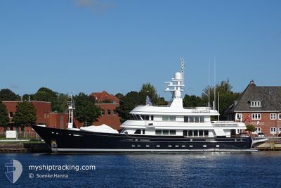
MOONSHADOW
Yacht
Current Trip
PUERTLD
| Trip Time | 1 h, 6 mins |
|---|---|
| Trip Distance | 10.22 nm |
| AVG Speed | 7.8 Knots |
| MAX Speed | 10.7 Knots |
| Dybgang | 2.7 m |
| AVG Wind | 8.7 knots |
| MAX Wind | 10.7 knots |
| MIN Temp | 19.3°C / 66.74°F |
| MAX Temp | 21°C / 69.8°F |
| Position Modtaget | 1 d siden |
Current Position
| Longitude | --- |
|---|---|
| Latitude | --- |
| Status | Moored |
| Fart | |
| Kurs | 78° |
| Område | North Atlantic Ocean |
| Station | T-AIS |
| Position Modtaget | 1 d siden |
Info
Information
The current position of MOONSHADOW is in North Atlantic Ocean with coordinates 28.91608° / -13.70487° as reported on 2025-12-11 17:08 by AIS to our vessel tracker app. The vessel's current speed is 0 Knots and is currently inside the port of PUERTO CALERO.
The vessel MOONSHADOW (IMO: 1007419, MMSI: 319887000) is a Yacht that was built in 2003 ( 22 år gamle ). It's sailing under the flag of [KY] Cayman Is.
In this page you can find informations about the vessels current position, last detected port calls, and current voyage information. If the vessels is not in coverage by AIS you will find the latest position.
The current position of MOONSHADOW is detected by our AIS receivers and we are not responsible for the reliability of the data. The last position was recorded while the vessel was in Coverage by the Ais receivers of our vessel tracking app.
The current draught of MOONSHADOW as reported by AIS is 2.7 meters
Weather
| Temperature | 17.6°C / 63.68°F |
|---|---|
| Wind Speed | 12 knots |
| Direction | 4° N |
| Pressure | 1021.4 hPa |
| Humidity | 60.4 % |
| Cloud Coverage | 76 % |
Featured Company
Last Port Calls
| Port | Arrival | Departure | Time In Port |
|---|---|---|---|
| 2025-12-05 13:34 | |||
| 2025-11-20 13:24 | 2025-12-05 12:28 | 14 d | |
| 2025-11-17 09:48 | 2025-11-17 20:10 | 10 h | |
| 2025-10-14 11:18 | 2025-11-17 08:53 | ||
| 2025-10-14 08:09 | 2025-10-14 10:48 | 2 h | |
| 2025-10-05 09:14 | 2025-10-05 13:00 | 3 h | |
| 2025-10-04 08:13 | 2025-10-04 08:17 | 3 m | |
| 2025-10-03 08:52 | 2025-10-04 06:41 | 21 h | |
| 2025-10-02 07:43 | 2025-10-02 21:03 | 13 h | |
| 2025-10-02 01:27 |
Last Trips
| Origin | Departure | Destination | Arrival | Distance | |
|---|---|---|---|---|---|
| 2025-12-05 12:28 | 2025-12-05 13:34 | 10.22 nm | |||
| 2025-11-17 20:10 | 2025-11-20 13:24 | 601.93 nm | |||
| 2025-11-17 08:53 | 2025-11-17 09:48 | 2.96 nm | |||
| 2025-10-14 10:48 | 2025-10-14 11:18 | 5.15 nm | |||
| 2025-10-05 13:00 | 2025-10-14 08:09 | 330.63 nm | |||
| 2025-10-04 08:17 | 2025-10-05 09:14 | 157.15 nm | |||
| 2025-10-04 06:41 | 2025-10-04 08:13 | 13.71 nm | |||
| 2025-10-02 21:03 | 2025-10-03 08:52 | 120.25 nm | |||
| 2025-10-02 01:27 | 2025-10-02 07:43 | 64.84 nm |
Events
| Tid | Hændelsen | Detaljer | Position / Dest | Info |
|---|---|---|---|---|
| 2025-12-11 17:08 | Udenfor Dækning |
28.91608 / -13.70487
North Atlantic Ocean
[ES] PUERTO CALERO
|
Fart: Kurs: 174.6° |
|
| 2025-12-11 13:42 | Destination er ændret | PUERTLD PUERTO CALERO |
28.91604 / -13.70490
[ES] PUERTO CALERO
|
Fart: Kurs: 78° |
| 2025-12-11 11:17 | Indenfor Dækning |
28.91603 / -13.70489
North Atlantic Ocean
[ES] PUERTO CALERO
|
Fart: Kurs: 183.1° |
|
| 2025-12-08 18:52 | Udenfor Dækning |
28.91606 / -13.70490
North Atlantic Ocean
[ES] PUERTO CALERO
|
Fart: Kurs: 177.7° |
|
| 2025-12-08 12:31 | Indenfor Dækning |
28.91633 / -13.70627
North Atlantic Ocean
[ES] PUERTO CALERO
|
Fart: Kurs: 201° |
|
| 2025-12-07 21:37 | Udenfor Dækning |
28.91635 / -13.70625
North Atlantic Ocean
[ES] PUERTO CALERO
|
Fart: Kurs: 179.9° |
|
| 2025-12-07 21:37 | Indenfor Dækning |
28.91635 / -13.70625
North Atlantic Ocean
[ES] PUERTO CALERO
|
Fart: Kurs: 179.9° |
|
| 2025-12-07 20:04 | Udenfor Dækning |
28.91636 / -13.70625
North Atlantic Ocean
[ES] PUERTO CALERO
|
Fart: Kurs: 185.9° |
|
| 2025-12-07 17:49 | Indenfor Dækning |
28.91636 / -13.70625
North Atlantic Ocean
[ES] PUERTO CALERO
|
Fart: Kurs: 175.6° |
|
| 2025-12-06 07:52 | Udenfor Dækning |
28.91630 / -13.70626
North Atlantic Ocean
[ES] PUERTO CALERO
|
Fart: Kurs: 189.3° |