
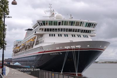
BALMORAL
Passengers Ship
Current Trip
| Time Travelled | 1 day |
|---|---|
| Remaining Time | 14 h, 46 mins |
| Distance Travelled | 681.63 nm |
| Remaining Distance | 260.64 nm |
| AVG Speed | 16.8 Knots |
| MAX Speed | 21.4 Knots |
| AVG Wind | 21.7 knots |
| MAX Wind | 39 knots |
| MIN Temp | -0.5°C / 31.1°F |
| MAX Temp | 9.3°C / 48.74°F |
| Dybgang | 7.1 m |
| Position Modtaget | 2 m siden |
Current Position
| Longitude | --- |
|---|---|
| Latitude | --- |
| Status | Under way using engine |
| Fart | 17.7 Knots |
| Kurs | 325° |
| Område | North Sea |
| Station | T-AIS |
| Position Modtaget | 2 m siden |
Info
Information
The current position of BALMORAL is in North Sea with coordinates 58.77648° / 5.20286° as reported on 2026-02-01 11:37 by AIS to our vessel tracker app. The vessel's current speed is 17.7 Knots and is heading at the port of ALESUND. The estimated time of arrival as calculated by MyShipTracking vessel tracking app is 2026-02-02 03:25 LT
The vessel BALMORAL (IMO: 8506294, MMSI: 308785000) is a Passengers Ship that was built in 1988 ( 38 år gamle ). It's sailing under the flag of [BS] Bahamas.
In this page you can find informations about the vessels current position, last detected port calls, and current voyage information. If the vessels is not in coverage by AIS you will find the latest position.
The current position of BALMORAL is detected by our AIS receivers and we are not responsible for the reliability of the data. The last position was recorded while the vessel was in Coverage by the Ais receivers of our vessel tracking app.
The current draught of BALMORAL as reported by AIS is 7.1 meters
Weather
| Temperature | 0.3°C / 32.54°F |
|---|---|
| Wind Speed | 33 knots |
| Direction | 117° ESE |
| Pressure | 1016.5 hPa |
| Humidity | 67.4 % |
| Cloud Coverage | 100 % |
Featured Company
Last Port Calls
| Port | Arrival | Departure | Time In Port |
|---|---|---|---|
| 2026-01-30 05:52 | 2026-01-30 21:08 | 15 h | |
| 2026-01-28 17:22 | 2026-01-29 16:22 | 22 h | |
| 2026-01-26 06:50 | 2026-01-26 15:47 | 8 h | |
| 2026-01-24 12:46 | 2026-01-24 20:51 | 8 h | |
| 2026-01-23 07:21 | 2026-01-23 21:07 | 13 h | |
| 2026-01-20 05:33 | 2026-01-20 17:30 | 11 h | |
| 2026-01-16 09:48 | 2026-01-17 15:07 | 1 d | |
| 2026-01-14 06:37 | 2026-01-14 17:39 | 11 h | |
| 2026-01-13 07:00 | 2026-01-13 17:35 | 10 h | |
| 2026-01-12 11:59 | 2026-01-12 20:38 | 8 h |
Most Visited Ports (Last year)
| Port | Arrivals | |
|---|---|---|
| 21 | ||
| 8 | ||
| 5 | ||
| 5 | ||
| 4 | ||
| 4 |
Last Trips
| Origin | Departure | Destination | Arrival | Distance | |
|---|---|---|---|---|---|
| 2026-01-29 16:22 | 2026-01-30 05:52 | 204.42 nm | |||
| 2026-01-26 15:47 | 2026-01-28 17:22 | 844.28 nm | |||
| 2026-01-24 20:51 | 2026-01-26 06:50 | 405.04 nm | |||
| 2026-01-23 21:07 | 2026-01-24 12:46 | 170.35 nm | |||
| 2026-01-20 17:30 | 2026-01-23 07:21 | 720.54 nm | |||
| 2026-01-17 15:07 | 2026-01-20 05:33 | 923.85 nm | |||
| 2026-01-14 17:39 | 2026-01-16 09:48 | 634.91 nm | |||
| 2026-01-13 17:35 | 2026-01-14 06:37 | 158.05 nm | |||
| 2026-01-12 20:38 | 2026-01-13 07:00 | 101.14 nm | |||
| 2026-01-12 20:38 | 2026-01-12 11:59 | 101.14 nm |
Events
| Tid | Hændelsen | Detaljer | Position / Dest | Info |
|---|---|---|---|---|
| 2026-02-01 09:43 | Status er ændret | Under way using engine Default |
58.33410 / 5.80340
NO AES
|
Fart: 16.6 kn Kurs: 318° |
| 2026-02-01 09:41 | Status er ændret | Default Under way using engine |
58.32815 / 5.81423
NO AES
|
Fart: 16.5 kn Kurs: 317.9° |
| 2026-02-01 09:22 | Status er ændret | Under way using engine Default |
58.26241 / 5.94199
NO AES
|
Fart: 18.4 kn Kurs: 312° |
| 2026-02-01 09:21 | Status er ændret | Default Under way using engine |
58.25827 / 5.95017
NO AES
|
Fart: 18.1 kn Kurs: 313.9° |
| 2026-02-01 04:24 | Ændre havområde | Norwegian part of the North Sea Danish part of the North Sea |
57.09816 / 6.67747
North Sea
NO AES
|
Fart: 16.1 kn Kurs: 6.3° |
| 2026-02-01 03:47 | Status er ændret | Under way using engine Default |
56.93355 / 6.64034
NO AES
|
Fart: 16 kn Kurs: 5° |
| 2026-02-01 03:47 | Indenfor Dækning |
56.93355 / 6.64034
North Sea
NO AES
|
Fart: 16 kn Kurs: 5.5° |
|
| 2026-01-31 22:52 | Status er ændret | Default Under way using engine |
55.63232 / 6.02386
NO AES
|
Fart: 17.5 kn Kurs: 19.6° |
| 2026-01-31 22:45 | Udenfor Dækning |
55.60286 / 6.00555
North Sea
NO AES
|
Fart: 17.5 kn Kurs: 19.6° |
|
| 2026-01-31 22:37 | Ændre havområde | Danish part of the North Sea German part of the North Sea |
55.56744 / 5.98359
North Sea
NO AES
|
Fart: 17.4 kn Kurs: 18.3° |