
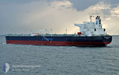
MINERVA KARTERIA
Tanker
Current Trip
PANAMA
| Time Travelled | 29 days |
|---|---|
| Remaining Time | --- |
| Distance Travelled | 6652.50 nm |
| Remaining Distance | --- |
| AVG Speed | 11.9 Knots |
| MAX Speed | 14.7 Knots |
| AVG Wind | 10.1 knots |
| MAX Wind | 30.9 knots |
| MIN Temp | 17°C / 62.6°F |
| MAX Temp | 30.4°C / 86.72°F |
| Dybgang | 12.1 m |
| Position Modtaget | 4 d siden |
Current Position
| Longitude | -79.58429° |
|---|---|
| Latitude | 8.97560° |
| Status | Under way using engine |
| Fart | 1 Knots |
| Kurs | 143° |
| Område | Caribbean Sea |
| Station | T-AIS |
| Position Modtaget | 4 d siden |
Info
Information
The current position of MINERVA KARTERIA is in Caribbean Sea with coordinates 8.97560° / -79.58429° as reported on 2024-05-31 21:26 by AIS to our vessel tracker app. The vessel's current speed is 1 Knots
The vessel MINERVA KARTERIA (IMO: 9787170, MMSI: 241574000) is a Tanker It's sailing under the flag of [GR] Greece.
In this page you can find informations about the vessels current position, last detected port calls, and current voyage information. If the vessels is not in coverage by AIS you will find the latest position.
The current position of MINERVA KARTERIA is detected by our AIS receivers and we are not responsible for the reliability of the data. The last position was recorded while the vessel was in Coverage by the Ais receivers of our vessel tracking app.
The current draught of MINERVA KARTERIA as reported by AIS is 12.1 meters
Weather
| Temperature | 28°C / 82.4°F |
|---|---|
| Wind Speed | 13 knots |
| Direction | 273° W |
| Pressure | 1008.9 hPa |
| Humidity | 72.2 % |
| Cloud Coverage | 1 % |
Featured Company
Most Visited Ports (Last year)
| Port | Arrivals | |
|---|---|---|
| 3 | ||
| 2 | ||
| 2 | ||
| 2 | ||
| 2 | ||
| 1 |
Last Trips
Events
| Tid | Hændelsen | Detaljer | Position / Dest | Info |
|---|---|---|---|---|
| 2024-05-31 21:36 | Status er ændret | Default Under way using engine |
8.97134 / -79.58083
PANAMA
|
Fart: 1 kn Kurs: 143° |
| 2024-05-31 21:36 | START Sejllads | 1.04 nm, North West of RODMAN |
8.97134 / -79.58083
PANAMA
|
Fart: 4.3 kn Kurs: 140° |
| 2024-05-31 21:26 | Udenfor Dækning |
8.97560 / -79.58429
Caribbean Sea
|
Fart: 1 kn Kurs: 141° |
|
| 2024-05-31 20:27 | Status er ændret | Under way using engine Default |
8.98150 / -79.58892
PANAMA
|
Fart: Kurs: 142° |
| 2024-05-31 20:24 | Status er ændret | Default Under way using engine |
8.98151 / -79.58894
PANAMA
|
Fart: Kurs: 143° |
| 2024-05-31 19:10 | STOP Sejllads | 2.44 nm, North West of RODMAN |
8.99004 / -79.59556
PANAMA
|
Fart: Kurs: 142° |
| 2024-05-31 19:03 | Status er ændret | Under way using engine Default |
8.99240 / -79.59719
PANAMA
|
Fart: 3.2 kn Kurs: 142° |
| 2024-05-31 18:48 | Indenfor Dækning |
8.99184 / -79.59676
Caribbean Sea
|
Fart: 2 kn Kurs: 143° |
|
| 2024-05-31 13:52 | START Sejllads | 5.5 nm, South of CRISTOBAL |
9.25430 / -79.91335
PANAMA
|
Fart: 3.5 kn Kurs: 217° |
| 2024-05-31 12:44 | STOP Sejllads | 4.46 nm, South of CRISTOBAL |
9.27170 / -79.91249
PANAMA
|
Fart: Kurs: 172° |