
MARWIN
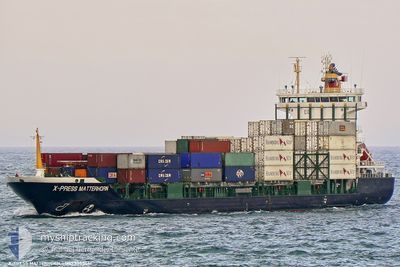
Container Ship
Current Trip
| Time Travelled | 1 day |
|---|---|
| Remaining Time | 12 h, 2 mins |
| Distance Travelled | 338.60 nm |
| Remaining Distance | 160.88 nm |
| AVG Speed | 13 Knots |
| MAX Speed | 13.8 Knots |
| AVG Wind | 13.2 knots |
| MAX Wind | 18.5 knots |
| MIN Temp | 20.7°C / 69.26°F |
| MAX Temp | 22.2°C / 71.96°F |
| Dybgang | 7.1 m |
| Position Modtaget | 1 m siden |
Current Position
| Longitude | --- |
|---|---|
| Latitude | --- |
| Status | Under way using engine |
| Fart | 12.9 Knots |
| Kurs | 36.1° |
| Område | Mediterranean Sea - Eastern Basin |
| Station | T-AIS |
| Position Modtaget | 1 m siden |
Info
Information
The current position of MARWIN is in Mediterranean Sea - Eastern Basin with coordinates 34.67770° / 34.06555° as reported on 2025-12-05 12:56 by AIS to our vessel tracker app. The vessel's current speed is 12.9 Knots and is heading at the port of ISKENDERUN. The estimated time of arrival as calculated by MyShipTracking vessel tracking app is 2025-12-06 04:00 LT
The vessel MARWIN (IMO: 9385441, MMSI: 352002597) is a Container Ship that was built in 2007 ( 18 år gamle ). It's sailing under the flag of [PA] Panama.
In this page you can find informations about the vessels current position, last detected port calls, and current voyage information. If the vessels is not in coverage by AIS you will find the latest position.
The current position of MARWIN is detected by our AIS receivers and we are not responsible for the reliability of the data. The last position was recorded while the vessel was in Coverage by the Ais receivers of our vessel tracking app.
The current draught of MARWIN as reported by AIS is 7.1 meters
Weather
| Temperature | 21.2°C / 70.16°F |
|---|---|
| Wind Speed | 14 knots |
| Direction | 69° ENE |
| Pressure | 1012.1 hPa |
| Humidity | 64.4 % |
| Cloud Coverage | 55 % |
Featured Company
Most Visited Ports (Last year)
| Port | Arrivals | |
|---|---|---|
| 10 | ||
| 9 | ||
| 2 | ||
| 1 | ||
| 1 | ||
| 1 |
Last Trips
| Origin | Departure | Destination | Arrival | Distance | |
|---|---|---|---|---|---|
| 2025-12-01 16:01 | 2025-12-03 19:33 | 562.58 nm | |||
| 2025-11-27 19:58 | 2025-12-01 12:11 | 339.00 nm | |||
| 2025-11-27 08:03 | 2025-11-27 13:45 | 61.55 nm | |||
| 2025-10-03 01:14 | 2025-11-26 23:46 | 1909.74 nm | |||
| 2025-09-27 09:36 | 2025-10-01 21:53 | 1241.42 nm |
Events
| Tid | Hændelsen | Detaljer | Position / Dest | Info |
|---|---|---|---|---|
| 2025-12-05 12:25 | Status er ændret | Under way using engine Default |
34.59593 / 33.97926
TRISK
|
Fart: 12.9 kn Kurs: 55° |
| 2025-12-05 12:21 | Status er ændret | Default Under way using engine |
34.58821 / 33.96516
TRISK
|
Fart: 13.1 kn Kurs: 56° |
| 2025-12-05 11:49 | Status er ændret | Under way using engine Default |
34.52305 / 33.84771
TRISK
|
Fart: 12.8 kn Kurs: 55° |
| 2025-12-05 11:49 | Indenfor Dækning |
34.52305 / 33.84771
Mediterranean Sea - Eastern Basin
TRISK
|
Fart: 13.1 kn Kurs: 56° |
|
| 2025-12-05 09:45 | Status er ændret | Default Under way using engine |
34.32364 / 33.35800
TRISK
|
Fart: 13.1 kn Kurs: 66.6° |
| 2025-12-05 09:38 | Status er ændret | Under way using engine Default |
34.31412 / 33.33111
TRISK
|
Fart: 13 kn Kurs: 67° |
| 2025-12-05 09:38 | Udenfor Dækning |
34.31412 / 33.33111
Mediterranean Sea - Eastern Basin
TRISK
|
Fart: 13.1 kn Kurs: 66.6° |
|
| 2025-12-05 09:29 | Status er ændret | Default Under way using engine |
34.30051 / 33.29311
TRISK
|
Fart: 13.3 kn Kurs: 66.5° |
| 2025-12-05 09:18 | Status er ændret | Under way using engine Default |
34.28395 / 33.24759
TRISK
|
Fart: 13.3 kn Kurs: 65° |
| 2025-12-05 09:17 | Status er ændret | Default Under way using engine |
34.28269 / 33.24419
TRISK
|
Fart: 13.3 kn Kurs: 66.2° |