
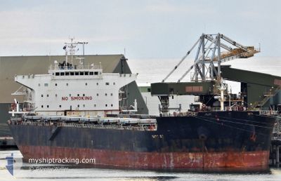
MARIA G.O.
Cargo
Current Trip
| Time Travelled | 9 days |
|---|---|
| Remaining Time | 2 days |
| Distance Travelled | 2206.33 nm |
| Remaining Distance | 615.05 nm |
| AVG Speed | 10.3 Knots |
| MAX Speed | 12.1 Knots |
| AVG Wind | 9 knots |
| MAX Wind | 17 knots |
| MIN Temp | 24.4°C / 75.92°F |
| MAX Temp | 30.8°C / 87.44°F |
| Dybgang | 14.4 m |
| Position Modtaget | 2 d siden |
Current Position
| Longitude | 77.32058° |
|---|---|
| Latitude | 7.72558° |
| Status | Under way using engine |
| Fart | 10.6 Knots |
| Kurs | 125° |
| Område | Laccadive Sea |
| Station | T-AIS |
| Position Modtaget | 2 d siden |
Info
Information
The current position of MARIA G.O. is in Laccadive Sea with coordinates 7.72558° / 77.32058° as reported on 2024-05-02 11:12 by AIS to our vessel tracker app. The vessel's current speed is 10.6 Knots and is heading at the port of PARADIP. The estimated time of arrival as calculated by MyShipTracking vessel tracking app is 2024-05-07 07:05 LT
The vessel MARIA G.O. (IMO: 9511428, MMSI: 538003954) is a Cargo It's sailing under the flag of [MH] Marshall Is.
In this page you can find informations about the vessels current position, last detected port calls, and current voyage information. If the vessels is not in coverage by AIS you will find the latest position.
The current position of MARIA G.O. is detected by our AIS receivers and we are not responsible for the reliability of the data. The last position was recorded while the vessel was in Coverage by the Ais receivers of our vessel tracking app.
The current draught of MARIA G.O. as reported by AIS is 14.4 meters
Weather
| Temperature | 30.4°C / 86.72°F |
|---|---|
| Wind Speed | 15 knots |
| Direction | 179° S |
| Pressure | 1006.5 hPa |
| Humidity | 78.2 % |
| Cloud Coverage | 4 % |
Featured Company
Events
| Tid | Hændelsen | Detaljer | Position / Dest | Info |
|---|---|---|---|---|
| 2024-05-02 11:16 | Status er ændret | Default Under way using engine |
7.71833 / 77.32833
PARADIP
|
Fart: 10.6 kn Kurs: 125° |
| 2024-05-02 11:12 | Status er ændret | Under way using engine Default |
7.72558 / 77.32058
PARADIP
|
Fart: 10 kn Kurs: 124° |
| 2024-05-02 11:12 | Udenfor Dækning |
7.72558 / 77.32058
Laccadive Sea
PARADIP
|
Fart: 10.6 kn Kurs: 125° |
|
| 2024-05-02 10:55 | Status er ændret | Default Under way using engine |
7.75333 / 77.27834
PARADIP
|
Fart: 10.5 kn Kurs: 124° |
| 2024-05-02 06:33 | Dybgangen er ændret | 14.4 10.9 |
8.28598 / 76.69817
PARADIP
|
Fart: 11 kn Kurs: 145° |
| 2024-05-02 06:33 | Destination er ændret | PARADIP HAZIRA |
8.28598 / 76.69817
PARADIP
|
Fart: 11 kn Kurs: 145° |
| 2024-05-02 06:33 | ETA er ændret | 2024/05/07 00:30 2024/04/05 22:00 |
8.28598 / 76.69817
PARADIP
|
Fart: 11 kn Kurs: 145° |
| 2024-05-02 05:46 | Status er ændret | Under way using engine Default |
8.39300 / 76.61495
HAZIRA
|
Fart: 10 kn Kurs: 143° |
| 2024-05-02 05:37 | Status er ændret | Default Under way using engine |
8.41333 / 76.59834
HAZIRA
|
Fart: 10.8 kn Kurs: 143° |
| 2024-05-02 05:27 | Status er ændret | Under way using engine Default |
8.43912 / 76.58053
HAZIRA
|
Fart: 10.8 kn Kurs: 141° |