
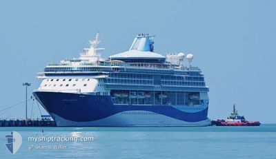
MARELLA DISCOVERY 2
Passengers Ship
Current Trip
| Time Travelled | 12 h, 37 mins |
|---|---|
| Remaining Time | 5 mins |
| Distance Travelled | 168.32 nm |
| Remaining Distance | 10.22 nm |
| AVG Speed | 13.6 Knots |
| MAX Speed | 14.9 Knots |
| AVG Wind | 4 knots |
| MAX Wind | 7.2 knots |
| MIN Temp | 25.5°C / 77.9°F |
| MAX Temp | 26.1°C / 78.98°F |
| Dybgang | 8 m |
| Position Modtaget | 3 m siden |
Current Position
| Longitude | --- |
|---|---|
| Latitude | --- |
| Status | Under way using engine |
| Fart | 11 Knots |
| Kurs | 120° |
| Område | Caribbean Sea |
| Station | T-AIS |
| Position Modtaget | 3 m siden |
Info
Information
The current position of MARELLA DISCOVERY 2 is in Caribbean Sea with coordinates 17.14654° / -61.91543° as reported on 2026-01-06 10:37 by AIS to our vessel tracker app. The vessel's current speed is 11 Knots and is heading at the port of ST JOHNS. The estimated time of arrival as calculated by MyShipTracking vessel tracking app is 2026-01-06 06:45 LT
The vessel MARELLA DISCOVERY 2 (IMO: 9070620, MMSI: 311378000) is a Passengers Ship that was built in 1995 ( 31 år gamle ). It's sailing under the flag of [BS] Bahamas.
In this page you can find informations about the vessels current position, last detected port calls, and current voyage information. If the vessels is not in coverage by AIS you will find the latest position.
The current position of MARELLA DISCOVERY 2 is detected by our AIS receivers and we are not responsible for the reliability of the data. The last position was recorded while the vessel was in Coverage by the Ais receivers of our vessel tracking app.
The current draught of MARELLA DISCOVERY 2 as reported by AIS is 8 meters
Weather
| Temperature | 25.8°C / 78.44°F |
|---|---|
| Wind Speed | 5 knots |
| Direction | 337° NNW |
| Pressure | 1012.9 hPa |
| Humidity | 72.5 % |
| Cloud Coverage | 80 % |
Featured Company
Last Port Calls
| Port | Arrival | Departure | Time In Port |
|---|---|---|---|
| 2026-01-05 07:14 | 2026-01-05 18:03 | 10 h | |
| 2026-01-04 07:48 | 2026-01-04 17:56 | 10 h | |
| 2026-01-03 07:17 | 2026-01-03 18:06 | 10 h | |
| 2026-01-01 06:42 | 2026-01-01 20:21 | 13 h | |
| 2025-12-28 07:14 | 2025-12-28 20:14 | 12 h | |
| 2025-12-26 06:51 | 2025-12-26 13:11 | 6 h | |
| 2025-12-24 07:18 | 2025-12-24 16:11 | 8 h | |
| 2025-12-23 07:11 | 2025-12-23 18:28 | 11 h | |
| 2025-12-22 07:16 | 2025-12-22 18:00 | 10 h | |
| 2025-12-21 06:59 | 2025-12-21 18:29 | 11 h |
Last Trips
| Origin | Departure | Destination | Arrival | Distance | |
|---|---|---|---|---|---|
| 2026-01-04 17:56 | 2026-01-05 07:14 | 162.89 nm | |||
| 2026-01-03 18:06 | 2026-01-04 07:48 | 171.62 nm | |||
| 2026-01-01 20:21 | 2026-01-03 07:17 | 349.11 nm | |||
| 2025-12-28 20:14 | 2026-01-01 06:42 | 750.82 nm | |||
| 2025-12-26 13:11 | 2025-12-28 07:14 | 485.06 nm | |||
| 2025-12-24 16:11 | 2025-12-26 06:51 | 367.16 nm | |||
| 2025-12-23 18:28 | 2025-12-24 07:18 | 164.60 nm | |||
| 2025-12-22 18:00 | 2025-12-23 07:11 | 102.32 nm | |||
| 2025-12-21 18:29 | 2025-12-22 07:16 | 124.85 nm | |||
| 2025-12-20 18:06 | 2025-12-21 06:59 | 101.82 nm |
Events
| Tid | Hændelsen | Detaljer | Position / Dest | Info |
|---|---|---|---|---|
| 2026-01-06 09:22 | Ændre havområde | Antigua and Barbuda part of the Caribbean Sea Montserrat part of the Caribbean Sea |
17.02535 / -62.12077
Caribbean Sea
AGSJO
|
Fart: 13.9 kn Kurs: 47.3° |
| 2026-01-06 08:49 | Fundet i havområde | Montserrat part of the Caribbean Sea |
16.94644 / -62.21775
Caribbean Sea
AGSJO
|
Fart: 14.2 kn Kurs: 54.5° |
| 2026-01-06 08:24 | Status er ændret | Under way using engine Default |
16.89012 / -62.29112
AGSJO
|
Fart: 14.2 kn Kurs: 54° |
| 2026-01-06 08:18 | Status er ændret | Default Under way using engine |
16.87438 / -62.31144
AGSJO
|
Fart: 14.2 kn Kurs: 53.8° |
| 2026-01-06 08:17 | Status er ændret | Under way using engine Default |
16.87368 / -62.31236
AGSJO
|
Fart: 14.3 kn Kurs: 56° |
| 2026-01-06 08:17 | Indenfor Dækning |
16.87368 / -62.31236
Caribbean Sea
AGSJO
|
Fart: 14.2 kn Kurs: 53.8° |
|
| 2026-01-06 08:17 | Ændre havområde | Antigua and Barbuda part of the Caribbean Sea Sint-Eustasius part of the Caribbean Sea |
16.87368 / -62.31236
Caribbean Sea
AGSJO
|
Fart: 14.2 kn Kurs: 53.8° |
| 2026-01-06 00:23 | Status er ændret | Default Under way using engine |
17.50681 / -63.09773
AGSJO
|
Fart: 14.1 kn Kurs: 174.9° |
| 2026-01-06 00:14 | Udenfor Dækning |
17.54195 / -63.10149
Caribbean Sea
AGSJO
|
Fart: 14.1 kn Kurs: 174.9° |
|
| 2026-01-06 00:04 | Ændre havområde | Sint-Eustasius part of the Caribbean Sea Saba part of the Caribbean Sea |
17.58121 / -63.10544
Caribbean Sea
AGSJO
|
Fart: 14.3 kn Kurs: 177.3° |