
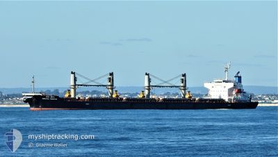
MARATHA PRESTIGE
Bulk Carrier
Current Trip
| Time Travelled | 28 days |
|---|---|
| Remaining Time | --- |
| Distance Travelled | 8232.14 nm |
| Remaining Distance | --- |
| AVG Speed | 11.9 Knots |
| MAX Speed | 11.9 Knots |
| AVG Wind | 10.3 knots |
| MAX Wind | 28.8 knots |
| MIN Temp | 7.3°C / 45.14°F |
| MAX Temp | 30.8°C / 87.44°F |
| Dybgang | 7.7 m |
| Position Modtaget | 5 d siden |
Current Position
| Longitude | 141.04706° |
|---|---|
| Latitude | 35.22772° |
| Status | Under way using engine |
| Fart | 14.2 Knots |
| Kurs | 63.1° |
| Område | North Pacific Ocean |
| Station | T-AIS |
| Position Modtaget | 5 d siden |
Info
Information
The current position of MARATHA PRESTIGE is in North Pacific Ocean with coordinates 35.22772° / 141.04706° as reported on 2024-05-15 20:44 by AIS to our vessel tracker app. The vessel's current speed is 14.2 Knots and is heading at the port of ENSENADA. The estimated time of arrival as calculated by MyShipTracking vessel tracking app is 2024-06-02 12:00 LT
The vessel MARATHA PRESTIGE (IMO: 9561332, MMSI: 419000160) is a Bulk Carrier that was built in 2010 ( 14 år gamle ). It's sailing under the flag of [IN] India.
In this page you can find informations about the vessels current position, last detected port calls, and current voyage information. If the vessels is not in coverage by AIS you will find the latest position.
The current position of MARATHA PRESTIGE is detected by our AIS receivers and we are not responsible for the reliability of the data. The last position was recorded while the vessel was in Coverage by the Ais receivers of our vessel tracking app.
The current draught of MARATHA PRESTIGE as reported by AIS is 7.7 meters
Weather
| Temperature | 7.2°C / 44.96°F |
|---|---|
| Wind Speed | 7 knots |
| Direction | 307° NW |
| Pressure | 1021.6 hPa |
| Humidity | 81.1 % |
| Cloud Coverage | 100 % |
Featured Company
Last Trips
| Origin | Departure | Destination | Arrival | Distance | |
|---|---|---|---|---|---|
| 2024-04-11 14:08 | 2024-04-15 00:33 | 470.19 nm | |||
| 2024-02-10 17:30 | 2024-04-04 22:44 | 6908.33 nm |
Events
| Tid | Hændelsen | Detaljer | Position / Dest | Info |
|---|---|---|---|---|
| 2024-05-15 20:51 | Status er ændret | Default Under way using engine |
35.24185 / 141.07735
ENSENADA
|
Fart: 14.2 kn Kurs: 63.1° |
| 2024-05-15 20:44 | Udenfor Dækning |
35.22772 / 141.04706
North Pacific Ocean
ENSENADA
|
Fart: 14.2 kn Kurs: 63.1° |
|
| 2024-05-15 20:29 | Status er ændret | Under way using engine Default |
35.20074 / 140.98261
ENSENADA
|
Fart: 14.2 kn Kurs: 62° |
| 2024-05-15 20:10 | Status er ændret | Default Under way using engine |
35.16641 / 140.90250
ENSENADA
|
Fart: 14.2 kn Kurs: 62° |
| 2024-05-15 15:31 | ETA er ændret | 2024/06/02 12:00 2024/06/06 10:00 |
34.68183 / 139.77843
ENSENADA
|
Fart: 11.8 kn Kurs: 67.3° |
| 2024-05-15 15:08 | Ændre havområde | Japanese part of the North Pacific Ocean Malaysian part of the Singapore Strait |
34.65507 / 139.69642
North Pacific Ocean
ENSENADA
|
Fart: 11.5 kn Kurs: 69.8° |
| 2024-05-15 15:08 | Status er ændret | Under way using engine Default |
34.65507 / 139.69642
ENSENADA
|
Fart: 11.5 kn Kurs: 66° |
| 2024-05-15 15:03 | Indenfor Dækning |
34.65507 / 139.69642
North Pacific Ocean
ENSENADA
|
Fart: 11.5 kn Kurs: 69.8° |