
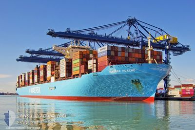
MAERSK HUACHO
Cargo A
Current Trip
| Time Travelled | 6 days |
|---|---|
| Remaining Time | --- |
| Distance Travelled | 1803.90 nm |
| Remaining Distance | --- |
| AVG Speed | 16.1 Knots |
| MAX Speed | 19.6 Knots |
| AVG Wind | 19.7 knots |
| MAX Wind | 28.7 knots |
| MIN Temp | 13.8°C / 56.84°F |
| MAX Temp | 20.9°C / 69.62°F |
| Dybgang | 12.5 m |
| Position Modtaget | 2 d siden |
Current Position
| Longitude | --- |
|---|---|
| Latitude | --- |
| Status | Under way using engine |
| Fart | 13.6 Knots |
| Kurs | 112.9° |
| Område | Mediterranean Sea - Eastern Basin |
| Station | T-AIS |
| Position Modtaget | 2 d siden |
Info
Information
The current position of MAERSK HUACHO is in Mediterranean Sea - Eastern Basin with coordinates 31.48055° / 32.33665° as reported on 2025-12-08 15:42 by AIS to our vessel tracker app. The vessel's current speed is 13.6 Knots and is heading at the port of PORT SAID. The estimated time of arrival as calculated by MyShipTracking vessel tracking app is 2025-12-08 18:30 LT
The vessel MAERSK HUACHO (IMO: 9848948, MMSI: 563078200) is a Cargo A It's sailing under the flag of [SG] Singapore.
In this page you can find informations about the vessels current position, last detected port calls, and current voyage information. If the vessels is not in coverage by AIS you will find the latest position.
The current position of MAERSK HUACHO is detected by our AIS receivers and we are not responsible for the reliability of the data. The last position was recorded while the vessel was in Coverage by the Ais receivers of our vessel tracking app.
The current draught of MAERSK HUACHO as reported by AIS is 12.5 meters
Weather
| Temperature | 19.2°C / 66.56°F |
|---|---|
| Wind Speed | 11 knots |
| Direction | 337° NNW |
| Pressure | 1017.5 hPa |
| Humidity | 62.6 % |
| Cloud Coverage | 3 % |
Featured Company
Last Port Calls
| Port | Arrival | Departure | Time In Port |
|---|---|---|---|
| 2025-12-08 19:45 | 2025-12-10 13:57 | 1 d | |
| 2025-12-03 11:19 | 2025-12-04 12:15 | 1 d | |
| 2025-11-05 21:52 | 2025-11-06 19:14 | 21 h | |
| 2025-11-01 06:10 | 2025-11-02 06:02 | 23 h | |
| 2025-10-28 14:58 | 2025-10-29 13:10 | 22 h | |
| 2025-10-23 22:36 | 2025-10-25 11:47 | 1 d | |
| 2025-10-19 19:09 | 2025-10-20 15:49 | 20 h |
Most Visited Ports (Last year)
| Port | Arrivals | |
|---|---|---|
| 7 | ||
| 6 | ||
| 6 | ||
| 4 | ||
| 4 | ||
| 4 |
Last Trips
| Origin | Departure | Destination | Arrival | Distance | |
|---|---|---|---|---|---|
| 2025-12-04 12:15 | 2025-12-08 19:45 | 1688.86 nm | |||
| 2025-11-06 19:14 | 2025-12-03 11:19 | 10138.84 nm | |||
| 2025-11-02 06:02 | 2025-11-05 21:52 | 1106.17 nm | |||
| 2025-10-29 13:10 | 2025-11-01 06:10 | 535.36 nm | |||
| 2025-10-25 11:47 | 2025-10-28 14:58 | 963.13 nm | |||
| 2025-10-20 15:49 | 2025-10-23 22:36 | 1018.11 nm | |||
| 2025-09-25 18:06 | 2025-10-19 19:09 | 9411.81 nm |
Events
| Tid | Hændelsen | Detaljer | Position / Dest | Info |
|---|---|---|---|---|
| 2025-12-10 11:57 | Afsejlet fra sidste havn |
|
31.23477 / 32.35914
PORT SAID, EGYPT
|
Fart: 8.9 kn Kurs: 11° |
| 2025-12-10 11:36 | START Sejllads |
31.19643 / 32.34875
[EG] SUEZ CANAL
|
Fart: 3.2 kn Kurs: 16° |
|
| 2025-12-08 18:08 | STOP Sejllads |
31.19368 / 32.35018
[EG] SUEZ CANAL
|
Fart: 0.2 kn Kurs: 190° |
|
| 2025-12-08 17:45 | Skibe i havn |
|
31.20907 / 32.35267
[EG] SUEZ CANAL
|
Fart: 5.4 kn Kurs: 192° |
| 2025-12-08 15:54 | Status er ændret | Default Under way using engine |
31.46418 / 32.38244
PORT SAID, EGYPT
|
Fart: 13.6 kn Kurs: 112.9° |
| 2025-12-08 15:42 | Udenfor Dækning |
31.48055 / 32.33665
Mediterranean Sea - Eastern Basin
PORT SAID, EGYPT
|
Fart: 13.6 kn Kurs: 112.9° |
|
| 2025-12-08 15:30 | Ændre havområde | Egyptian part of the Mediterranean Sea - Eastern Basin Maltese part of the Mediterranean Sea - Eastern Basin |
31.49815 / 32.28583
Mediterranean Sea - Eastern Basin
PORT SAID, EGYPT
|
Fart: 13.8 kn Kurs: 111.6° |
| 2025-12-08 15:30 | Status er ændret | Under way using engine Default |
31.49815 / 32.28583
PORT SAID, EGYPT
|
Fart: 13.7 kn Kurs: 112° |
| 2025-12-08 15:16 | Indenfor Dækning |
31.49815 / 32.28583
Mediterranean Sea - Eastern Basin
PORT SAID, EGYPT
|
Fart: 13.8 kn Kurs: 111.6° |
|
| 2025-12-06 05:26 | Udenfor Dækning |
36.28533 / 14.53773
Mediterranean Sea - Eastern Basin
PORT SAID, EGYPT
|
Fart: 16.5 kn Kurs: 109.8° |