
LANGENESS
Cargo A
Current Trip
| Time Travelled | 2 days |
|---|---|
| Remaining Time | 2 h, 17 mins |
| Distance Travelled | 706.41 nm |
| Remaining Distance | 38.94 nm |
| AVG Speed | 14.1 Knots |
| MAX Speed | 17.1 Knots |
| AVG Wind | 21.1 knots |
| MAX Wind | 31 knots |
| MIN Temp | 13°C / 55.4°F |
| MAX Temp | 18.2°C / 64.76°F |
| Dybgang | 9.4 m |
| Position Modtaget | 1 m siden |
Current Position
| Longitude | --- |
|---|---|
| Latitude | --- |
| Status | Under way using engine |
| Fart | 15 Knots |
| Kurs | 82.8° |
| Område | Sea of Marmara |
| Station | T-AIS |
| Position Modtaget | 1 m siden |
Info
Information
The current position of LANGENESS is in Sea of Marmara with coordinates 40.81121° / 28.36109° as reported on 2026-01-07 16:24 by AIS to our vessel tracker app. The vessel's current speed is 15 Knots and is heading at the port of ISTANBUL. The estimated time of arrival as calculated by MyShipTracking vessel tracking app is 2026-01-07 21:43 LT
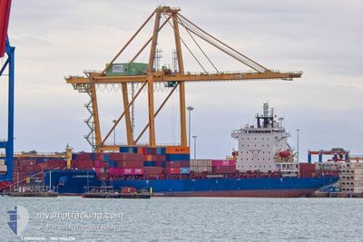
The vessel LANGENESS (IMO: 9944778, MMSI: 305540000) is a Cargo A It's sailing under the flag of [AG] Antigua Barbuda.
In this page you can find informations about the vessels current position, last detected port calls, and current voyage information. If the vessels is not in coverage by AIS you will find the latest position.
The current position of LANGENESS is detected by our AIS receivers and we are not responsible for the reliability of the data. The last position was recorded while the vessel was in Coverage by the Ais receivers of our vessel tracking app.
The current draught of LANGENESS as reported by AIS is 9.4 meters
Weather
| Temperature | 14.7°C / 58.46°F |
|---|---|
| Wind Speed | 22 knots |
| Direction | 197° SSW |
| Pressure | 1010.5 hPa |
| Humidity | 70.7 % |
| Cloud Coverage | 31 % |
Featured Company
Last Port Calls
| Port | Arrival | Departure | Time In Port |
|---|---|---|---|
| 2026-01-04 21:54 | 2026-01-05 17:16 | 19 h | |
| 2026-01-03 13:05 | 2026-01-04 03:16 | 14 h | |
| 2025-12-27 07:16 | 2025-12-28 01:34 | 18 h | |
| 2025-12-21 16:39 | 2025-12-22 17:41 | 1 d | |
| 2025-12-14 03:56 | 2025-12-14 16:07 | 12 h | |
| 2025-12-08 22:39 | 2025-12-09 13:36 | 14 h | |
| 2025-12-07 07:33 | 2025-12-07 22:25 | 14 h | |
| 2025-12-04 11:09 | 2025-12-05 21:05 | 1 d | |
| 2025-11-25 08:57 | 2025-11-29 18:14 | 4 d | |
| 2025-11-23 03:19 | 2025-11-24 01:15 | 21 h |
Most Visited Ports (Last year)
| Port | Arrivals | |
|---|---|---|
| 14 | ||
| 12 | ||
| 12 | ||
| 11 | ||
| 11 | ||
| 11 |
Last Trips
| Origin | Departure | Destination | Arrival | Distance | |
|---|---|---|---|---|---|
| 2026-01-04 03:16 | 2026-01-04 21:54 | 149.87 nm | |||
| 2025-12-28 01:34 | 2026-01-03 13:05 | 1911.65 nm | |||
| 2025-12-22 17:41 | 2025-12-27 07:16 | 647.66 nm | |||
| 2025-12-14 16:07 | 2025-12-21 16:39 | 181.91 nm | |||
| 2025-12-09 13:36 | 2025-12-14 03:56 | 1490.94 nm | |||
| 2025-12-07 22:25 | 2025-12-08 22:39 | 258.52 nm | |||
| 2025-12-05 21:05 | 2025-12-07 07:33 | 555.35 nm | |||
| 2025-11-29 18:14 | 2025-12-04 11:09 | 1811.66 nm | |||
| 2025-11-24 01:15 | 2025-11-25 08:57 | 404.54 nm | |||
| 2025-11-19 03:51 | 2025-11-23 03:19 | 179.35 nm |
Events
| Tid | Hændelsen | Detaljer | Position / Dest | Info |
|---|---|---|---|---|
| 2026-01-07 14:14 | Status er ændret | Under way using engine Default |
40.73604 / 27.66647
TRIST
|
Fart: 14.4 kn Kurs: 74° |
| 2026-01-07 13:57 | Indenfor Dækning |
40.73718 / 27.67681
Sea of Marmara
TRIST
|
Fart: 14.3 kn Kurs: 85.6° |
|
| 2026-01-07 09:59 | Status er ændret | Default Under way using engine |
40.27577 / 26.54517
TRIST
|
Fart: 15.2 kn Kurs: 48.9° |
| 2026-01-07 09:56 | Udenfor Dækning |
40.26908 / 26.53535
Sea of Marmara
TRIST
|
Fart: 15.2 kn Kurs: 48.9° |
|
| 2026-01-07 08:10 | Ændre havområde | Turkish part of the Sea of Marmara Turkish part of the Aegean Sea |
40.01988 / 26.19193
Sea of Marmara
TRIST
|
Fart: 9.3 kn Kurs: 78.1° |
| 2026-01-07 07:31 | Status er ændret | Under way using engine Default |
39.98156 / 26.02547
TRIST
|
Fart: 15.4 kn Kurs: 42° |
| 2026-01-07 07:11 | Status er ændret | Default Under way using engine |
39.92049 / 25.94891
TRIST
|
Fart: 15 kn Kurs: 40° |
| 2026-01-07 06:58 | Fundet i havområde | Turkish part of the Aegean Sea |
39.87974 / 25.90127
Aegean Sea
TRIST
|
Fart: 15.2 kn Kurs: 41.4° |
| 2026-01-07 06:36 | Status er ændret | Under way using engine Default |
39.81717 / 25.83271
TRIST
|
Fart: 12.6 kn Kurs: 11° |
| 2026-01-07 06:16 | Status er ændret | Default Under way using engine |
39.74987 / 25.81620
TRIST
|
Fart: 12.6 kn Kurs: 8° |