
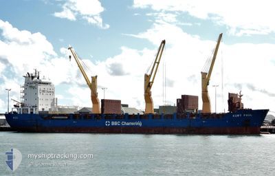
KURT PAUL
General Cargo
Current Trip
| Time Travelled | 5 days |
|---|---|
| Remaining Time | --- |
| Distance Travelled | 705.99 nm |
| Remaining Distance | --- |
| AVG Speed | 8.9 Knots |
| MAX Speed | 12.9 Knots |
| AVG Wind | 5.9 knots |
| MAX Wind | 12.8 knots |
| MIN Temp | 28.6°C / 83.48°F |
| MAX Temp | 30.4°C / 86.72°F |
| Dybgang | 6.3 m |
| Position Modtaget | 1 m siden |
Current Position
| Longitude | 103.82002° |
|---|---|
| Latitude | 1.23297° |
| Status | At anchor |
| Fart | |
| Kurs | 304° |
| Område | Singapore Strait |
| Station | T-AIS |
| Position Modtaget | 1 m siden |
Info
Information
The current position of KURT PAUL is in Singapore Strait with coordinates 1.23297° / 103.82002° as reported on 2024-04-30 21:53 by AIS to our vessel tracker app. The vessel's current speed is 0 Knots
The vessel KURT PAUL (IMO: 9435856, MMSI: 305361000) is a General Cargo that was built in 2009 ( 15 år gamle ). It's sailing under the flag of [AG] Antigua Barbuda.
In this page you can find informations about the vessels current position, last detected port calls, and current voyage information. If the vessels is not in coverage by AIS you will find the latest position.
The current position of KURT PAUL is detected by our AIS receivers and we are not responsible for the reliability of the data. The last position was recorded while the vessel was in Coverage by the Ais receivers of our vessel tracking app.
The current draught of KURT PAUL as reported by AIS is 6.3 meters
Weather
| Temperature | 29.3°C / 84.74°F |
|---|---|
| Wind Speed | 7 knots |
| Direction | 124° SE |
| Pressure | 1005.3 hPa |
| Humidity | 76.6 % |
| Cloud Coverage | 100 % |
Featured Company
Last Port Calls
| Port | Arrival | Departure | Time In Port |
|---|---|---|---|
| 2024-04-22 06:08 | 2024-04-25 21:24 | 3 d | |
| 2024-03-26 20:51 | 2024-04-11 22:55 | 16 d | |
| 2024-03-13 02:17 | 2024-03-13 21:27 | 19 h | |
| 2024-02-20 22:37 | 2024-02-28 04:42 | 7 d | |
| 2024-02-07 10:06 | 2024-02-08 11:06 | 1 d |
Most Visited Ports (Last year)
| Port | Arrivals | |
|---|---|---|
| 10 | ||
| 10 | ||
| 1 |
Last Trips
| Origin | Departure | Destination | Arrival | Distance | |
|---|---|---|---|---|---|
| 2024-04-12 08:55 | 2024-04-22 13:08 | 3000.98 nm | |||
| 2024-03-14 05:27 | 2024-03-27 06:51 | 3413.92 nm | |||
| 2024-02-28 14:42 | 2024-03-13 10:17 | 3394.24 nm | |||
| 2024-02-08 19:06 | 2024-02-21 08:37 | 3388.97 nm | |||
| 2024-01-22 16:54 | 2024-02-07 18:06 | 3385.46 nm |
Events
| Tid | Hændelsen | Detaljer | Position / Dest | Info |
|---|---|---|---|---|
| 2024-04-30 19:53 | Status er ændret | At anchor Default |
1.23337 / 103.82014
SIN-PEBGA
|
Fart: Kurs: 293° |
| 2024-04-30 19:47 | Status er ændret | Default At anchor |
1.23349 / 103.82008
SIN-PEBGA
|
Fart: Kurs: 293° |
| 2024-04-30 19:14 | Status er ændret | At anchor Default |
1.23276 / 103.81951
SIN-PEBGA
|
Fart: 0.3 kn Kurs: 8° |
| 2024-04-30 19:05 | Status er ændret | Default At anchor |
1.23260 / 103.81869
SIN-PEBGA
|
Fart: 0.3 kn Kurs: 8° |
| 2024-04-30 12:53 | Status er ændret | At anchor Default |
1.23500 / 103.81748
SIN-PEBGA
|
Fart: 1.1 kn Kurs: 94° |
| 2024-04-30 12:47 | Status er ændret | Default At anchor |
1.23414 / 103.81705
SIN-PEBGA
|
Fart: 0.4 kn Kurs: 90° |
| 2024-04-30 10:05 | Status er ændret | At anchor Default |
1.23427 / 103.81754
SIN-PEBGA
|
Fart: 0.2 kn Kurs: 129° |
| 2024-04-30 09:59 | Status er ændret | Default At anchor |
1.23440 / 103.81759
SIN-PEBGA
|
Fart: 0.2 kn Kurs: 129° |
| 2024-04-30 09:17 | Status er ændret | At anchor Default |
1.23376 / 103.81780
SIN-PEBGA
|
Fart: 0.1 kn Kurs: 99° |
| 2024-04-30 09:14 | Status er ændret | Default At anchor |
1.23354 / 103.81774
SIN-PEBGA
|
Fart: Kurs: 101° |